Property Record
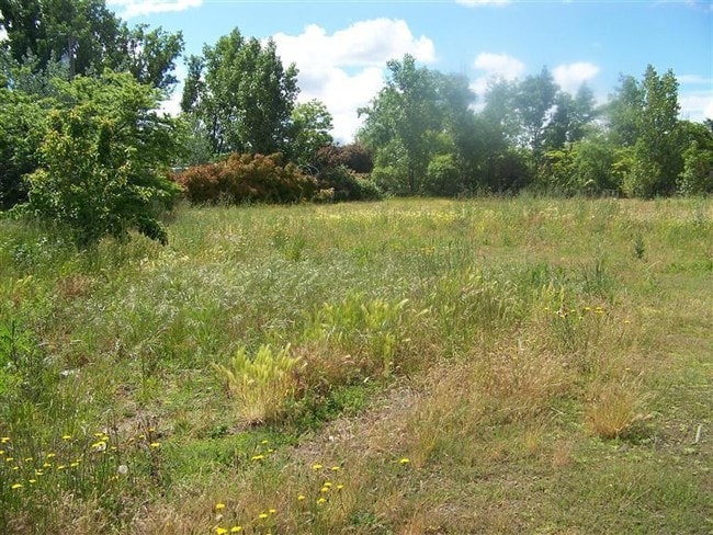
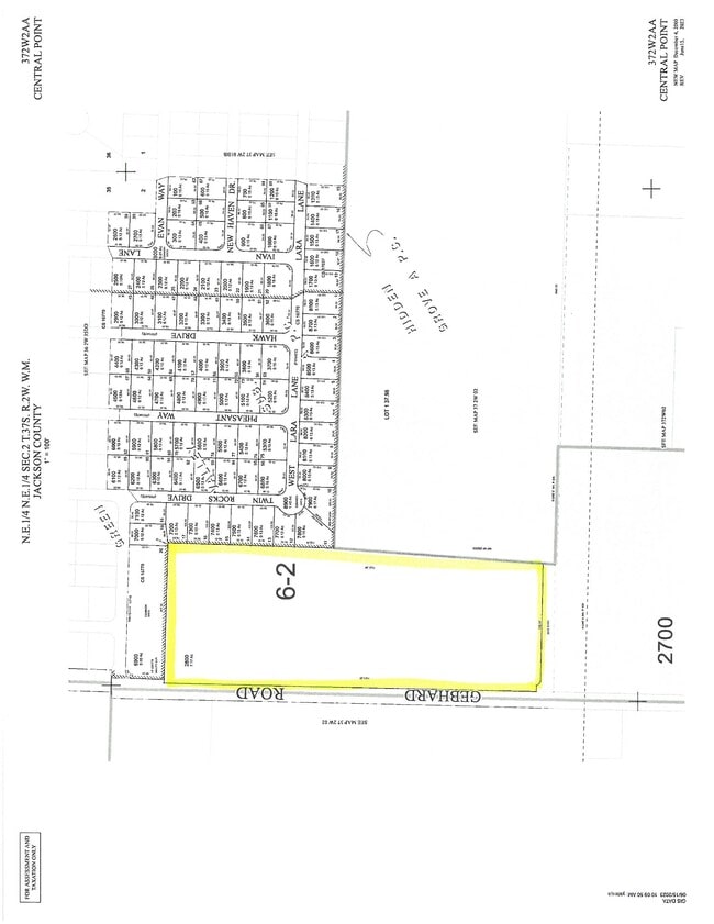
4922 Gebhard Rd, Central Point, OR 97502


This Property Is For Sale
NEARBY LISTINGS FOR SALE OR LEASE
Property Detail
4922 Gebhard Rd
10195726
Jackson
Sfr
Oregon
X
7.17 AC
41029C1769F
Medford/Grants Pass
2025
Other Market Areas
2026
Medford, OR
001002
DEMOGRAPHICS near 4922 Gebhard Rd
1 mile
3 mile
5 mile
2024 Total Population
5,035
32,965
90,509
2029 Population
4,982
32,847
90,033
Pop Growth 2024-2029
(1.05%)
(0.36%)
(0.53%)
Average Age
40
40
40
2024 Total Households
1,883
12,583
34,595
HH Growth 2024-2029
(1.17%)
(0.42%)
(0.59%)
Median Household Inc
$60,107
$69,036
$62,334
Avg Household Size
2.60
2.50
2.50
2024 Avg HH Vehicles
2.00
2.00
2.00
Median Home Value
$336,173
$314,772
$316,794
Median Year Built
1994
1990
1981
Nearby Places
Map Layers
Map Styles
 Street
 Aerial
Transit
 Traffic
 Biking
Places
Listings with unknown addresses are not visible on the map
- Restaurants
- Banks
- Shops
- Fitness
- Groceries
PUBLIC TRANSPORTATION
AIRPORT
Rogue Valley International - Medford
Drive
Walk
Distance
Rogue Valley International - Medford
5 min
2.4 mi
Freight Ports
Port of Coos Bay, OR
Drive
Walk
Distance
Port of Coos Bay, OR
214 min
162.2 mi
Nearby Properties
Address
Land Use
TOTAL SIZE
Lot Size
Zoning
Address
Land Use
TOTAL SIZE
Lot Size
Zoning
290.83 AC
I-L
Address
Land Use
TOTAL SIZE
Lot Size
Zoning
49.38 AC
GI
Address
Land Use
TOTAL SIZE
Lot Size
Zoning
22.07 AC
GI
Address
Land Use
TOTAL SIZE
Lot Size
Zoning
30.66 AC
GI
Address
Land Use
TOTAL SIZE
Lot Size
Zoning
600,000 SF
18.27 AC
M-1
Address
Land Use
TOTAL SIZE
Lot Size
Zoning
14.84 AC
GI
Address
Land Use
TOTAL SIZE
Lot Size
Zoning
31.96 AC
GI
Address
Land Use
TOTAL SIZE
Lot Size
Zoning
11,180 SF
1.58 AC
MFR-20
Address
Land Use
TOTAL SIZE
Lot Size
Zoning
88,434 SF
12.10 AC
I-L
Address
Land Use
TOTAL SIZE
Lot Size
Zoning
125,910 SF
14.29 AC
C-R
Address
Land Use
TOTAL SIZE
Lot Size
Zoning
30.87 AC
CIVIC
Address
Land Use
TOTAL SIZE
Lot Size
Zoning
88.67 AC
I-L
Address
Land Use
TOTAL SIZE
Lot Size
Zoning
136,756 SF
12.50 AC
C-R
Address
Land Use
TOTAL SIZE
Lot Size
Zoning
177.42 AC
GI
Address
Land Use
TOTAL SIZE
Lot Size
Zoning
49 AC
GI
Address
Land Use
TOTAL SIZE
Lot Size
Zoning
50.78 AC
GI
Address
Land Use
TOTAL SIZE
Lot Size
Zoning
35,272 SF
10.01 AC
GI
Address
Land Use
TOTAL SIZE
Lot Size
Zoning
109,042 SF
7.06 AC
C-R
Address
Land Use
TOTAL SIZE
Lot Size
Zoning
15.97 AC
GI
Address
Land Use
TOTAL SIZE
Lot Size
Zoning
6,039 SF
5.26 AC
MMR
Address
Land Use
TOTAL SIZE
Lot Size
Zoning
13.49 AC
M-1
Address
Land Use
TOTAL SIZE
Lot Size
Zoning
31,283 SF
2.95 AC
I-L
Address
Land Use
TOTAL SIZE
Lot Size
Zoning
164,324 SF
7.40 AC
C-R
Address
Land Use
TOTAL SIZE
Lot Size
Zoning
144,396 SF
10.67 AC
C-R
Address
Land Use
TOTAL SIZE
Lot Size
Zoning
102,184 SF
5.82 AC
I-L
Address
Land Use
TOTAL SIZE
Lot Size
Zoning
164,324 SF
6.42 AC
C-R
Address
Land Use
TOTAL SIZE
Lot Size
Zoning
98,547 SF
4.36 AC
I-L
Address
Land Use
TOTAL SIZE
Lot Size
Zoning
62.39 AC
GI
Address
Land Use
TOTAL SIZE
Lot Size
Zoning
60,561 SF
2.72 AC
HMR
The World's #1 Commercial Real Estate Marketplace
Connect with us
© 2026 CoStar Group
The information above has been obtained from sources believed reliable. While we do not doubt its accuracy we have not verified it and make no guarantee, warranty or representation about it. It is your responsibility to independently confirm its accuracy and completeness. Any projections, opinions, assumptions, or estimates used are for example only and do not represent the current or future performance of the property. The value of this transaction to you depends on tax and other factors which should be evaluated by your tax, financial, and legal advisors. You and your advisors should conduct a careful, independent investigation of the property to determine to your satisfaction the suitability of the property for your needs.