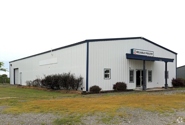
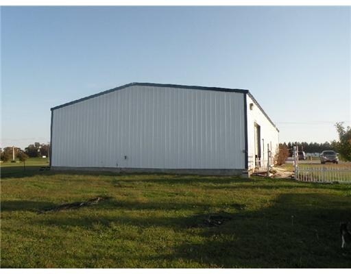
Property Record
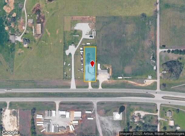
4920 Highway 412, Colcord, OK 74338
NEARBY LISTINGS FOR SALE OR LEASE
Property Detail
4920 Highway 412
0080802
West Siloam-X Land
Warehouse
25-20-25 PT SW NE SW DESCRIBED AS: S 360' OF E 120' OF SW NE SW 2166-336
X
Delaware
40041C0600E
Oklahoma
2024
0.99 AC
2025
Oklahoma East Area
976200
Other Market Areas
4,500 SF
DEMOGRAPHICS near 4920 Highway 412
1 Mile
3 Mile
5 Mile
2024 Total Population
660
9,494
23,288
2029 Population
680
10,827
27,044
Pop Growth 2024-2029
+ 3.03%
+ 14.04%
+ 16.13%
Average Age
40
36
37
2024 Total Households
232
3,173
8,030
HH Growth 2024-2029
+ 2.59%
+ 13.87%
+ 16.08%
Median Household Inc
$53,225
$55,231
$59,949
Avg Household Size
2.70
2.70
2.70
2024 Avg HH Vehicles
2.00
2.00
2.00
Median Home Value
$156,034
$171,178
$181,337
Median Year Built
1989
1984
1992
Nearby Places
Map Layers
Map Styles
 Street
 Aerial
- Restaurants
- Banks
- Shops
- Fitness
- Groceries
PUBLIC TRANSPORTATION
AIRPORT
Northwest Arkansas Ntl
DRIVE
WALK
Distance
Northwest Arkansas Ntl
48 min
26.4 mi
Nearby Properties
Address
Land Use
TOTAL SIZE
Lot Size
Zoning
Address
Land Use
TOTAL SIZE
Lot Size
Zoning
85,903 SF
10 AC
Address
Land Use
TOTAL SIZE
Lot Size
Zoning
53,071 SF
2.07 AC
Address
Land Use
TOTAL SIZE
Lot Size
Zoning
41,748 SF
5.44 AC
Address
Land Use
TOTAL SIZE
Lot Size
Zoning
20,714 SF
0.57 AC
Address
Land Use
TOTAL SIZE
Lot Size
Zoning
40,709 SF
4.24 AC
Address
Land Use
TOTAL SIZE
Lot Size
Zoning
244,674 SF
18.51 AC
Address
Land Use
TOTAL SIZE
Lot Size
Zoning
20,484 SF
0.93 AC
Address
Land Use
TOTAL SIZE
Lot Size
Zoning
23,918 SF
1.95 AC
Address
Land Use
TOTAL SIZE
Lot Size
Zoning
16,250 SF
4.57 AC
Address
Land Use
TOTAL SIZE
Lot Size
Zoning
36,126 SF
1.97 AC
Address
Land Use
TOTAL SIZE
Lot Size
Zoning
7,160 SF
2.05 AC
Address
Land Use
TOTAL SIZE
Lot Size
Zoning
88,576 SF
4.45 AC
Address
Land Use
TOTAL SIZE
Lot Size
Zoning
46,882 SF
7.62 AC
Address
Land Use
TOTAL SIZE
Lot Size
Zoning
6,547 SF
2.19 AC
Address
Land Use
TOTAL SIZE
Lot Size
Zoning
Address
Land Use
TOTAL SIZE
Lot Size
Zoning
14,729 SF
1.87 AC
Address
Land Use
TOTAL SIZE
Lot Size
Zoning
14,540 SF
Address
Land Use
TOTAL SIZE
Lot Size
Zoning
4,716 SF
0.02 AC
Address
Land Use
TOTAL SIZE
Lot Size
Zoning
21,532 SF
3.38 AC
Address
Land Use
TOTAL SIZE
Lot Size
Zoning
6,694 SF
1.24 AC
Address
Land Use
TOTAL SIZE
Lot Size
Zoning
38,640 SF
1.28 AC
Address
Land Use
TOTAL SIZE
Lot Size
Zoning
14,056 SF
0.72 AC
Address
Land Use
TOTAL SIZE
Lot Size
Zoning
16,660 SF
0.96 AC
Address
Land Use
TOTAL SIZE
Lot Size
Zoning
12,717 SF
3.57 AC
Address
Land Use
TOTAL SIZE
Lot Size
Zoning
12,088 SF
1.14 AC
Address
Land Use
TOTAL SIZE
Lot Size
Zoning
19,440 SF
1.80 AC
Address
Land Use
TOTAL SIZE
Lot Size
Zoning
25,190 SF
4.56 AC
Address
Land Use
TOTAL SIZE
Lot Size
Zoning
4,464 SF
1.29 AC
Address
Land Use
TOTAL SIZE
Lot Size
Zoning
9,852 SF
0.70 AC
The World's #1 Commercial Real Estate Marketplace
Connect with us
© 2025 CoStar Group
The information above has been obtained from sources believed reliable. While we do not doubt its accuracy we have not verified it and make no guarantee, warranty or representation about it. It is your responsibility to independently confirm its accuracy and completeness. Any projections, opinions, assumptions, or estimates used are for example only and do not represent the current or future performance of the property. The value of this transaction to you depends on tax and other factors which should be evaluated by your tax, financial, and legal advisors. You and your advisors should conduct a careful, independent investigation of the property to determine to your satisfaction the suitability of the property for your needs.