Property Record
4920 N State Route 60 Nw, Mcconnelsville, OH 43756

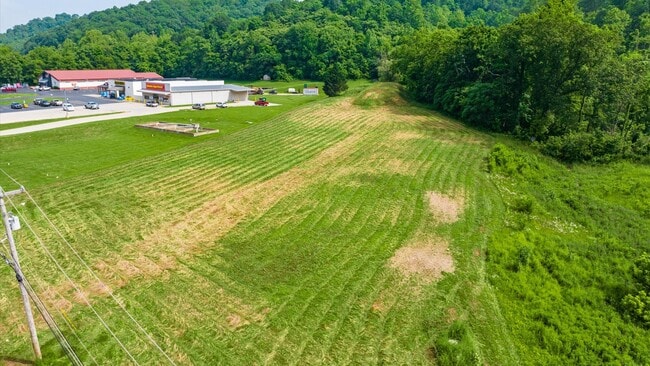
This Property Is For Sale
NEARBY LISTINGS FOR SALE OR LEASE
-
-
View all Mcconnelsville listings for sale on LoopNet.com
Property Detail
4920 N State Route 60 Nw
130-000-380-0
Subdivision 23
Residentialacreage
R12 T10 S03 SD 23
X
Morgan
39115C0150D
Ohio
2024
1.78 AC
2024
Ohio South Area
968900
Other Market Areas
1,248 SF
DEMOGRAPHICS near 4920 N State Route 60 Nw
1 Mile
3 Mile
5 Mile
2024 Total Population
473
3,836
5,242
2029 Population
470
3,819
5,224
Pop Growth 2024-2029
(0.63%)
(0.44%)
(0.34%)
Average Age
44
44
44
2024 Total Households
207
1,682
2,270
HH Growth 2024-2029
(0.48%)
(0.42%)
(0.40%)
Median Household Inc
$55,384
$52,110
$53,128
Avg Household Size
2.20
2.20
2.30
2024 Avg HH Vehicles
2.00
2.00
2.00
Median Home Value
$124,138
$131,331
$137,924
Median Year Built
1963
1965
1970
Nearby Places
Map Layers
Map Styles
 Street
 Aerial
- Restaurants
- Banks
- Shops
- Fitness
- Groceries
Nearby Properties
Address
Land Use
TOTAL SIZE
Lot Size
Zoning
Address
Land Use
TOTAL SIZE
Lot Size
Zoning
4.14 AC
Address
Land Use
TOTAL SIZE
Lot Size
Zoning
438,000 SF
50.37 AC
Address
Land Use
TOTAL SIZE
Lot Size
Zoning
121,328 SF
15.11 AC
Address
Land Use
TOTAL SIZE
Lot Size
Zoning
99,100 SF
8.03 AC
Address
Land Use
TOTAL SIZE
Lot Size
Zoning
568,605 SF
2.18 AC
Address
Land Use
TOTAL SIZE
Lot Size
Zoning
60,088 SF
3.48 AC
Address
Land Use
TOTAL SIZE
Lot Size
Zoning
Address
Land Use
TOTAL SIZE
Lot Size
Zoning
450,868 SF
0.20 AC
Address
Land Use
TOTAL SIZE
Lot Size
Zoning
114,134 SF
6.82 AC
Address
Land Use
TOTAL SIZE
Lot Size
Zoning
101,672 SF
2.40 AC
Address
Land Use
TOTAL SIZE
Lot Size
Zoning
18.98 AC
Address
Land Use
TOTAL SIZE
Lot Size
Zoning
258,720 SF
0.63 AC
Address
Land Use
TOTAL SIZE
Lot Size
Zoning
131,040 SF
1.46 AC
Address
Land Use
TOTAL SIZE
Lot Size
Zoning
483,888 SF
24.19 AC
Address
Land Use
TOTAL SIZE
Lot Size
Zoning
389,472 SF
0.40 AC
Address
Land Use
TOTAL SIZE
Lot Size
Zoning
210,000 SF
33.76 AC
Address
Land Use
TOTAL SIZE
Lot Size
Zoning
144,060 SF
0.40 AC
Address
Land Use
TOTAL SIZE
Lot Size
Zoning
151,484 SF
0.21 AC
Address
Land Use
TOTAL SIZE
Lot Size
Zoning
Address
Land Use
TOTAL SIZE
Lot Size
Zoning
15,360 SF
7.13 AC
Address
Land Use
TOTAL SIZE
Lot Size
Zoning
4,554 SF
3.80 AC
Address
Land Use
TOTAL SIZE
Lot Size
Zoning
252,000 SF
0.20 AC
Address
Land Use
TOTAL SIZE
Lot Size
Zoning
90,296 SF
2.53 AC
Address
Land Use
TOTAL SIZE
Lot Size
Zoning
155.54 AC
Address
Land Use
TOTAL SIZE
Lot Size
Zoning
9,552 SF
3.68 AC
Address
Land Use
TOTAL SIZE
Lot Size
Zoning
63,360 SF
1.20 AC
Address
Land Use
TOTAL SIZE
Lot Size
Zoning
428,378 SF
4.40 AC
Address
Land Use
TOTAL SIZE
Lot Size
Zoning
27,200 SF
1.04 AC
Address
Land Use
TOTAL SIZE
Lot Size
Zoning
226,998 SF
0.18 AC
Address
Land Use
TOTAL SIZE
Lot Size
Zoning
136,000 SF
0.19 AC
The World's #1 Commercial Real Estate Marketplace
Connect with us
© 2025 CoStar Group
The information above has been obtained from sources believed reliable. While we do not doubt its accuracy we have not verified it and make no guarantee, warranty or representation about it. It is your responsibility to independently confirm its accuracy and completeness. Any projections, opinions, assumptions, or estimates used are for example only and do not represent the current or future performance of the property. The value of this transaction to you depends on tax and other factors which should be evaluated by your tax, financial, and legal advisors. You and your advisors should conduct a careful, independent investigation of the property to determine to your satisfaction the suitability of the property for your needs.