Property Record
4920 Niagara Rd, College Park, MD 20740

Save to a Folder
{{folder.Name}}
{{folder.ListingIds.length}} Properties
{{folder.ListingIds.length}} Property
Create a New Folder
Current Lease Availabilities
Property Detail
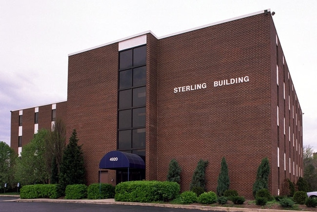
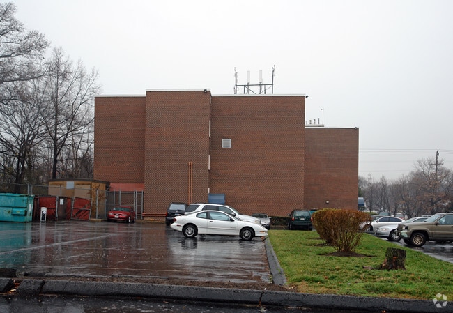
4920 Niagara Rd
01-0030833
OUTLOT 5
Commercialnec
Prince Georges
CGO
Maryland
B and X Area of moderate flood hazard, usually the area between the limits of the 100-year and 500-year floods.
5
2024
0.54 AC
2025
College Park
806900
Washington, DC
42,364 SF
Washington-Arlington-Alexandria, DC-VA-MD-WV
NEARBY LISTINGS FOR SALE OR LEASE
DEMOGRAPHICS near 4920 Niagara Rd
1 mile
3 mile
5 mile
2025 Total Population
11,052
98,081
364,353
2030 Population
11,038
99,108
369,373
Pop Growth 2025-2030
(0.13%)
+ 1.05%
+ 1.38%
Average Age
37
36
37
2025 Total Households
4,192
31,842
119,012
HH Growth 2025-2030
(0.17%)
+ 1.00%
+ 1.48%
Median Household Inc
$92,650
$83,115
$90,338
Avg Household Size
2.60
2.70
2.90
2025 Avg HH Vehicles
2.00
2.00
2.00
Median Home Value
$407,839
$418,061
$443,305
Median Year Built
1971
1969
1969
Nearby Places
Map Layers
Map Styles
 Street
 Aerial
Layers
 Traffic
 Biking
Places
Listings with unknown addresses are not visible on the map
- Restaurants
- Banks
- Shops
- Fitness
- Groceries
PUBLIC TRANSPORTATION
TRANSIT/SUBWAY
Greenbelt (Camden Line - Maryland Area Regional Commuter Trains (The MARC))
Drive
Walk
Distance
Greenbelt (Camden Line - Maryland Area Regional Commuter Trains (The MARC))
5 min
16 min
0.8 mi
Greenbelt (Green Line - Washington Metropolitan Area Transit Authority Metrorail (Metrorail))
Drive
Walk
Distance
Greenbelt (Green Line - Washington Metropolitan Area Transit Authority Metrorail (Metrorail))
5 min
18 min
0.9 mi
COMMUTER RAIL
Drive
Walk
Distance
5 min
16 min
0.8 mi
Drive
Walk
Distance
5 min
16 min
0.8 mi
AIRPORT
Ronald Reagan Washington Ntl
Drive
Walk
Distance
Ronald Reagan Washington Ntl
33 min
19.7 mi
Baltimore/Washington International Thurgood Marshall
Drive
Walk
Distance
Baltimore/Washington International Thurgood Marshall
35 min
21.6 mi
Washington Dulles International
Drive
Walk
Distance
Washington Dulles International
55 min
35.5 mi
Freight Ports
Port of Baltimore
Drive
Walk
Distance
Port of Baltimore
39 min
29.4 mi
Nearby Properties
Address
Land Use
TOTAL SIZE
Lot Size
Zoning
Address
Land Use
TOTAL SIZE
Lot Size
Zoning
2,043 SF
1,011.13 AC
RR
Address
Land Use
TOTAL SIZE
Lot Size
Zoning
13.01 AC
RR
Address
Land Use
TOTAL SIZE
Lot Size
Zoning
456,429 SF
35.07 AC
I3
Address
Land Use
TOTAL SIZE
Lot Size
Zoning
1,244,733 SF
38.03 AC
RE2
Address
Land Use
TOTAL SIZE
Lot Size
Zoning
639,347 SF
2.28 AC
RTOLE
Address
Land Use
TOTAL SIZE
Lot Size
Zoning
398,693 SF
2.57 AC
LTOE
Address
Land Use
TOTAL SIZE
Lot Size
Zoning
74,664 SF
1.83 AC
RTOLE
Address
Land Use
TOTAL SIZE
Lot Size
Zoning
3.53 AC
RTOLE
Address
Land Use
TOTAL SIZE
Lot Size
Zoning
330,003 SF
1.74 AC
RTOLE
Address
Land Use
TOTAL SIZE
Lot Size
Zoning
1,146,407 SF
60.25 AC
AG
Address
Land Use
TOTAL SIZE
Lot Size
Zoning
2.05 AC
RTOLE
Address
Land Use
TOTAL SIZE
Lot Size
Zoning
8,060 SF
1.63 AC
LTOE
Address
Land Use
TOTAL SIZE
Lot Size
Zoning
393,700 SF
1.30 AC
RTOLC
Address
Land Use
TOTAL SIZE
Lot Size
Zoning
508 SF
7.27 AC
LTOE
Address
Land Use
TOTAL SIZE
Lot Size
Zoning
0.79 AC
RTOLE
Address
Land Use
TOTAL SIZE
Lot Size
Zoning
330,555 SF
2.12 AC
NAC
Address
Land Use
TOTAL SIZE
Lot Size
Zoning
9,184 SF
2.50 AC
LTOE
Address
Land Use
TOTAL SIZE
Lot Size
Zoning
132,330 SF
3.20 AC
RTOLE
Address
Land Use
TOTAL SIZE
Lot Size
Zoning
15.90 AC
RTOLE
Address
Land Use
TOTAL SIZE
Lot Size
Zoning
309,374 SF
2.01 AC
RTOLE
Address
Land Use
TOTAL SIZE
Lot Size
Zoning
2,240.90 AC
ROS
Address
Land Use
TOTAL SIZE
Lot Size
Zoning
6.39 AC
RMF48
Address
Land Use
TOTAL SIZE
Lot Size
Zoning
190,067 SF
0.72 AC
LTOE
Address
Land Use
TOTAL SIZE
Lot Size
Zoning
5.58 AC
RTOLC
Address
Land Use
TOTAL SIZE
Lot Size
Zoning
264,093 SF
22.74 AC
CGO
Address
Land Use
TOTAL SIZE
Lot Size
Zoning
569,794 SF
5.70 AC
RMF48
Address
Land Use
TOTAL SIZE
Lot Size
Zoning
43,382 SF
2.18 AC
Address
Land Use
TOTAL SIZE
Lot Size
Zoning
256 SF
2.54 AC
LTOC
Address
Land Use
TOTAL SIZE
Lot Size
Zoning
17.48 AC
RMF20
Address
Land Use
TOTAL SIZE
Lot Size
Zoning
20.79 AC
RTOLE
The World's #1 Commercial Real Estate Marketplace
Connect with us
© 2026 CoStar Group
The information above has been obtained from sources believed reliable. While we do not doubt its accuracy we have not verified it and make no guarantee, warranty or representation about it. It is your responsibility to independently confirm its accuracy and completeness. Any projections, opinions, assumptions, or estimates used are for example only and do not represent the current or future performance of the property. The value of this transaction to you depends on tax and other factors which should be evaluated by your tax, financial, and legal advisors. You and your advisors should conduct a careful, independent investigation of the property to determine to your satisfaction the suitability of the property for your needs.