Property Record
3281 N Decatur Blvd, Las Vegas, NV 89130


NEARBY LISTINGS FOR SALE OR LEASE
Property Detail
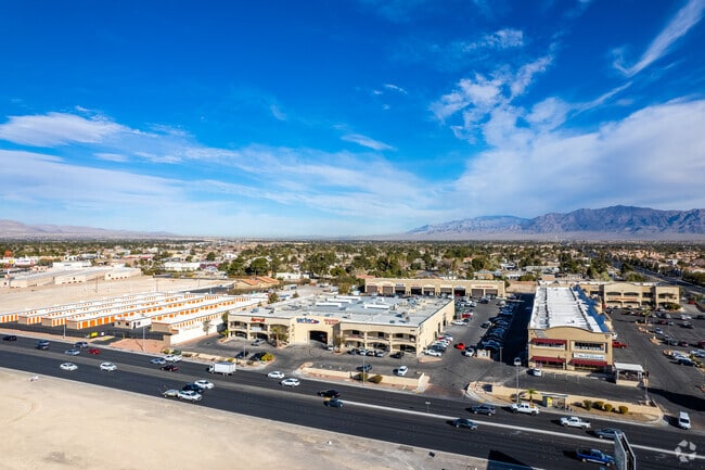
3281 N Decatur Blvd
Las Vegas-Henderson-North Las Vegas, NV
Red Feather Shopping Center
138-12-813-001
RED FEATHER SHOPPING CENTER PLAT BOOK 89 PAGE 86 LOT 1
Commercialnec
Clark
A
Nevada
32003C2155F
1
2025
8.43 AC
2025
North Las Vegas
003414
Las Vegas
105,168 SF
DEMOGRAPHICS near 3281 N Decatur Blvd
1 Mile
3 Mile
5 Mile
2024 Total Population
16,433
180,132
455,739
2029 Population
17,460
192,812
488,276
Pop Growth 2024-2029
+ 6.25%
+ 7.04%
+ 7.14%
Average Age
39
38
39
2024 Total Households
5,949
63,607
162,265
HH Growth 2024-2029
+ 6.24%
+ 7.02%
+ 7.14%
Median Household Inc
$50,551
$55,287
$57,907
Avg Household Size
2.70
2.80
2.70
2024 Avg HH Vehicles
2.00
2.00
2.00
Median Home Value
$338,696
$299,653
$324,797
Median Year Built
1992
1991
1992
Nearby Places
Map Layers
Map Styles
 Street
 Aerial
- Restaurants
- Banks
- Shops
- Fitness
- Groceries
PUBLIC TRANSPORTATION
AIRPORT
Harry Reid International
DRIVE
WALK
Distance
Harry Reid International
55 min
19.0 mi
Boulder City Municipal
DRIVE
WALK
Distance
Boulder City Municipal
44 min
31.6 mi
SALE & LEASE HISTORY
LISTING DATE
SALE/LEASE

Nov 08, 2016
For Lease
Jan 04, 2019
For Lease
Nearby Properties
Address
Land Use
TOTAL SIZE
Lot Size
Zoning
Address
Land Use
TOTAL SIZE
Lot Size
Zoning
647,754 SF
38.57 AC
C2
Address
Land Use
TOTAL SIZE
Lot Size
Zoning
34.83 AC
CV
Address
Land Use
TOTAL SIZE
Lot Size
Zoning
724,845 SF
37.33 AC
M2
Address
Land Use
TOTAL SIZE
Lot Size
Zoning
161.14 AC
CV
Address
Land Use
TOTAL SIZE
Lot Size
Zoning
5,643 SF
10.29 AC
Address
Land Use
TOTAL SIZE
Lot Size
Zoning
35.49 AC
R1
Address
Land Use
TOTAL SIZE
Lot Size
Zoning
37.31 AC
CV
Address
Land Use
TOTAL SIZE
Lot Size
Zoning
390,851 SF
48.43 AC
PUD
Address
Land Use
TOTAL SIZE
Lot Size
Zoning
36.24 AC
M2
Address
Land Use
TOTAL SIZE
Lot Size
Zoning
7,148 SF
7.26 AC
Address
Land Use
TOTAL SIZE
Lot Size
Zoning
14,793 SF
9.57 AC
CPB
Address
Land Use
TOTAL SIZE
Lot Size
Zoning
346,277 SF
37.61 AC
PUD
Address
Land Use
TOTAL SIZE
Lot Size
Zoning
5,057 SF
9.46 AC
RE
Address
Land Use
TOTAL SIZE
Lot Size
Zoning
378,212 SF
6.38 AC
Address
Land Use
TOTAL SIZE
Lot Size
Zoning
3,518 SF
11.95 AC
Address
Land Use
TOTAL SIZE
Lot Size
Zoning
407,991 SF
26.52 AC
M2
Address
Land Use
TOTAL SIZE
Lot Size
Zoning
445,206 SF
24.81 AC
M2
Address
Land Use
TOTAL SIZE
Lot Size
Zoning
263,881 SF
7.49 AC
R-4
Address
Land Use
TOTAL SIZE
Lot Size
Zoning
7,704 SF
22.18 AC
N:PUD
Address
Land Use
TOTAL SIZE
Lot Size
Zoning
5,750 SF
19.67 AC
R3
Address
Land Use
TOTAL SIZE
Lot Size
Zoning
4,084 SF
1.84 AC
CPB
Address
Land Use
TOTAL SIZE
Lot Size
Zoning
211,331 SF
6.70 AC
USC
Address
Land Use
TOTAL SIZE
Lot Size
Zoning
329,442 SF
32.53 AC
C1
Address
Land Use
TOTAL SIZE
Lot Size
Zoning
7,234 SF
9.21 AC
Address
Land Use
TOTAL SIZE
Lot Size
Zoning
6,280 SF
8.72 AC
RPD18
Address
Land Use
TOTAL SIZE
Lot Size
Zoning
3,618 SF
10 AC
L:R-3
Address
Land Use
TOTAL SIZE
Lot Size
Zoning
1,883 SF
18.13 AC
C2
The World's #1 Commercial Real Estate Marketplace
Connect with us
© 2026 CoStar Group
The information above has been obtained from sources believed reliable. While we do not doubt its accuracy we have not verified it and make no guarantee, warranty or representation about it. It is your responsibility to independently confirm its accuracy and completeness. Any projections, opinions, assumptions, or estimates used are for example only and do not represent the current or future performance of the property. The value of this transaction to you depends on tax and other factors which should be evaluated by your tax, financial, and legal advisors. You and your advisors should conduct a careful, independent investigation of the property to determine to your satisfaction the suitability of the property for your needs.