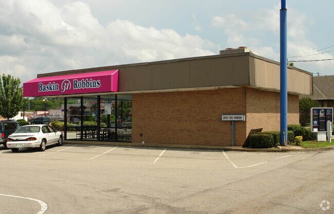
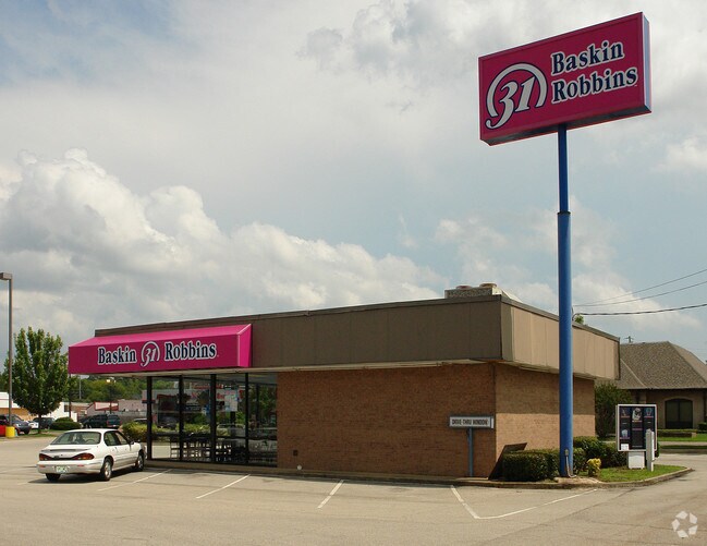
Property Record
4910 N Highway 55, Jackson, MS 39211
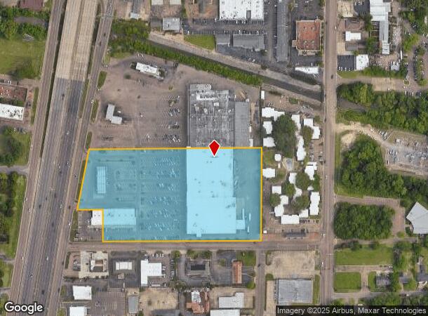
NEARBY LISTINGS FOR SALE OR LEASE
Property Detail
4910 N Highway 55
0507-0330-002
BEG INT W/L OLD CANTON RD & N/L JACKSONIAN PLAZA W 300 FT TO POB N 435.57 FT W 817.53 FT S/LY 291.75 FT E 124.70 FT S 147.94 FT E 734.69 FT TO POB PT SW 1/4 NE 1/4 SEC 13 T6N CONT 8.045 AC LESS TO HWY
Storebuilding
Hinds
AE
Mississippi
28049C0307H
8.05 AC
2024
North Jackson
2025
Jackson
000100
Jackson, MS
101,406 SF
DEMOGRAPHICS near 4910 N Highway 55
1 Mile
3 Mile
5 Mile
2024 Total Population
9,630
49,667
100,804
2029 Population
9,095
47,032
98,449
Pop Growth 2024-2029
(5.56%)
(5.31%)
(2.34%)
Average Age
37
39
39
2024 Total Households
4,355
21,710
44,739
HH Growth 2024-2029
(5.72%)
(5.42%)
(2.42%)
Median Household Inc
$54,007
$46,303
$44,263
Avg Household Size
2.20
2.20
2.10
2024 Avg HH Vehicles
2.00
2.00
2.00
Median Home Value
$162,861
$156,521
$149,888
Median Year Built
1969
1970
1974
Nearby Places
Map Layers
Map Styles
 Street
 Aerial
- Restaurants
- Banks
- Shops
- Fitness
- Groceries
PUBLIC TRANSPORTATION
COMMUTER RAIL
Jackson (City of New Orleans - Amtrak)
DRIVE
WALK
Distance
Jackson (City of New Orleans - Amtrak)
11 min
6.7 mi
AIRPORT
Jackson-Medgar Wiley Evers International
DRIVE
WALK
Distance
Jackson-Medgar Wiley Evers International
22 min
10.8 mi
Freight Ports
Port of Greater Baton Rouge
DRIVE
WALK
Distance
Port of Greater Baton Rouge
205 min
182.4 mi
Nearby Properties
Address
Land Use
TOTAL SIZE
Lot Size
Zoning
Address
Land Use
TOTAL SIZE
Lot Size
Zoning
7,561 SF
153.82 AC
Address
Land Use
TOTAL SIZE
Lot Size
Zoning
416,776 SF
18.77 AC
Address
Land Use
TOTAL SIZE
Lot Size
Zoning
40,445 SF
3 AC
Address
Land Use
TOTAL SIZE
Lot Size
Zoning
51,260 SF
1.58 AC
Address
Land Use
TOTAL SIZE
Lot Size
Zoning
236.80 AC
Address
Land Use
TOTAL SIZE
Lot Size
Zoning
33,960 SF
19,602 AC
Address
Land Use
TOTAL SIZE
Lot Size
Zoning
59,840 SF
2.72 AC
Address
Land Use
TOTAL SIZE
Lot Size
Zoning
55,160 SF
3 AC
Address
Land Use
TOTAL SIZE
Lot Size
Zoning
108,198 SF
15.40 AC
Address
Land Use
TOTAL SIZE
Lot Size
Zoning
64,949 SF
3 AC
Address
Land Use
TOTAL SIZE
Lot Size
Zoning
81,649 SF
5.60 AC
Address
Land Use
TOTAL SIZE
Lot Size
Zoning
54,291 SF
6.99 AC
Address
Land Use
TOTAL SIZE
Lot Size
Zoning
15,374 SF
0.64 AC
Address
Land Use
TOTAL SIZE
Lot Size
Zoning
102,249 SF
14.38 AC
Address
Land Use
TOTAL SIZE
Lot Size
Zoning
67,575 SF
3 AC
Address
Land Use
TOTAL SIZE
Lot Size
Zoning
10,620 SF
2.81 AC
Address
Land Use
TOTAL SIZE
Lot Size
Zoning
230,401 SF
643,381.54 AC
Address
Land Use
TOTAL SIZE
Lot Size
Zoning
4.38 AC
Address
Land Use
TOTAL SIZE
Lot Size
Zoning
20.54 AC
Address
Land Use
TOTAL SIZE
Lot Size
Zoning
23,589 SF
110,808.08 AC
Address
Land Use
TOTAL SIZE
Lot Size
Zoning
93.67 AC
Address
Land Use
TOTAL SIZE
Lot Size
Zoning
78,239 SF
4 AC
Address
Land Use
TOTAL SIZE
Lot Size
Zoning
9,003 SF
1.80 AC
Address
Land Use
TOTAL SIZE
Lot Size
Zoning
148,195 SF
11.66 AC
Address
Land Use
TOTAL SIZE
Lot Size
Zoning
223,203 SF
625,957.30 AC
Address
Land Use
TOTAL SIZE
Lot Size
Zoning
81,911 SF
15.53 AC
Address
Land Use
TOTAL SIZE
Lot Size
Zoning
26,875 SF
3 AC
Address
Land Use
TOTAL SIZE
Lot Size
Zoning
83,318 SF
4.35 AC
Address
Land Use
TOTAL SIZE
Lot Size
Zoning
276,170.80 AC
Address
Land Use
TOTAL SIZE
Lot Size
Zoning
349,916 SF
29.10 AC
The World's #1 Commercial Real Estate Marketplace
Connect with us
© 2026 CoStar Group
The information above has been obtained from sources believed reliable. While we do not doubt its accuracy we have not verified it and make no guarantee, warranty or representation about it. It is your responsibility to independently confirm its accuracy and completeness. Any projections, opinions, assumptions, or estimates used are for example only and do not represent the current or future performance of the property. The value of this transaction to you depends on tax and other factors which should be evaluated by your tax, financial, and legal advisors. You and your advisors should conduct a careful, independent investigation of the property to determine to your satisfaction the suitability of the property for your needs.