Property Record
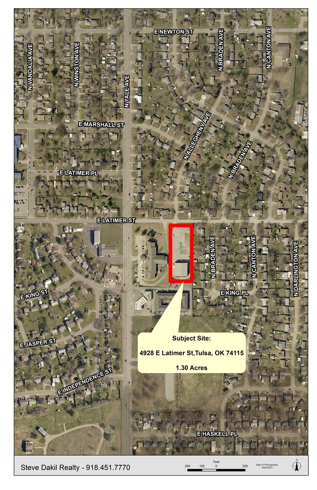
4928 E Latimer St, Tulsa, OK 74115


Property Detail
4928 E Latimer St
90334-03-34-29870
BEG 300.8E & 230S NWC SW TH E150 S230 W150 N230 POB LESS S50 THEREOF SEC 34 20 13 .620ACS
Religious
Tulsa
RS3
Oklahoma
B and X Area of moderate flood hazard, usually the area between the limits of the 100-year and 500-year floods.
0.62 AC
0
Northeast
2025
Tulsa
001600
Tulsa, OK
8,100 SF
NEARBY LISTINGS FOR SALE OR LEASE
-
-
View all Tulsa listings for sale on LoopNet.com
DEMOGRAPHICS near 4928 E Latimer St
1 mile
3 mile
5 mile
2025 Total Population
11,817
82,648
182,873
2030 Population
12,241
86,136
190,205
Pop Growth 2025-2030
+ 3.59%
+ 4.22%
+ 4.01%
Average Age
36
36
38
2025 Total Households
4,456
32,118
75,007
HH Growth 2025-2030
+ 3.66%
+ 4.36%
+ 4.20%
Median Household Inc
$43,164
$50,267
$53,698
Avg Household Size
2.50
2.40
2.30
2025 Avg HH Vehicles
2.00
2.00
2.00
Median Home Value
$77,144
$125,863
$167,277
Median Year Built
1954
1954
1958
Nearby Places
Map Layers
Map Styles
 Street
 Aerial
Transit
 Traffic
 Biking
Places
Listings with unknown addresses are not visible on the map
- Restaurants
- Banks
- Shops
- Fitness
- Groceries
PUBLIC TRANSPORTATION
AIRPORT
Tulsa International
Drive
Walk
Distance
Tulsa International
11 min
5.2 mi
Freight Ports
Drive
Walk
Distance
21 min
14.7 mi
SALE & LEASE HISTORY
LISTING DATE
SALE/LEASE

Sep 24, 2016
For Sale
Oct 26, 2022
For Sale
Apr 11, 2018
For Sale
Nearby Properties
Address
Land Use
TOTAL SIZE
Lot Size
Zoning
Address
Land Use
TOTAL SIZE
Lot Size
Zoning
1,604,892 SF
208.96 AC
AG
Address
Land Use
TOTAL SIZE
Lot Size
Zoning
1,673,798 SF
90.26 AC
NCU
Address
Land Use
TOTAL SIZE
Lot Size
Zoning
353.75 AC
IL
Address
Land Use
TOTAL SIZE
Lot Size
Zoning
175,176 SF
1.57 AC
RM2
Address
Land Use
TOTAL SIZE
Lot Size
Zoning
230,620 SF
16.72 AC
RM2
Address
Land Use
TOTAL SIZE
Lot Size
Zoning
94,115 SF
15.18 AC
IM
Address
Land Use
TOTAL SIZE
Lot Size
Zoning
106,579 SF
6.76 AC
RM1
Address
Land Use
TOTAL SIZE
Lot Size
Zoning
60,320 SF
5.23 AC
NCU
Address
Land Use
TOTAL SIZE
Lot Size
Zoning
163,321 SF
10.74 AC
RS3
Address
Land Use
TOTAL SIZE
Lot Size
Zoning
228.59 AC
IL
Address
Land Use
TOTAL SIZE
Lot Size
Zoning
46,610 SF
14.99 AC
RM2
Address
Land Use
TOTAL SIZE
Lot Size
Zoning
195,492 SF
17.11 AC
RM1
Address
Land Use
TOTAL SIZE
Lot Size
Zoning
77,346 SF
8.59 AC
RS3
Address
Land Use
TOTAL SIZE
Lot Size
Zoning
51,539 SF
0.96 AC
RM2
Address
Land Use
TOTAL SIZE
Lot Size
Zoning
96,983 SF
5.42 AC
RM2
Address
Land Use
TOTAL SIZE
Lot Size
Zoning
118,824 SF
38.79 AC
IM
Address
Land Use
TOTAL SIZE
Lot Size
Zoning
194,615 SF
18.68 AC
RS3
Address
Land Use
TOTAL SIZE
Lot Size
Zoning
110.77 AC
IL
Address
Land Use
TOTAL SIZE
Lot Size
Zoning
121,518 SF
8.52 AC
IM
Address
Land Use
TOTAL SIZE
Lot Size
Zoning
62,968 SF
2.32 AC
NCU
Address
Land Use
TOTAL SIZE
Lot Size
Zoning
109,438 SF
1.77 AC
RM3
Address
Land Use
TOTAL SIZE
Lot Size
Zoning
103,248 SF
8.87 AC
IL
Address
Land Use
TOTAL SIZE
Lot Size
Zoning
36,962 SF
1.23 AC
CH
Address
Land Use
TOTAL SIZE
Lot Size
Zoning
97.68 AC
CH
Address
Land Use
TOTAL SIZE
Lot Size
Zoning
29,584 SF
2.99 AC
IM
Address
Land Use
TOTAL SIZE
Lot Size
Zoning
92,121 SF
9.34 AC
CS
Address
Land Use
TOTAL SIZE
Lot Size
Zoning
41,874 SF
35.70 AC
RS3
Address
Land Use
TOTAL SIZE
Lot Size
Zoning
592,475 SF
4.38 AC
CH
Address
Land Use
TOTAL SIZE
Lot Size
Zoning
117,204 SF
9.79 AC
IM
Address
Land Use
TOTAL SIZE
Lot Size
Zoning
34,356 SF
35.67 AC
RS3
The World's #1 Commercial Real Estate Marketplace
Connect with us
© 2026 CoStar Group
The information above has been obtained from sources believed reliable. While we do not doubt its accuracy we have not verified it and make no guarantee, warranty or representation about it. It is your responsibility to independently confirm its accuracy and completeness. Any projections, opinions, assumptions, or estimates used are for example only and do not represent the current or future performance of the property. The value of this transaction to you depends on tax and other factors which should be evaluated by your tax, financial, and legal advisors. You and your advisors should conduct a careful, independent investigation of the property to determine to your satisfaction the suitability of the property for your needs.