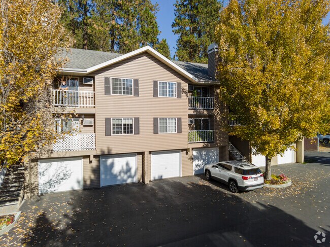
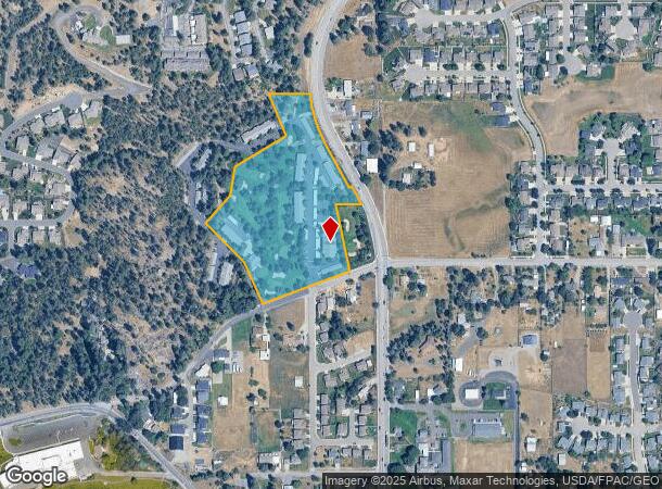
Property Record
4929 N Pasadena Ln, Spokane, WA 99212
NEARBY LISTINGS FOR SALE OR LEASE
-
-
View all Spokane listings for sale on LoopNet.com
Property Detail
4929 N Pasadena Ln
46316.0628
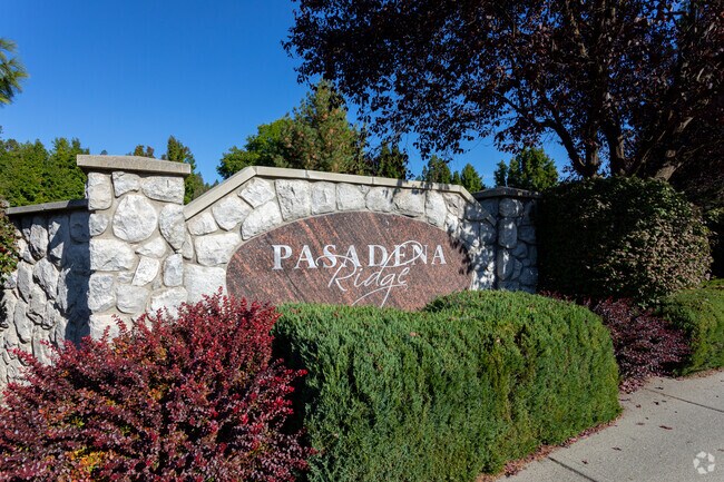
Pasadena Park
Apartment
PRIOR REF 5864639
AE
Spokane
53063C0558D
Washington
2025
9.30 AC
2025
North Spokane County
012200
Spokane
40,248 SF
Spokane-Spokane Valley, WA
DEMOGRAPHICS near 4929 N Pasadena Ln
1 Mile
3 Mile
5 Mile
2024 Total Population
7,208
38,554
119,335
2029 Population
7,657
41,085
126,959
Pop Growth 2024-2029
+ 6.23%
+ 6.56%
+ 6.39%
Average Age
43
39
40
2024 Total Households
2,826
15,871
47,889
HH Growth 2024-2029
+ 6.37%
+ 6.71%
+ 6.54%
Median Household Inc
$97,009
$62,546
$58,177
Avg Household Size
2.50
2.40
2.40
2024 Avg HH Vehicles
2.00
2.00
2.00
Median Home Value
$420,942
$326,724
$289,543
Median Year Built
1994
1978
1974
Nearby Places
Map Layers
Map Styles
 Street
 Aerial
- Restaurants
- Banks
- Shops
- Fitness
- Groceries
PUBLIC TRANSPORTATION
COMMUTER RAIL
Spokane (Empire Builder - Amtrak)
DRIVE
WALK
Distance
Spokane (Empire Builder - Amtrak)
16 min
8.9 mi
AIRPORT
Spokane International
DRIVE
WALK
Distance
Spokane International
23 min
14.8 mi
Freight Ports
Port of Everett
DRIVE
WALK
Distance
Port of Everett
351 min
310.4 mi
Nearby Properties
Address
Land Use
TOTAL SIZE
Lot Size
Zoning
Address
Land Use
TOTAL SIZE
Lot Size
Zoning
355,192 SF
35.83 AC
I-2
Address
Land Use
TOTAL SIZE
Lot Size
Zoning
259,169 SF
13.42 AC
MF-2
Address
Land Use
TOTAL SIZE
Lot Size
Zoning
378,750 SF
17.38 AC
R-2
Address
Land Use
TOTAL SIZE
Lot Size
Zoning
204,730 SF
8.60 AC
MUC
Address
Land Use
TOTAL SIZE
Lot Size
Zoning
175,936 SF
12.16 AC
MF-2
Address
Land Use
TOTAL SIZE
Lot Size
Zoning
87,989 SF
5.38 AC
MF-2
Address
Land Use
TOTAL SIZE
Lot Size
Zoning
151,690 SF
7.89 AC
MF-2
Address
Land Use
TOTAL SIZE
Lot Size
Zoning
96,424 SF
9.04 AC
I-1
Address
Land Use
TOTAL SIZE
Lot Size
Zoning
120,296 SF
9.26 AC
MF-2
Address
Land Use
TOTAL SIZE
Lot Size
Zoning
139,164 SF
5.62 AC
MUC
Address
Land Use
TOTAL SIZE
Lot Size
Zoning
134,104 SF
5.89 AC
HDR
Address
Land Use
TOTAL SIZE
Lot Size
Zoning
89,120 SF
5.83 AC
MDR
Address
Land Use
TOTAL SIZE
Lot Size
Zoning
123,938 SF
7.70 AC
MF-2
Address
Land Use
TOTAL SIZE
Lot Size
Zoning
76,190 SF
4.03 AC
MUC
Address
Land Use
TOTAL SIZE
Lot Size
Zoning
72,903 SF
6.35 AC
MF-2
Address
Land Use
TOTAL SIZE
Lot Size
Zoning
118,810 SF
11.23 AC
MUC
Address
Land Use
TOTAL SIZE
Lot Size
Zoning
418,875 SF
18.79 AC
I-1
Address
Land Use
TOTAL SIZE
Lot Size
Zoning
100,656 SF
4.86 AC
MUC
Address
Land Use
TOTAL SIZE
Lot Size
Zoning
104,760 SF
6.96 AC
HDR
Address
Land Use
TOTAL SIZE
Lot Size
Zoning
38,889 SF
114.18 AC
LI
Address
Land Use
TOTAL SIZE
Lot Size
Zoning
200 SF
159.15 AC
LI
Address
Land Use
TOTAL SIZE
Lot Size
Zoning
82,801 SF
5.14 AC
MF-2
Address
Land Use
TOTAL SIZE
Lot Size
Zoning
90,423 SF
2.48 AC
C
Address
Land Use
TOTAL SIZE
Lot Size
Zoning
73,500 SF
4.14 AC
MUC
Address
Land Use
TOTAL SIZE
Lot Size
Zoning
78,194 SF
4.28 AC
MF-2
Address
Land Use
TOTAL SIZE
Lot Size
Zoning
79,516 SF
3.45 AC
MF-2
Address
Land Use
TOTAL SIZE
Lot Size
Zoning
87,488 SF
3.28 AC
MF-2
Address
Land Use
TOTAL SIZE
Lot Size
Zoning
75,442 SF
3.92 AC
C-1
Address
Land Use
TOTAL SIZE
Lot Size
Zoning
79,046 SF
4.10 AC
HDR
Address
Land Use
TOTAL SIZE
Lot Size
Zoning
73,760 SF
6.01 AC
MF-2
The World's #1 Commercial Real Estate Marketplace
Connect with us
© 2026 CoStar Group
The information above has been obtained from sources believed reliable. While we do not doubt its accuracy we have not verified it and make no guarantee, warranty or representation about it. It is your responsibility to independently confirm its accuracy and completeness. Any projections, opinions, assumptions, or estimates used are for example only and do not represent the current or future performance of the property. The value of this transaction to you depends on tax and other factors which should be evaluated by your tax, financial, and legal advisors. You and your advisors should conduct a careful, independent investigation of the property to determine to your satisfaction the suitability of the property for your needs.