Property Record
4929 Riverwind Pointe Dr, Evansville, IN 47715


NEARBY LISTINGS FOR SALE OR LEASE
Property Detail
4929 Riverwind Pointe Dr
Evansville, IN-KY
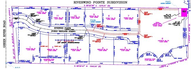
Riverwind Pointe Sub Ph 1
82-09-01-005-181.003-026
RIVERWIND POINTE I LOT 3 & PT L 2
Officebuilding
Vanderburgh
X
Indiana
21101C0105F
3
2024
1.50 AC
2024
Eastside
003805
Evansville
21,152 SF
DEMOGRAPHICS near 4929 Riverwind Pointe Dr
1 Mile
3 Mile
5 Mile
2024 Total Population
5,771
45,858
97,695
2029 Population
5,748
45,792
98,823
Pop Growth 2024-2029
(0.40%)
(0.14%)
+ 1.15%
Average Age
38
40
40
2024 Total Households
2,603
20,145
42,764
HH Growth 2024-2029
(0.46%)
(0.16%)
+ 1.09%
Median Household Inc
$48,124
$54,842
$51,500
Avg Household Size
2.20
2.20
2.20
2024 Avg HH Vehicles
2.00
2.00
2.00
Median Home Value
$127,431
$142,611
$137,302
Median Year Built
1981
1970
1969
Nearby Places
Map Layers
Map Styles
 Street
 Aerial
- Restaurants
- Banks
- Shops
- Fitness
- Groceries
PUBLIC TRANSPORTATION
AIRPORT
Evansville Regional
DRIVE
WALK
Distance
Evansville Regional
17 min
9.5 mi
Freight Ports
Port of Toledo
DRIVE
WALK
Distance
Port of Toledo
457 min
394.6 mi
SALE & LEASE HISTORY
LISTING DATE
SALE/LEASE

Sep 24, 2016
For Sale
Oct 01, 2019
For Lease
Oct 01, 2019
For Sale
Jul 18, 2018
For Lease
Aug 03, 2023
For Sale
Aug 03, 2023
For Sale
Aug 03, 2023
For Sale
Nearby Properties
Address
Land Use
TOTAL SIZE
Lot Size
Zoning
Address
Land Use
TOTAL SIZE
Lot Size
Zoning
109,983 SF
27.50 AC
Address
Land Use
TOTAL SIZE
Lot Size
Zoning
169,860 SF
20.33 AC
Address
Land Use
TOTAL SIZE
Lot Size
Zoning
176,128 SF
18.79 AC
Address
Land Use
TOTAL SIZE
Lot Size
Zoning
37,199 SF
27.28 AC
Address
Land Use
TOTAL SIZE
Lot Size
Zoning
5,000 SF
21.20 AC
Address
Land Use
TOTAL SIZE
Lot Size
Zoning
7,705 SF
27.73 AC
Address
Land Use
TOTAL SIZE
Lot Size
Zoning
8,700 SF
22.09 AC
Address
Land Use
TOTAL SIZE
Lot Size
Zoning
210,137 SF
18 AC
Address
Land Use
TOTAL SIZE
Lot Size
Zoning
45,500 SF
6.46 AC
Address
Land Use
TOTAL SIZE
Lot Size
Zoning
3,757 SF
18.83 AC
Address
Land Use
TOTAL SIZE
Lot Size
Zoning
143,846 SF
11.09 AC
Address
Land Use
TOTAL SIZE
Lot Size
Zoning
10,587 SF
11.69 AC
Address
Land Use
TOTAL SIZE
Lot Size
Zoning
75,433 SF
2.29 AC
Address
Land Use
TOTAL SIZE
Lot Size
Zoning
11,976 SF
14.20 AC
Address
Land Use
TOTAL SIZE
Lot Size
Zoning
184,046 SF
10.05 AC
Address
Land Use
TOTAL SIZE
Lot Size
Zoning
13,364 SF
5.57 AC
Address
Land Use
TOTAL SIZE
Lot Size
Zoning
37,404 SF
12 AC
Address
Land Use
TOTAL SIZE
Lot Size
Zoning
3,552 SF
9.48 AC
Address
Land Use
TOTAL SIZE
Lot Size
Zoning
12,744 SF
6.19 AC
Address
Land Use
TOTAL SIZE
Lot Size
Zoning
170,760 SF
15.49 AC
Address
Land Use
TOTAL SIZE
Lot Size
Zoning
9,916 SF
11.62 AC
Address
Land Use
TOTAL SIZE
Lot Size
Zoning
71,499 SF
2.39 AC
Address
Land Use
TOTAL SIZE
Lot Size
Zoning
151,262 SF
11.03 AC
Address
Land Use
TOTAL SIZE
Lot Size
Zoning
13,231 SF
8.04 AC
Address
Land Use
TOTAL SIZE
Lot Size
Zoning
83,218 SF
1.83 AC
Address
Land Use
TOTAL SIZE
Lot Size
Zoning
115,291 SF
8.85 AC
Address
Land Use
TOTAL SIZE
Lot Size
Zoning
7,154 SF
13.59 AC
Address
Land Use
TOTAL SIZE
Lot Size
Zoning
66,751 SF
2.33 AC
Address
Land Use
TOTAL SIZE
Lot Size
Zoning
43,672 SF
8.01 AC
Address
Land Use
TOTAL SIZE
Lot Size
Zoning
11,286 SF
4.07 AC
The World's #1 Commercial Real Estate Marketplace
Connect with us
© 2025 CoStar Group
The information above has been obtained from sources believed reliable. While we do not doubt its accuracy we have not verified it and make no guarantee, warranty or representation about it. It is your responsibility to independently confirm its accuracy and completeness. Any projections, opinions, assumptions, or estimates used are for example only and do not represent the current or future performance of the property. The value of this transaction to you depends on tax and other factors which should be evaluated by your tax, financial, and legal advisors. You and your advisors should conduct a careful, independent investigation of the property to determine to your satisfaction the suitability of the property for your needs.