Property Record
4929 State Route 59, Ravenna, OH 44266


NEARBY LISTINGS FOR SALE OR LEASE
Property Detail
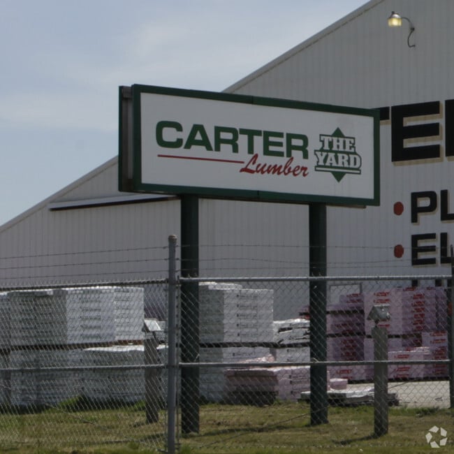
4929 State Route 59
Akron, OH
Ravenna Bldg Co
29-325-00-00-003-000
LOTS 31 & 25
Storebuilding
Portage
X
Ohio
39133C0162D
31,25
2024
11.09 AC
2024
Portage County
601100
Cleveland
23,819 SF
DEMOGRAPHICS near 4929 State Route 59
1 Mile
3 Mile
5 Mile
2024 Total Population
2,864
19,217
32,458
2029 Population
2,917
19,588
32,961
Pop Growth 2024-2029
+ 1.85%
+ 1.93%
+ 1.55%
Average Age
45
42
42
2024 Total Households
1,372
8,459
14,042
HH Growth 2024-2029
+ 1.75%
+ 1.81%
+ 1.43%
Median Household Inc
$49,687
$45,046
$51,067
Avg Household Size
2.00
2.20
2.20
2024 Avg HH Vehicles
2.00
2.00
2.00
Median Home Value
$164,617
$124,572
$146,170
Median Year Built
1970
1967
1972
Nearby Places
Map Layers
Map Styles
 Street
 Aerial
- Restaurants
- Banks
- Shops
- Fitness
- Groceries
PUBLIC TRANSPORTATION
AIRPORT
Akron-Canton Regional
DRIVE
WALK
Distance
Akron-Canton Regional
39 min
30.9 mi
Freight Ports
Port of Toledo
DRIVE
WALK
Distance
Port of Toledo
166 min
140.4 mi
Nearby Properties
Address
Land Use
TOTAL SIZE
Lot Size
Zoning
Address
Land Use
TOTAL SIZE
Lot Size
Zoning
485,791 SF
53.13 AC
Address
Land Use
TOTAL SIZE
Lot Size
Zoning
234,656 SF
23.85 AC
Address
Land Use
TOTAL SIZE
Lot Size
Zoning
161,135 SF
68.79 AC
Address
Land Use
TOTAL SIZE
Lot Size
Zoning
206,254 SF
63.78 AC
Address
Land Use
TOTAL SIZE
Lot Size
Zoning
462,174 SF
33.80 AC
Address
Land Use
TOTAL SIZE
Lot Size
Zoning
350,894 SF
40.36 AC
Address
Land Use
TOTAL SIZE
Lot Size
Zoning
66,771 SF
6.97 AC
Address
Land Use
TOTAL SIZE
Lot Size
Zoning
33,257 SF
5.57 AC
Address
Land Use
TOTAL SIZE
Lot Size
Zoning
36,912 SF
4.30 AC
Address
Land Use
TOTAL SIZE
Lot Size
Zoning
208,007 SF
14.60 AC
Address
Land Use
TOTAL SIZE
Lot Size
Zoning
138,051 SF
1.96 AC
Address
Land Use
TOTAL SIZE
Lot Size
Zoning
58,213 SF
1.05 AC
Address
Land Use
TOTAL SIZE
Lot Size
Zoning
80,180 SF
0.57 AC
Address
Land Use
TOTAL SIZE
Lot Size
Zoning
130,941 SF
16.23 AC
Address
Land Use
TOTAL SIZE
Lot Size
Zoning
35,078 SF
7.59 AC
Address
Land Use
TOTAL SIZE
Lot Size
Zoning
97,732 SF
5.20 AC
Address
Land Use
TOTAL SIZE
Lot Size
Zoning
36,652 SF
8.47 AC
Address
Land Use
TOTAL SIZE
Lot Size
Zoning
54,280 SF
5.44 AC
Address
Land Use
TOTAL SIZE
Lot Size
Zoning
166,392 SF
15.10 AC
Address
Land Use
TOTAL SIZE
Lot Size
Zoning
Address
Land Use
TOTAL SIZE
Lot Size
Zoning
80,466 SF
4.42 AC
Address
Land Use
TOTAL SIZE
Lot Size
Zoning
161,000 SF
28.39 AC
Address
Land Use
TOTAL SIZE
Lot Size
Zoning
61,746 SF
12.51 AC
Address
Land Use
TOTAL SIZE
Lot Size
Zoning
69,958 SF
5 AC
Address
Land Use
TOTAL SIZE
Lot Size
Zoning
109,100 SF
12.91 AC
Address
Land Use
TOTAL SIZE
Lot Size
Zoning
69,060 SF
11.88 AC
Address
Land Use
TOTAL SIZE
Lot Size
Zoning
30,105 SF
4.52 AC
Address
Land Use
TOTAL SIZE
Lot Size
Zoning
21,450 SF
0.75 AC
Address
Land Use
TOTAL SIZE
Lot Size
Zoning
33,026 SF
0.45 AC
Address
Land Use
TOTAL SIZE
Lot Size
Zoning
19,584 SF
4.35 AC
The World's #1 Commercial Real Estate Marketplace
Connect with us
© 2025 CoStar Group
The information above has been obtained from sources believed reliable. While we do not doubt its accuracy we have not verified it and make no guarantee, warranty or representation about it. It is your responsibility to independently confirm its accuracy and completeness. Any projections, opinions, assumptions, or estimates used are for example only and do not represent the current or future performance of the property. The value of this transaction to you depends on tax and other factors which should be evaluated by your tax, financial, and legal advisors. You and your advisors should conduct a careful, independent investigation of the property to determine to your satisfaction the suitability of the property for your needs.