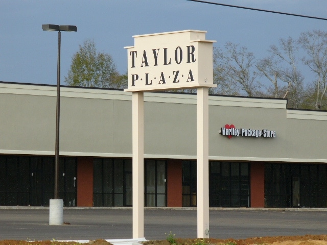
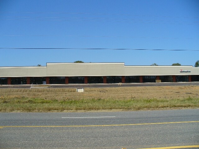
Property Record
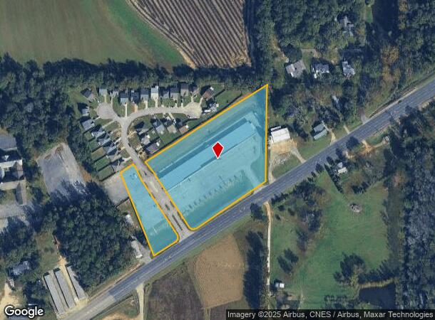
4930 W State Highway 52, Taylor, AL 36305
NEARBY LISTINGS FOR SALE OR LEASE
Property Detail
4930 W State Highway 52
17-03-05-0-000-012-000
Nw4 Nw4 Of S15 T2n R26e 3.77Ac & 1.30Ac;
Commercialofficeresidentialmixeduse
PT OF NW1/4 OF NW1/4 OF SEC 05 T2N R26E
X
Houston
01069C0212G
Alabama
2025
4.96 AC
2025
Dothan/Enterprise
042100
Other Market Areas
31,000 SF
Dothan, AL
DEMOGRAPHICS near 4930 W State Highway 52
1 Mile
3 Mile
5 Mile
2024 Total Population
1,679
16,369
47,881
2029 Population
1,722
16,681
48,667
Pop Growth 2024-2029
+ 2.56%
+ 1.91%
+ 1.64%
Average Age
38
40
41
2024 Total Households
626
6,627
20,028
HH Growth 2024-2029
+ 2.56%
+ 1.83%
+ 1.61%
Median Household Inc
$62,129
$64,359
$54,390
Avg Household Size
2.60
2.40
2.30
2024 Avg HH Vehicles
2.00
2.00
2.00
Median Home Value
$150,710
$173,799
$174,961
Median Year Built
1992
1995
1985
Nearby Places
Map Layers
Map Styles
 Street
 Aerial
- Restaurants
- Banks
- Shops
- Fitness
- Groceries
PUBLIC TRANSPORTATION
AIRPORT
Dothan Regional
DRIVE
WALK
Distance
Dothan Regional
21 min
10.7 mi
SALE & LEASE HISTORY
LISTING DATE
SALE/LEASE

Sep 25, 2016
For Lease
Nearby Properties
Address
Land Use
TOTAL SIZE
Lot Size
Zoning
Address
Land Use
TOTAL SIZE
Lot Size
Zoning
192,165 SF
2 AC
Address
Land Use
TOTAL SIZE
Lot Size
Zoning
30,503 SF
10.57 AC
Address
Land Use
TOTAL SIZE
Lot Size
Zoning
22,840 SF
10 AC
Address
Land Use
TOTAL SIZE
Lot Size
Zoning
10,086 SF
16.80 AC
Address
Land Use
TOTAL SIZE
Lot Size
Zoning
79,961 SF
12.40 AC
Address
Land Use
TOTAL SIZE
Lot Size
Zoning
9,112 SF
10.50 AC
Address
Land Use
TOTAL SIZE
Lot Size
Zoning
145,107 SF
14.30 AC
Address
Land Use
TOTAL SIZE
Lot Size
Zoning
14,624 SF
9.05 AC
Address
Land Use
TOTAL SIZE
Lot Size
Zoning
65,972 SF
3.84 AC
Address
Land Use
TOTAL SIZE
Lot Size
Zoning
390 SF
11.10 AC
Address
Land Use
TOTAL SIZE
Lot Size
Zoning
46,974 SF
0.55 AC
Address
Land Use
TOTAL SIZE
Lot Size
Zoning
37,140 SF
0.43 AC
Address
Land Use
TOTAL SIZE
Lot Size
Zoning
62,263 SF
20 AC
Address
Land Use
TOTAL SIZE
Lot Size
Zoning
1,536 SF
40.30 AC
Address
Land Use
TOTAL SIZE
Lot Size
Zoning
4,800 SF
18 AC
Address
Land Use
TOTAL SIZE
Lot Size
Zoning
20,241 SF
4 AC
Address
Land Use
TOTAL SIZE
Lot Size
Zoning
9,508 SF
7.22 AC
Address
Land Use
TOTAL SIZE
Lot Size
Zoning
5,008 SF
3.24 AC
Address
Land Use
TOTAL SIZE
Lot Size
Zoning
2,535 SF
32 AC
Address
Land Use
TOTAL SIZE
Lot Size
Zoning
36,418 SF
2.01 AC
Address
Land Use
TOTAL SIZE
Lot Size
Zoning
22,024 SF
4.52 AC
Address
Land Use
TOTAL SIZE
Lot Size
Zoning
12,558 SF
87 SF
Address
Land Use
TOTAL SIZE
Lot Size
Zoning
40,529 SF
1.80 AC
Address
Land Use
TOTAL SIZE
Lot Size
Zoning
22,734 SF
3.70 AC
Address
Land Use
TOTAL SIZE
Lot Size
Zoning
7,200 SF
4.40 AC
Address
Land Use
TOTAL SIZE
Lot Size
Zoning
44,693 SF
10.50 AC
Address
Land Use
TOTAL SIZE
Lot Size
Zoning
36,194 SF
1.98 AC
Address
Land Use
TOTAL SIZE
Lot Size
Zoning
17,219 SF
5.90 AC
Address
Land Use
TOTAL SIZE
Lot Size
Zoning
18,000 SF
5.83 AC
The World's #1 Commercial Real Estate Marketplace
Connect with us
© 2026 CoStar Group
The information above has been obtained from sources believed reliable. While we do not doubt its accuracy we have not verified it and make no guarantee, warranty or representation about it. It is your responsibility to independently confirm its accuracy and completeness. Any projections, opinions, assumptions, or estimates used are for example only and do not represent the current or future performance of the property. The value of this transaction to you depends on tax and other factors which should be evaluated by your tax, financial, and legal advisors. You and your advisors should conduct a careful, independent investigation of the property to determine to your satisfaction the suitability of the property for your needs.