Property Record
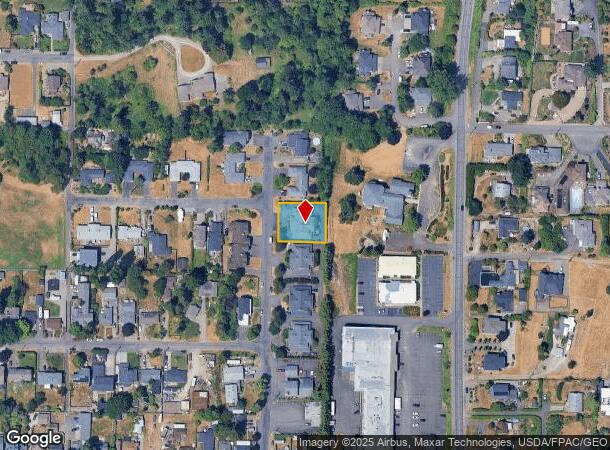
4931 Wa Tau Ga Ave Ne, Tacoma, WA 98422

NEARBY LISTINGS FOR SALE OR LEASE
-
-
View all Tacoma listings for sale on LoopNet.com
Property Detail
4931 Wa Tau Ga Ave Ne
Seattle-Tacoma-Bellevue, WA
Hyada Park
470000-3034
NORTH30.5 FT LOT2 PCL D
Quadruplex
Pierce
X
Washington
53033C1225G
2
2024
0.30 AC
2025
Northeast Tacoma
940001
Seattle/Puget Sound
5,112 SF
DEMOGRAPHICS near 4931 Wa Tau Ga Ave Ne
1 Mile
3 Mile
5 Mile
2024 Total Population
3,771
38,038
165,661
2029 Population
3,857
38,713
169,383
Pop Growth 2024-2029
+ 2.28%
+ 1.77%
+ 2.25%
Average Age
46
42
40
2024 Total Households
1,504
15,948
67,019
HH Growth 2024-2029
+ 2.39%
+ 2.01%
+ 2.54%
Median Household Inc
$138,703
$102,107
$88,663
Avg Household Size
2.40
2.30
2.30
2024 Avg HH Vehicles
2.00
2.00
2.00
Median Home Value
$728,634
$625,091
$495,858
Median Year Built
1979
1975
1976
Nearby Places
Map Layers
Map Styles
 Street
 Aerial
- Restaurants
- Banks
- Shops
- Fitness
- Groceries
PUBLIC TRANSPORTATION
AIRPORT
Seattle-Tacoma International
DRIVE
WALK
Distance
Seattle-Tacoma International
38 min
17.6 mi
Nearby Properties
Address
Land Use
TOTAL SIZE
Lot Size
Zoning
Address
Land Use
TOTAL SIZE
Lot Size
Zoning
6,794 SF
127.94 AC
S10
Address
Land Use
TOTAL SIZE
Lot Size
Zoning
161,799 SF
108.15 AC
PMI
Address
Land Use
TOTAL SIZE
Lot Size
Zoning
1 SF
8.63 AC
M2
Address
Land Use
TOTAL SIZE
Lot Size
Zoning
10,000 SF
59.94 AC
S10
Address
Land Use
TOTAL SIZE
Lot Size
Zoning
259,560 SF
16.20 AC
RM2400
Address
Land Use
TOTAL SIZE
Lot Size
Zoning
18,860 SF
35.98 AC
S10
Address
Land Use
TOTAL SIZE
Lot Size
Zoning
1 SF
49.87 AC
S10
Address
Land Use
TOTAL SIZE
Lot Size
Zoning
279,294 SF
74.24 AC
S13
Address
Land Use
TOTAL SIZE
Lot Size
Zoning
210,196 SF
12.75 AC
R2
Address
Land Use
TOTAL SIZE
Lot Size
Zoning
72,000 SF
59.37 AC
PMI
Address
Land Use
TOTAL SIZE
Lot Size
Zoning
186,027 SF
9.76 AC
R2
Address
Land Use
TOTAL SIZE
Lot Size
Zoning
15.16 AC
CP-1
Address
Land Use
TOTAL SIZE
Lot Size
Zoning
112,281 SF
2.61 AC
RCX
Address
Land Use
TOTAL SIZE
Lot Size
Zoning
110,296 SF
0.28 AC
DR
Address
Land Use
TOTAL SIZE
Lot Size
Zoning
280,525 SF
16.58 AC
Address
Land Use
TOTAL SIZE
Lot Size
Zoning
209,407 SF
Address
Land Use
TOTAL SIZE
Lot Size
Zoning
169,165 SF
0.73 AC
DR
Address
Land Use
TOTAL SIZE
Lot Size
Zoning
114,452 SF
9.83 AC
R2
Address
Land Use
TOTAL SIZE
Lot Size
Zoning
72 SF
17.29 AC
S7
Address
Land Use
TOTAL SIZE
Lot Size
Zoning
24,244 SF
109.59 AC
R2
Address
Land Use
TOTAL SIZE
Lot Size
Zoning
277,945 SF
32.32 AC
TAC
Address
Land Use
TOTAL SIZE
Lot Size
Zoning
102,104 SF
7.50 AC
R3
Address
Land Use
TOTAL SIZE
Lot Size
Zoning
124,621 SF
30.71 AC
R2
Address
Land Use
TOTAL SIZE
Lot Size
Zoning
Address
Land Use
TOTAL SIZE
Lot Size
Zoning
276,565 SF
0.35 AC
HMX
Address
Land Use
TOTAL SIZE
Lot Size
Zoning
52,242 SF
0.89 AC
S10
Address
Land Use
TOTAL SIZE
Lot Size
Zoning
178,880 SF
5.94 AC
RCX
Address
Land Use
TOTAL SIZE
Lot Size
Zoning
122,790 SF
21.77 AC
PMI
Address
Land Use
TOTAL SIZE
Lot Size
Zoning
75,201 SF
4.64 AC
R2
Address
Land Use
TOTAL SIZE
Lot Size
Zoning
41,242 SF
0.44 AC
S6
The World's #1 Commercial Real Estate Marketplace
Connect with us
© 2025 CoStar Group
The information above has been obtained from sources believed reliable. While we do not doubt its accuracy we have not verified it and make no guarantee, warranty or representation about it. It is your responsibility to independently confirm its accuracy and completeness. Any projections, opinions, assumptions, or estimates used are for example only and do not represent the current or future performance of the property. The value of this transaction to you depends on tax and other factors which should be evaluated by your tax, financial, and legal advisors. You and your advisors should conduct a careful, independent investigation of the property to determine to your satisfaction the suitability of the property for your needs.