Property Record
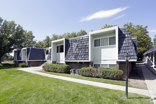
4935 Old Post Rd, Ogden, UT 84403


Property Detail
4935 Old Post Rd
07-014-0033
A PART OF THE NORTHWEST QUARTER OF SECTION 15, TOWNSHIP 5 NORTH, RANGE 1 WEST, SALT LAKE BASE AND MERIDIAN, U.S. SURVEY
Highriseapartments
Weber
B and X Area of moderate flood hazard, usually the area between the limits of the 100-year and 500-year floods.
Utah
2025
7.19 AC
2025
Southeast Ogden
202000
Salt Lake City
4,442 SF
Ogden, UT
NEARBY LISTINGS FOR SALE OR LEASE
DEMOGRAPHICS near 4935 Old Post Rd
1 mile
3 mile
5 mile
2024 Total Population
11,676
64,623
133,682
2029 Population
12,137
66,505
137,805
Pop Growth 2024-2029
+ 3.95%
+ 2.91%
+ 3.08%
Average Age
39
37
37
2024 Total Households
4,193
23,019
48,819
HH Growth 2024-2029
+ 4.44%
+ 3.25%
+ 3.39%
Median Household Inc
$112,634
$85,740
$79,587
Avg Household Size
2.60
2.70
2.60
2024 Avg HH Vehicles
2.00
2.00
2.00
Median Home Value
$550,541
$431,100
$406,148
Median Year Built
1990
1974
1974
Nearby Places
Map Layers
Map Styles
 Street
 Aerial
Transit
 Traffic
 Biking
Places
Listings with unknown addresses are not visible on the map
- Restaurants
- Banks
- Shops
- Fitness
- Groceries
PUBLIC TRANSPORTATION
COMMUTER RAIL
Ogden (FrontRunner North - Utah Transit Authority (UTA))
Drive
Walk
Distance
Ogden (FrontRunner North - Utah Transit Authority (UTA))
12 min
5.5 mi
Roy (FrontRunner North - Utah Transit Authority (UTA))
Drive
Walk
Distance
Roy (FrontRunner North - Utah Transit Authority (UTA))
17 min
8.3 mi
AIRPORT
Salt Lake City International
Drive
Walk
Distance
Salt Lake City International
45 min
33.9 mi
Freight Ports
Port of Stockton
Drive
Walk
Distance
Port of Stockton
746 min
724.3 mi
Nearby Properties
Address
Land Use
TOTAL SIZE
Lot Size
Zoning
Address
Land Use
TOTAL SIZE
Lot Size
Zoning
790,525 SF
57.26 AC
Address
Land Use
TOTAL SIZE
Lot Size
Zoning
13,376 SF
11.50 AC
Address
Land Use
TOTAL SIZE
Lot Size
Zoning
200,509 SF
12.75 AC
Address
Land Use
TOTAL SIZE
Lot Size
Zoning
83,038 SF
7.54 AC
Address
Land Use
TOTAL SIZE
Lot Size
Zoning
98,660 SF
3.18 AC
Address
Land Use
TOTAL SIZE
Lot Size
Zoning
115,094 SF
13.88 AC
Address
Land Use
TOTAL SIZE
Lot Size
Zoning
225,497 SF
20.33 AC
Address
Land Use
TOTAL SIZE
Lot Size
Zoning
134,796 SF
3.93 AC
Address
Land Use
TOTAL SIZE
Lot Size
Zoning
63,343 SF
16.43 AC
Address
Land Use
TOTAL SIZE
Lot Size
Zoning
73,942 SF
8.87 AC
Address
Land Use
TOTAL SIZE
Lot Size
Zoning
2,938 SF
9.69 AC
Address
Land Use
TOTAL SIZE
Lot Size
Zoning
10,440 SF
4.24 AC
Address
Land Use
TOTAL SIZE
Lot Size
Zoning
96,690 SF
1.39 AC
Address
Land Use
TOTAL SIZE
Lot Size
Zoning
202,920 SF
10.16 AC
Address
Land Use
TOTAL SIZE
Lot Size
Zoning
67,248 SF
13.28 AC
Address
Land Use
TOTAL SIZE
Lot Size
Zoning
48,290 SF
7.95 AC
Address
Land Use
TOTAL SIZE
Lot Size
Zoning
59,367 SF
5.90 AC
Address
Land Use
TOTAL SIZE
Lot Size
Zoning
367,709 SF
34 AC
Address
Land Use
TOTAL SIZE
Lot Size
Zoning
2,682 SF
27.83 AC
Address
Land Use
TOTAL SIZE
Lot Size
Zoning
52,323 SF
8.52 AC
Address
Land Use
TOTAL SIZE
Lot Size
Zoning
10,136 SF
2.25 AC
Address
Land Use
TOTAL SIZE
Lot Size
Zoning
4,504 SF
4.16 AC
The World's #1 Commercial Real Estate Marketplace
Connect with us
© 2026 CoStar Group
The information above has been obtained from sources believed reliable. While we do not doubt its accuracy we have not verified it and make no guarantee, warranty or representation about it. It is your responsibility to independently confirm its accuracy and completeness. Any projections, opinions, assumptions, or estimates used are for example only and do not represent the current or future performance of the property. The value of this transaction to you depends on tax and other factors which should be evaluated by your tax, financial, and legal advisors. You and your advisors should conduct a careful, independent investigation of the property to determine to your satisfaction the suitability of the property for your needs.