Property Record
4936 47Th St S, Fargo, ND 58104
Property Detail
4936 47Th St S
01-8434-00200-000
LOT: 3 BLOCK: 1 ADDITION: OSGOOD TOWNSITE 9TH ADDITIONAL: OSGOOD TOWNSITE 9TH LT 3 BLK 1
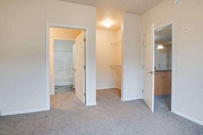
Apartment
CASS
MR3
North Dakota
AE The base floodplain where base flood elevations are provided. AE Zones are now used on new format FIRMs instead of A1-A30 Zones.
3
2025
2.21 AC
2025
Fargo
040501
Other Market Areas
54,170 SF
Fargo, ND-MN
NEARBY LISTINGS FOR SALE OR LEASE
DEMOGRAPHICS near 4936 47Th St S
1 mile
3 mile
5 mile
2025 Total Population
10,147
69,874
141,642
2030 Population
10,804
75,035
151,438
Pop Growth 2025-2030
+ 6.47%
+ 7.39%
+ 6.92%
Average Age
33
34
36
2025 Total Households
4,113
28,446
60,174
HH Growth 2025-2030
+ 7.03%
+ 7.69%
+ 7.10%
Median Household Inc
$82,593
$91,289
$78,745
Avg Household Size
2.40
2.40
2.30
2025 Avg HH Vehicles
2.00
2.00
2.00
Median Home Value
$355,758
$372,722
$320,766
Median Year Built
2009
2010
2001
Nearby Places
Map Layers
Map Styles
 Street
 Aerial
Layers
 Traffic
 Biking
Places
Listings with unknown addresses are not visible on the map
- Restaurants
- Banks
- Shops
- Fitness
- Groceries
PUBLIC TRANSPORTATION
COMMUTER RAIL
Drive
Walk
Distance
17 min
8.9 mi
AIRPORT
Hector International
Drive
Walk
Distance
Hector International
21 min
12.3 mi
Nearby Properties
Address
Land Use
TOTAL SIZE
Lot Size
Zoning
Address
Land Use
TOTAL SIZE
Lot Size
Zoning
161,184 SF
10.51 AC
GC
Address
Land Use
TOTAL SIZE
Lot Size
Zoning
55.68 AC
Address
Land Use
TOTAL SIZE
Lot Size
Zoning
Address
Land Use
TOTAL SIZE
Lot Size
Zoning
Address
Land Use
TOTAL SIZE
Lot Size
Zoning
Address
Land Use
TOTAL SIZE
Lot Size
Zoning
418,024 SF
10.88 AC
Address
Land Use
TOTAL SIZE
Lot Size
Zoning
Address
Land Use
TOTAL SIZE
Lot Size
Zoning
Address
Land Use
TOTAL SIZE
Lot Size
Zoning
7.66 AC
Address
Land Use
TOTAL SIZE
Lot Size
Zoning
Address
Land Use
TOTAL SIZE
Lot Size
Zoning
Address
Land Use
TOTAL SIZE
Lot Size
Zoning
42,366 SF
Address
Land Use
TOTAL SIZE
Lot Size
Zoning
Address
Land Use
TOTAL SIZE
Lot Size
Zoning
217,776 SF
31.82 AC
GC
Address
Land Use
TOTAL SIZE
Lot Size
Zoning
64,653 SF
2.20 AC
MR3
Address
Land Use
TOTAL SIZE
Lot Size
Zoning
34,100 SF
1.46 AC
MR3
Address
Land Use
TOTAL SIZE
Lot Size
Zoning
9,279 SF
8.33 AC
MR1
Address
Land Use
TOTAL SIZE
Lot Size
Zoning
48,300 SF
2.33 AC
MR3
Address
Land Use
TOTAL SIZE
Lot Size
Zoning
30,240 SF
1.54 AC
MR2
Address
Land Use
TOTAL SIZE
Lot Size
Zoning
152,509 SF
18.14 AC
Address
Land Use
TOTAL SIZE
Lot Size
Zoning
152,918 SF
5.38 AC
Address
Land Use
TOTAL SIZE
Lot Size
Zoning
Address
Land Use
TOTAL SIZE
Lot Size
Zoning
73,907 SF
3.41 AC
MR3
Address
Land Use
TOTAL SIZE
Lot Size
Zoning
191,151 SF
22.98 AC
LC
Address
Land Use
TOTAL SIZE
Lot Size
Zoning
54,927 SF
8.45 AC
Address
Land Use
TOTAL SIZE
Lot Size
Zoning
46,271 SF
2.06 AC
MR3
Address
Land Use
TOTAL SIZE
Lot Size
Zoning
123,777 SF
1.90 AC
Address
Land Use
TOTAL SIZE
Lot Size
Zoning
387,326 SF
16.51 AC
GC
Address
Land Use
TOTAL SIZE
Lot Size
Zoning
122,201 SF
8.92 AC
GO
Address
Land Use
TOTAL SIZE
Lot Size
Zoning
794,266 SF
36.84 AC
GC
The World's #1 Commercial Real Estate Marketplace
Connect with us
© 2026 CoStar Group
The information above has been obtained from sources believed reliable. While we do not doubt its accuracy we have not verified it and make no guarantee, warranty or representation about it. It is your responsibility to independently confirm its accuracy and completeness. Any projections, opinions, assumptions, or estimates used are for example only and do not represent the current or future performance of the property. The value of this transaction to you depends on tax and other factors which should be evaluated by your tax, financial, and legal advisors. You and your advisors should conduct a careful, independent investigation of the property to determine to your satisfaction the suitability of the property for your needs.