Property Record
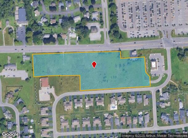
4938 W Taft Rd, Liverpool, NY 13088
NEARBY LISTINGS FOR SALE OR LEASE
Property Detail
4938 W Taft Rd
312489-116-001-0001-001-001-0000
Onondaga
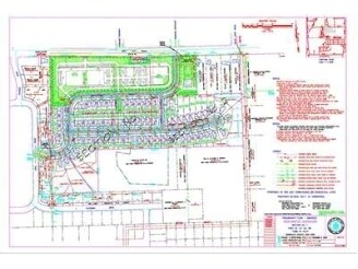
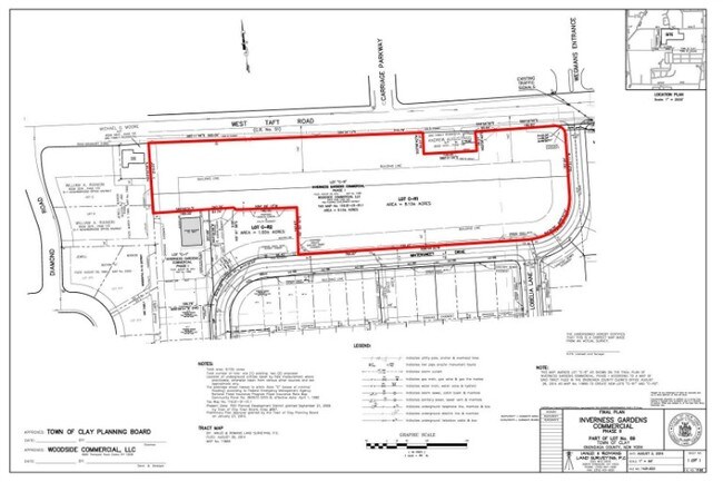
Commercialacreage
New York
X
1.001
36067C0206F
6.65 AC
2025
NE Outer Onondaga County
2024
Syracuse
011011
Syracuse, NY
DEMOGRAPHICS near 4938 W Taft Rd
1 Mile
3 Mile
5 Mile
2024 Total Population
9,480
58,526
150,014
2029 Population
9,224
57,020
145,824
Pop Growth 2024-2029
(2.70%)
(2.57%)
(2.79%)
Average Age
44
42
40
2024 Total Households
4,406
25,847
64,803
HH Growth 2024-2029
(2.84%)
(2.75%)
(2.88%)
Median Household Inc
$67,717
$66,928
$59,806
Avg Household Size
2.10
2.20
2.20
2024 Avg HH Vehicles
2.00
2.00
1.00
Median Home Value
$174,828
$150,455
$152,730
Median Year Built
1973
1964
1960
Nearby Places
- Restaurants
- Banks
- Shops
- Fitness
- Groceries
PUBLIC TRANSPORTATION
COMMUTER RAIL
Syracuse Regional Transportation Center (Empire Service - Amtrak, Lake Shore Limited - Amtrak, Maple Leaf - Amtrak)
DRIVE
WALK
Distance
Syracuse Regional Transportation Center (Empire Service - Amtrak, Lake Shore Limited - Amtrak, Maple Leaf - Amtrak)
10 min
4.5 mi
Syracuse (Toronto - New York - VIA Rail)
DRIVE
WALK
Distance
Syracuse (Toronto - New York - VIA Rail)
10 min
4.6 mi
AIRPORT
Syracuse Hancock International
DRIVE
WALK
Distance
Syracuse Hancock International
8 min
3.7 mi
Freight Ports
Albany, NY Port
DRIVE
WALK
Distance
Albany, NY Port
175 min
146.8 mi
SALE & LEASE HISTORY
LISTING DATE
SALE/LEASE

Sep 25, 2016
For Lease
May 15, 2017
For Sale
Jun 25, 2018
For Sale
Nearby Properties
Address
Land Use
TOTAL SIZE
Lot Size
Zoning
Address
Land Use
TOTAL SIZE
Lot Size
Zoning
11,484 SF
16.36 AC
03 - MULTI
Address
Land Use
TOTAL SIZE
Lot Size
Zoning
218,439 SF
18.85 AC
Address
Land Use
TOTAL SIZE
Lot Size
Zoning
77,150 SF
159.25 AC
06 - INDUS
Address
Land Use
TOTAL SIZE
Lot Size
Zoning
151,326 SF
9.23 AC
05 - COMME
Address
Land Use
TOTAL SIZE
Lot Size
Zoning
3,968 SF
14.31 AC
03 - MULTI
Address
Land Use
TOTAL SIZE
Lot Size
Zoning
7,229 SF
111.29 AC
05 - COMME
Address
Land Use
TOTAL SIZE
Lot Size
Zoning
11,952 SF
9.14 AC
03 - MULTI
Address
Land Use
TOTAL SIZE
Lot Size
Zoning
38,000 SF
9.90 AC
22
Address
Land Use
TOTAL SIZE
Lot Size
Zoning
3.59 AC
04 - FARM
Address
Land Use
TOTAL SIZE
Lot Size
Zoning
71,074 SF
27.78 AC
02 - SINGL
Address
Land Use
TOTAL SIZE
Lot Size
Zoning
78,656 SF
9.14 AC
06 - INDUS
Address
Land Use
TOTAL SIZE
Lot Size
Zoning
32,586 SF
6.87 AC
06 - INDUS
Address
Land Use
TOTAL SIZE
Lot Size
Zoning
118,651 SF
12.27 AC
02 - SINGL
Address
Land Use
TOTAL SIZE
Lot Size
Zoning
17,240 SF
6.49 AC
03 - MULTI
Address
Land Use
TOTAL SIZE
Lot Size
Zoning
66,476 SF
7.68 AC
03 - MULTI
Address
Land Use
TOTAL SIZE
Lot Size
Zoning
109,642 SF
22.17 AC
06 - INDUS
Address
Land Use
TOTAL SIZE
Lot Size
Zoning
71,194 SF
10.76 AC
02 - SINGL
Address
Land Use
TOTAL SIZE
Lot Size
Zoning
96,084 SF
8.74 AC
06 - INDUS
Address
Land Use
TOTAL SIZE
Lot Size
Zoning
11,059 SF
8.23 AC
06 - INDUS
Address
Land Use
TOTAL SIZE
Lot Size
Zoning
64,833 SF
3.25 AC
05 - COMME
Address
Land Use
TOTAL SIZE
Lot Size
Zoning
57,993 SF
16.80 AC
02 - SINGL
Address
Land Use
TOTAL SIZE
Lot Size
Zoning
1.66 AC
06 - INDUS
Address
Land Use
TOTAL SIZE
Lot Size
Zoning
14,508 SF
8.74 AC
03 - MULTI
Address
Land Use
TOTAL SIZE
Lot Size
Zoning
41,292 SF
8.50 AC
05 - COMME
Address
Land Use
TOTAL SIZE
Lot Size
Zoning
210,170 SF
17.87 AC
06 - INDUS
Address
Land Use
TOTAL SIZE
Lot Size
Zoning
69,904 SF
4.63 AC
05 - COMME
Address
Land Use
TOTAL SIZE
Lot Size
Zoning
8,992 SF
6.63 AC
06 - INDUS
Address
Land Use
TOTAL SIZE
Lot Size
Zoning
121,221 SF
6.18 AC
05 - COMME
Address
Land Use
TOTAL SIZE
Lot Size
Zoning
116,534 SF
0.01 AC
03 - MULTI
Address
Land Use
TOTAL SIZE
Lot Size
Zoning
84,190 SF
3.87 AC
05 - COMME
The World's #1 Commercial Real Estate Marketplace
Connect with us
© 2025 CoStar Group
The information above has been obtained from sources believed reliable. While we do not doubt its accuracy we have not verified it and make no guarantee, warranty or representation about it. It is your responsibility to independently confirm its accuracy and completeness. Any projections, opinions, assumptions, or estimates used are for example only and do not represent the current or future performance of the property. The value of this transaction to you depends on tax and other factors which should be evaluated by your tax, financial, and legal advisors. You and your advisors should conduct a careful, independent investigation of the property to determine to your satisfaction the suitability of the property for your needs.