Property Record
4939 Lamm Rd, Wilson, NC 27893

Save to a Folder
{{folder.Name}}
{{folder.ListingIds.length}} Properties
{{folder.ListingIds.length}} Property
Create a New Folder
Property Detail
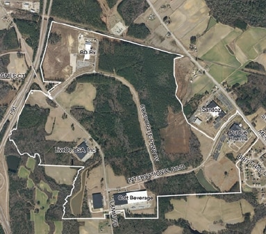
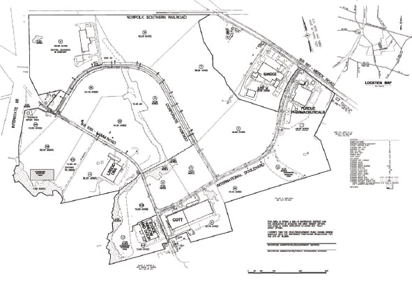
4939 Lamm Rd
2792-76-2147.000
4939 LAMM RD L10B WLSN CORP PK 49.29AC
Realpropertynec
WILSON
HI
North Carolina
B and X Area of moderate flood hazard, usually the area between the limits of the 100-year and 500-year floods.
49.29 AC
2025
Rocky Mount/Wilson
2026
Other Market Areas
001502
Wilson, NC
138,421 SF
NEARBY LISTINGS FOR SALE OR LEASE
DEMOGRAPHICS near 4939 Lamm Rd
1 mile
3 mile
5 mile
2025 Total Population
167
9,547
41,488
2030 Population
170
9,701
42,210
Pop Growth 2025-2030
+ 1.80%
+ 1.61%
+ 1.74%
Average Age
42
41
41
2025 Total Households
71
4,016
17,382
HH Growth 2025-2030
+ 1.41%
+ 1.92%
+ 1.86%
Median Household Inc
$64,411
$65,481
$58,611
Avg Household Size
2.40
2.40
2.30
2025 Avg HH Vehicles
2.00
2.00
2.00
Median Home Value
$215,909
$239,217
$236,950
Median Year Built
1999
1995
1986
Nearby Places
Map Layers
Map Styles
 Street
 Aerial
Layers
 Traffic
 Biking
Places
Listings with unknown addresses are not visible on the map
- Restaurants
- Banks
- Shops
- Fitness
- Groceries
PUBLIC TRANSPORTATION
COMMUTER RAIL
Wilson (Carolinian - Amtrak, Palmetto - Amtrak)
Drive
Walk
Distance
Wilson (Carolinian - Amtrak, Palmetto - Amtrak)
11 min
6.5 mi
Freight Ports
Port of Morehead City
Drive
Walk
Distance
Port of Morehead City
169 min
129.3 mi
SALE & LEASE HISTORY
LISTING DATE
SALE/LEASE

Sep 24, 2016
For Sale
Sep 24, 2016
For Sale
Jun 02, 2017
For Sale
Nearby Properties
Address
Land Use
TOTAL SIZE
Lot Size
Zoning
Address
Land Use
TOTAL SIZE
Lot Size
Zoning
93,759 SF
61.33 AC
HI
Address
Land Use
TOTAL SIZE
Lot Size
Zoning
41,689 SF
176.17 AC
Address
Land Use
TOTAL SIZE
Lot Size
Zoning
8,518 SF
18.75 AC
RMX
Address
Land Use
TOTAL SIZE
Lot Size
Zoning
6,295 SF
30.35 AC
GC
Address
Land Use
TOTAL SIZE
Lot Size
Zoning
624 SF
216.49 AC
M2
Address
Land Use
TOTAL SIZE
Lot Size
Zoning
190,721 SF
49.53 AC
HI
Address
Land Use
TOTAL SIZE
Lot Size
Zoning
14,520 SF
642.25 AC
HI
Address
Land Use
TOTAL SIZE
Lot Size
Zoning
159,765 SF
74.19 AC
AR
Address
Land Use
TOTAL SIZE
Lot Size
Zoning
11,375 SF
29.21 AC
HI
Address
Land Use
TOTAL SIZE
Lot Size
Zoning
4,803 SF
10.23 AC
RMX
Address
Land Use
TOTAL SIZE
Lot Size
Zoning
98,777 SF
50 AC
ICD
Address
Land Use
TOTAL SIZE
Lot Size
Zoning
338,739 SF
29.79 AC
HI
Address
Land Use
TOTAL SIZE
Lot Size
Zoning
135,620 SF
31.85 AC
HI
Address
Land Use
TOTAL SIZE
Lot Size
Zoning
11,664 SF
10.13 AC
HC
Address
Land Use
TOTAL SIZE
Lot Size
Zoning
11,760 SF
56.76 AC
ICD
Address
Land Use
TOTAL SIZE
Lot Size
Zoning
111,191 SF
10.64 AC
B4
Address
Land Use
TOTAL SIZE
Lot Size
Zoning
133,549 SF
21.49 AC
HC
Address
Land Use
TOTAL SIZE
Lot Size
Zoning
27,488 SF
17.21 AC
GR6
Address
Land Use
TOTAL SIZE
Lot Size
Zoning
1,942 SF
28.23 AC
HI
Address
Land Use
TOTAL SIZE
Lot Size
Zoning
7,350 SF
9.09 AC
GC
Address
Land Use
TOTAL SIZE
Lot Size
Zoning
17,136 SF
9.81 AC
GC
Address
Land Use
TOTAL SIZE
Lot Size
Zoning
30,676 SF
9.09 AC
GC
Address
Land Use
TOTAL SIZE
Lot Size
Zoning
13,036 SF
8 AC
SR4
Address
Land Use
TOTAL SIZE
Lot Size
Zoning
8,800 SF
7.51 AC
GC
Address
Land Use
TOTAL SIZE
Lot Size
Zoning
6,312 SF
10.97 AC
GC
Address
Land Use
TOTAL SIZE
Lot Size
Zoning
71,781 SF
26.09 AC
HC
Address
Land Use
TOTAL SIZE
Lot Size
Zoning
12,339 SF
2.48 AC
GC
Address
Land Use
TOTAL SIZE
Lot Size
Zoning
35,905 SF
13.32 AC
NC
Address
Land Use
TOTAL SIZE
Lot Size
Zoning
17,132 SF
2.04 AC
GC
The World's #1 Commercial Real Estate Marketplace
Connect with us
© 2026 CoStar Group
The information above has been obtained from sources believed reliable. While we do not doubt its accuracy we have not verified it and make no guarantee, warranty or representation about it. It is your responsibility to independently confirm its accuracy and completeness. Any projections, opinions, assumptions, or estimates used are for example only and do not represent the current or future performance of the property. The value of this transaction to you depends on tax and other factors which should be evaluated by your tax, financial, and legal advisors. You and your advisors should conduct a careful, independent investigation of the property to determine to your satisfaction the suitability of the property for your needs.