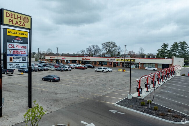
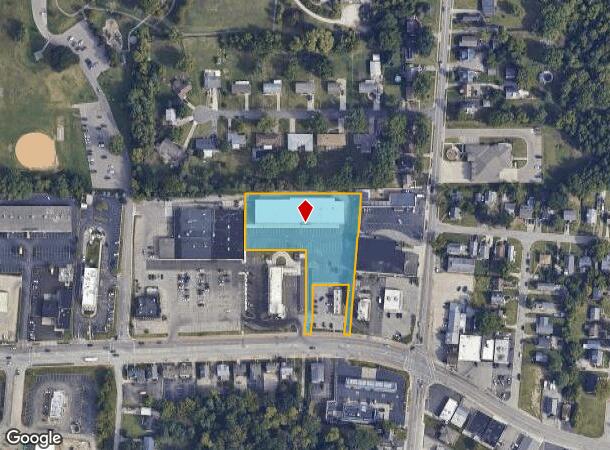
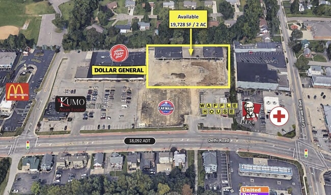
Property Record
4946 Delhi Rd, Cincinnati, OH 45238
NEARBY LISTINGS FOR SALE OR LEASE
Property Detail
4946 Delhi Rd
Cincinnati/Dayton
P T Williams Estate
Cincinnati, OH-KY-IN
NS DELHI PK1.8596 ACS11 T3 FR1
540-0041-0779
Hamilton
Regionalshoppingcenterormallwithanchorstore
Ohio
2024
1.86 AC
2024
Queensgate
009901
DEMOGRAPHICS near 4946 Delhi Rd
1 Mile
3 Mile
5 Mile
2024 Total Population
13,954
85,539
209,746
2029 Population
13,747
84,874
210,229
Pop Growth 2024-2029
(1.48%)
(0.78%)
+ 0.23%
Average Age
39
38
38
2024 Total Households
5,372
33,592
87,507
HH Growth 2024-2029
(1.66%)
(0.90%)
+ 0.24%
Median Household Inc
$70,618
$54,494
$52,419
Avg Household Size
2.60
2.40
2.30
2024 Avg HH Vehicles
2.00
2.00
2.00
Median Home Value
$148,843
$157,786
$173,002
Median Year Built
1965
1961
1961
Nearby Places
Map Layers
Map Styles
 Street
 Aerial
- Restaurants
- Banks
- Shops
- Fitness
- Groceries
PUBLIC TRANSPORTATION
COMMUTER RAIL
Cincinnati Union Terminal (Cardinal - Amtrak)
DRIVE
WALK
Distance
Cincinnati Union Terminal (Cardinal - Amtrak)
13 min
6.1 mi
AIRPORT
Cincinnati/Northern Kentucky International
DRIVE
WALK
Distance
Cincinnati/Northern Kentucky International
35 min
19.0 mi
Freight Ports
Port of Toledo
DRIVE
WALK
Distance
Port of Toledo
251 min
210.9 mi
SALE & LEASE HISTORY
LISTING DATE
SALE/LEASE

Sep 25, 2016
For Lease
Dec 06, 2023
For Lease
Dec 06, 2023
For Sale
Nearby Properties
Address
Land Use
TOTAL SIZE
Lot Size
Zoning
Address
Land Use
TOTAL SIZE
Lot Size
Zoning
157.77 AC
Address
Land Use
TOTAL SIZE
Lot Size
Zoning
46.68 AC
Address
Land Use
TOTAL SIZE
Lot Size
Zoning
177,092 SF
8.64 AC
Address
Land Use
TOTAL SIZE
Lot Size
Zoning
38.97 AC
Address
Land Use
TOTAL SIZE
Lot Size
Zoning
64,481 SF
16.99 AC
Address
Land Use
TOTAL SIZE
Lot Size
Zoning
177,200 SF
16.27 AC
Address
Land Use
TOTAL SIZE
Lot Size
Zoning
26.62 AC
Address
Land Use
TOTAL SIZE
Lot Size
Zoning
99.35 AC
Address
Land Use
TOTAL SIZE
Lot Size
Zoning
458,800 SF
49.35 AC
Address
Land Use
TOTAL SIZE
Lot Size
Zoning
30.43 AC
AA
Address
Land Use
TOTAL SIZE
Lot Size
Zoning
426,420 SF
20.59 AC
Address
Land Use
TOTAL SIZE
Lot Size
Zoning
5.89 AC
Address
Land Use
TOTAL SIZE
Lot Size
Zoning
316,800 SF
15.66 AC
Address
Land Use
TOTAL SIZE
Lot Size
Zoning
1,132,632 SF
7.11 AC
Address
Land Use
TOTAL SIZE
Lot Size
Zoning
130,500 SF
11.20 AC
Address
Land Use
TOTAL SIZE
Lot Size
Zoning
11.58 AC
Address
Land Use
TOTAL SIZE
Lot Size
Zoning
13.52 AC
Address
Land Use
TOTAL SIZE
Lot Size
Zoning
23.05 AC
Address
Land Use
TOTAL SIZE
Lot Size
Zoning
67,750 SF
5.69 AC
Address
Land Use
TOTAL SIZE
Lot Size
Zoning
12.28 AC
AA
Address
Land Use
TOTAL SIZE
Lot Size
Zoning
8.18 AC
SF4
Address
Land Use
TOTAL SIZE
Lot Size
Zoning
6.10 AC
Address
Land Use
TOTAL SIZE
Lot Size
Zoning
77,628 SF
2.18 AC
Address
Land Use
TOTAL SIZE
Lot Size
Zoning
13.44 AC
Address
Land Use
TOTAL SIZE
Lot Size
Zoning
122,854 SF
18.68 AC
Address
Land Use
TOTAL SIZE
Lot Size
Zoning
Address
Land Use
TOTAL SIZE
Lot Size
Zoning
6.58 AC
Address
Land Use
TOTAL SIZE
Lot Size
Zoning
83,870 SF
6.84 AC
Address
Land Use
TOTAL SIZE
Lot Size
Zoning
120,012 SF
7.33 AC
Address
Land Use
TOTAL SIZE
Lot Size
Zoning
58,910 SF
13.82 AC
The World's #1 Commercial Real Estate Marketplace
Connect with us
© 2025 CoStar Group
The information above has been obtained from sources believed reliable. While we do not doubt its accuracy we have not verified it and make no guarantee, warranty or representation about it. It is your responsibility to independently confirm its accuracy and completeness. Any projections, opinions, assumptions, or estimates used are for example only and do not represent the current or future performance of the property. The value of this transaction to you depends on tax and other factors which should be evaluated by your tax, financial, and legal advisors. You and your advisors should conduct a careful, independent investigation of the property to determine to your satisfaction the suitability of the property for your needs.