Property Record
495 Beach Airport Rd, Conroe, TX 77301


Save to a Folder
{{folder.Name}}
{{folder.ListingIds.length}} Properties
{{folder.ListingIds.length}} Property
Create a New Folder
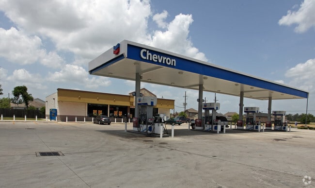
Property Detail
495 Beach Airport Rd
8743-01-20100
S874301 - SHADY WOODS 01 REPLAT, RES C, ACRES 1.965
Commercialnec
Montgomery
B and X Area of moderate flood hazard, usually the area between the limits of the 100-year and 500-year floods.
Texas
2024
1.97 AC
2025
Montgomery County
693902
Houston
4,558 SF
Houston-Pasadena-The Woodlands, TX
NEARBY LISTINGS FOR SALE OR LEASE
DEMOGRAPHICS near 495 Beach Airport Rd
1 mile
3 mile
5 mile
2025 Total Population
5,025
45,243
96,703
2030 Population
6,000
53,238
113,988
Pop Growth 2025-2030
+ 19.40%
+ 17.67%
+ 17.87%
Average Age
33
35
36
2025 Total Households
1,505
14,170
33,793
HH Growth 2025-2030
+ 19.87%
+ 19.03%
+ 18.76%
Median Household Inc
$102,500
$68,922
$70,710
Avg Household Size
3.30
2.90
2.70
2025 Avg HH Vehicles
2.00
2.00
2.00
Median Home Value
$233,706
$226,510
$285,147
Median Year Built
2010
2003
2004
Nearby Places
Map Layers
Map Styles
 Street
 Aerial
Layers
 Traffic
 Biking
Places
Listings with unknown addresses are not visible on the map
- Restaurants
- Banks
- Shops
- Fitness
- Groceries
PUBLIC TRANSPORTATION
AIRPORT
George Bush Intcntl/Houston
Drive
Walk
Distance
George Bush Intcntl/Houston
44 min
34.4 mi
Freight Ports
Port of Houston
Drive
Walk
Distance
Port of Houston
66 min
50.1 mi
Nearby Properties
Address
Land Use
TOTAL SIZE
Lot Size
Zoning
Address
Land Use
TOTAL SIZE
Lot Size
Zoning
322,082 SF
36.56 AC
1
Address
Land Use
TOTAL SIZE
Lot Size
Zoning
398,842 SF
23.75 AC
1
Address
Land Use
TOTAL SIZE
Lot Size
Zoning
619,770 SF
81.76 AC
Address
Land Use
TOTAL SIZE
Lot Size
Zoning
191,700 SF
19.41 AC
1
Address
Land Use
TOTAL SIZE
Lot Size
Zoning
326,478 SF
20.22 AC
Address
Land Use
TOTAL SIZE
Lot Size
Zoning
206,008 SF
107.61 AC
Address
Land Use
TOTAL SIZE
Lot Size
Zoning
191,006 SF
9.19 AC
Address
Land Use
TOTAL SIZE
Lot Size
Zoning
142,800 SF
7.82 AC
Address
Land Use
TOTAL SIZE
Lot Size
Zoning
123,674 SF
21.67 AC
Address
Land Use
TOTAL SIZE
Lot Size
Zoning
376,980 SF
24.37 AC
1
Address
Land Use
TOTAL SIZE
Lot Size
Zoning
242,944 SF
179.58 AC
Address
Land Use
TOTAL SIZE
Lot Size
Zoning
205,088 SF
79.14 AC
Address
Land Use
TOTAL SIZE
Lot Size
Zoning
210,383 SF
15.84 AC
Address
Land Use
TOTAL SIZE
Lot Size
Zoning
186,100 SF
29.68 AC
1
Address
Land Use
TOTAL SIZE
Lot Size
Zoning
192,624 SF
25.16 AC
Address
Land Use
TOTAL SIZE
Lot Size
Zoning
82,078 SF
61.15 AC
1
Address
Land Use
TOTAL SIZE
Lot Size
Zoning
66,712 SF
17.28 AC
Address
Land Use
TOTAL SIZE
Lot Size
Zoning
262,564 SF
51.89 AC
1
Address
Land Use
TOTAL SIZE
Lot Size
Zoning
86,634 SF
15.72 AC
Address
Land Use
TOTAL SIZE
Lot Size
Zoning
92,160 SF
0.82 AC
1
Address
Land Use
TOTAL SIZE
Lot Size
Zoning
118,897 SF
11.01 AC
Address
Land Use
TOTAL SIZE
Lot Size
Zoning
143,980 SF
6.53 AC
1
Address
Land Use
TOTAL SIZE
Lot Size
Zoning
38,742 SF
249.26 AC
1
Address
Land Use
TOTAL SIZE
Lot Size
Zoning
159,185 SF
18.45 AC
1
Address
Land Use
TOTAL SIZE
Lot Size
Zoning
117,392 SF
27 AC
1
Address
Land Use
TOTAL SIZE
Lot Size
Zoning
213,043 SF
15.95 AC
Address
Land Use
TOTAL SIZE
Lot Size
Zoning
143,641 SF
14.80 AC
1
Address
Land Use
TOTAL SIZE
Lot Size
Zoning
161,142 SF
493.71 AC
Address
Land Use
TOTAL SIZE
Lot Size
Zoning
271,500 SF
0.97 AC
1
Address
Land Use
TOTAL SIZE
Lot Size
Zoning
156,677 SF
19 AC
The World's #1 Commercial Real Estate Marketplace
Connect with us
© 2026 CoStar Group
The information above has been obtained from sources believed reliable. While we do not doubt its accuracy we have not verified it and make no guarantee, warranty or representation about it. It is your responsibility to independently confirm its accuracy and completeness. Any projections, opinions, assumptions, or estimates used are for example only and do not represent the current or future performance of the property. The value of this transaction to you depends on tax and other factors which should be evaluated by your tax, financial, and legal advisors. You and your advisors should conduct a careful, independent investigation of the property to determine to your satisfaction the suitability of the property for your needs.