Property Record
495 Highway 418, , SC

Property Detail
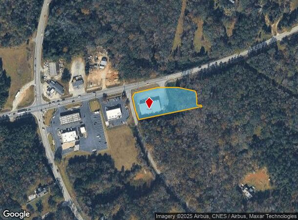
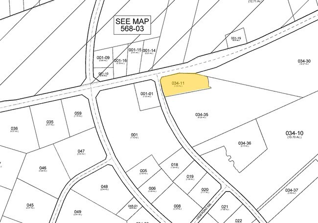
495 Highway 418
0568.05-01-034.11
MAP 0568.05
Storebuilding
GREENVILLE
UNZONED
South Carolina
B and X Area of moderate flood hazard, usually the area between the limits of the 100-year and 500-year floods.
034.11
2025
1.90 AC
2025
Western Greenville County
003015
Greenville/Spartanburg
1,554 SF
Greenville-Anderson-Greer, SC
NEARBY LISTINGS FOR SALE OR LEASE
DEMOGRAPHICS near 495 Highway 418
1 mile
3 mile
5 mile
2024 Total Population
1,272
14,816
57,522
2029 Population
1,380
16,059
62,208
Pop Growth 2024-2029
+ 8.49%
+ 8.39%
+ 8.15%
Average Age
42
40
40
2024 Total Households
465
5,454
21,690
HH Growth 2024-2029
+ 8.82%
+ 8.62%
+ 8.38%
Median Household Inc
$104,577
$93,285
$86,693
Avg Household Size
2.70
2.70
2.60
2024 Avg HH Vehicles
2.00
2.00
2.00
Median Home Value
$391,428
$337,625
$319,231
Median Year Built
2001
2005
1999
Nearby Places
Map Layers
Map Styles
 Street
 Aerial
Transit
 Traffic
 Biking
Places
Listings with unknown addresses are not visible on the map
- Restaurants
- Banks
- Shops
- Fitness
- Groceries
PUBLIC TRANSPORTATION
AIRPORT
Greenville Spartanburg International
Drive
Walk
Distance
Greenville Spartanburg International
30 min
21.0 mi
Nearby Properties
Address
Land Use
TOTAL SIZE
Lot Size
Zoning
Address
Land Use
TOTAL SIZE
Lot Size
Zoning
40.61 AC
I1
Address
Land Use
TOTAL SIZE
Lot Size
Zoning
16.32 AC
ROI
Address
Land Use
TOTAL SIZE
Lot Size
Zoning
Address
Land Use
TOTAL SIZE
Lot Size
Zoning
21.78 AC
I1
Address
Land Use
TOTAL SIZE
Lot Size
Zoning
14.75 AC
Address
Land Use
TOTAL SIZE
Lot Size
Zoning
Address
Land Use
TOTAL SIZE
Lot Size
Zoning
15.05 AC
I1
Address
Land Use
TOTAL SIZE
Lot Size
Zoning
25.87 AC
I1
Address
Land Use
TOTAL SIZE
Lot Size
Zoning
191 SF
98.20 AC
I1
Address
Land Use
TOTAL SIZE
Lot Size
Zoning
12.05 AC
RS
Address
Land Use
TOTAL SIZE
Lot Size
Zoning
1,158 SF
5.11 AC
I1
Address
Land Use
TOTAL SIZE
Lot Size
Zoning
22.60 AC
R12
Address
Land Use
TOTAL SIZE
Lot Size
Zoning
12.73 AC
I1
Address
Land Use
TOTAL SIZE
Lot Size
Zoning
14.60 AC
I1
Address
Land Use
TOTAL SIZE
Lot Size
Zoning
17.39 AC
ROI
Address
Land Use
TOTAL SIZE
Lot Size
Zoning
Address
Land Use
TOTAL SIZE
Lot Size
Zoning
23.20 AC
I1
Address
Land Use
TOTAL SIZE
Lot Size
Zoning
27.52 AC
UNZONED
Address
Land Use
TOTAL SIZE
Lot Size
Zoning
60.10 AC
RS
Address
Land Use
TOTAL SIZE
Lot Size
Zoning
16.70 AC
I1
Address
Land Use
TOTAL SIZE
Lot Size
Zoning
820 SF
6.71 AC
S1
Address
Land Use
TOTAL SIZE
Lot Size
Zoning
1,528 SF
22.81 AC
RM14
Address
Land Use
TOTAL SIZE
Lot Size
Zoning
211.65 AC
UNZONED
Address
Land Use
TOTAL SIZE
Lot Size
Zoning
13.17 AC
I1
Address
Land Use
TOTAL SIZE
Lot Size
Zoning
12.26 AC
RRROW
Address
Land Use
TOTAL SIZE
Lot Size
Zoning
8.95 AC
I1
Address
Land Use
TOTAL SIZE
Lot Size
Zoning
0.58 AC
Address
Land Use
TOTAL SIZE
Lot Size
Zoning
6.78 AC
C2
Address
Land Use
TOTAL SIZE
Lot Size
Zoning
Address
Land Use
TOTAL SIZE
Lot Size
Zoning
56.25 AC
NZ
The World's #1 Commercial Real Estate Marketplace
Connect with us
© 2026 CoStar Group
The information above has been obtained from sources believed reliable. While we do not doubt its accuracy we have not verified it and make no guarantee, warranty or representation about it. It is your responsibility to independently confirm its accuracy and completeness. Any projections, opinions, assumptions, or estimates used are for example only and do not represent the current or future performance of the property. The value of this transaction to you depends on tax and other factors which should be evaluated by your tax, financial, and legal advisors. You and your advisors should conduct a careful, independent investigation of the property to determine to your satisfaction the suitability of the property for your needs.