Property Record
495 W Clarendon St, Gladstone, OR 97027
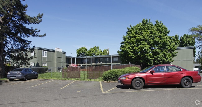
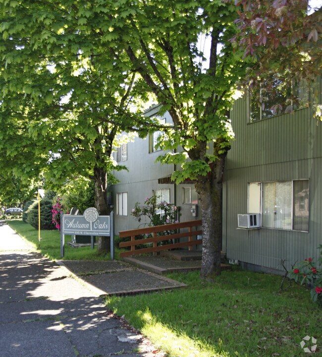

Property Detail
495 W Clarendon St
00529468
SECTION 19 TOWNSHIP 2S RANGE 2E QUARTER DD TAX LOT 05800
Multifamilydwelling
Clackamas
R5
Oregon
C and X Area of minimal flood hazard, usually depicted on FIRMs as above the 500-year flood level.
5800
2025
0.77 AC
2025
Gladstone
021900
Portland
1 SF
Portland-Vancouver-Hillsboro, OR-WA
NEARBY LISTINGS FOR SALE OR LEASE
DEMOGRAPHICS near 495 W Clarendon St
1 mile
3 mile
5 mile
2025 Total Population
10,017
81,608
183,639
2030 Population
10,033
81,601
183,925
Pop Growth 2025-2030
+ 0.16%
(0.01%)
+ 0.16%
Average Age
42
43
43
2025 Total Households
4,056
31,601
71,745
HH Growth 2025-2030
+ 0.12%
(0.09%)
+ 0.12%
Median Household Inc
$88,826
$100,426
$97,458
Avg Household Size
2.40
2.50
2.50
2025 Avg HH Vehicles
2.00
2.00
2.00
Median Home Value
$478,397
$609,944
$631,874
Median Year Built
1974
1978
1980
Nearby Places
Map Layers
Map Styles
 Street
 Aerial
Layers
 Traffic
 Biking
Places
Listings with unknown addresses are not visible on the map
- Restaurants
- Banks
- Shops
- Fitness
- Groceries
PUBLIC TRANSPORTATION
COMMUTER RAIL
Oregon City Amtrak (Amtrak Cascades - Amtrak)
Drive
Walk
Distance
Oregon City Amtrak (Amtrak Cascades - Amtrak)
4 min
1.7 mi
AIRPORT
Portland International
Drive
Walk
Distance
Portland International
28 min
17.8 mi
Freight Ports
Port of Portland
Drive
Walk
Distance
Port of Portland
27 min
14.7 mi
Nearby Properties
Address
Land Use
TOTAL SIZE
Lot Size
Zoning
Address
Land Use
TOTAL SIZE
Lot Size
Zoning
15.26 AC
GI
Address
Land Use
TOTAL SIZE
Lot Size
Zoning
9,233 SF
8.27 AC
MUE
Address
Land Use
TOTAL SIZE
Lot Size
Zoning
45 AC
GI
Address
Land Use
TOTAL SIZE
Lot Size
Zoning
12.16 AC
C3
Address
Land Use
TOTAL SIZE
Lot Size
Zoning
21.39 AC
CI
Address
Land Use
TOTAL SIZE
Lot Size
Zoning
3.11 AC
GC
Address
Land Use
TOTAL SIZE
Lot Size
Zoning
1,008 SF
10 AC
R3
Address
Land Use
TOTAL SIZE
Lot Size
Zoning
2,482 SF
5.14 AC
MR
Address
Land Use
TOTAL SIZE
Lot Size
Zoning
11 AC
MUD
Address
Land Use
TOTAL SIZE
Lot Size
Zoning
16.49 AC
MUD
Address
Land Use
TOTAL SIZE
Lot Size
Zoning
9.30 AC
C
Address
Land Use
TOTAL SIZE
Lot Size
Zoning
70.97 AC
OP
Address
Land Use
TOTAL SIZE
Lot Size
Zoning
Address
Land Use
TOTAL SIZE
Lot Size
Zoning
3.18 AC
C3
Address
Land Use
TOTAL SIZE
Lot Size
Zoning
8.27 AC
MR
Address
Land Use
TOTAL SIZE
Lot Size
Zoning
Address
Land Use
TOTAL SIZE
Lot Size
Zoning
9.21 AC
R3
Address
Land Use
TOTAL SIZE
Lot Size
Zoning
6 AC
OP
Address
Land Use
TOTAL SIZE
Lot Size
Zoning
4 AC
GI
Address
Land Use
TOTAL SIZE
Lot Size
Zoning
980 SF
6.19 AC
GC
Address
Land Use
TOTAL SIZE
Lot Size
Zoning
2,031 SF
3.91 AC
R10
Address
Land Use
TOTAL SIZE
Lot Size
Zoning
Address
Land Use
TOTAL SIZE
Lot Size
Zoning
8 AC
GI
Address
Land Use
TOTAL SIZE
Lot Size
Zoning
9.67 AC
C3
Address
Land Use
TOTAL SIZE
Lot Size
Zoning
10.61 AC
BP
Address
Land Use
TOTAL SIZE
Lot Size
Zoning
1.43 AC
C3
Address
Land Use
TOTAL SIZE
Lot Size
Zoning
6.16 AC
GC
Address
Land Use
TOTAL SIZE
Lot Size
Zoning
Address
Land Use
TOTAL SIZE
Lot Size
Zoning
1.67 AC
MUE
Address
Land Use
TOTAL SIZE
Lot Size
Zoning
5.43 AC
SHD
The World's #1 Commercial Real Estate Marketplace
Connect with us
© 2026 CoStar Group
The information above has been obtained from sources believed reliable. While we do not doubt its accuracy we have not verified it and make no guarantee, warranty or representation about it. It is your responsibility to independently confirm its accuracy and completeness. Any projections, opinions, assumptions, or estimates used are for example only and do not represent the current or future performance of the property. The value of this transaction to you depends on tax and other factors which should be evaluated by your tax, financial, and legal advisors. You and your advisors should conduct a careful, independent investigation of the property to determine to your satisfaction the suitability of the property for your needs.