Property Record
4950 71St Ave N, Pinellas Park, FL 33781
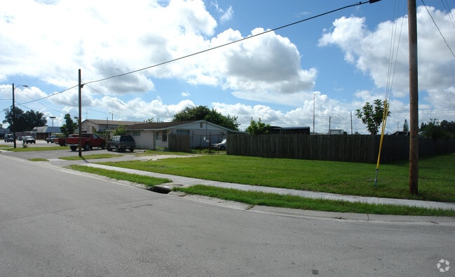

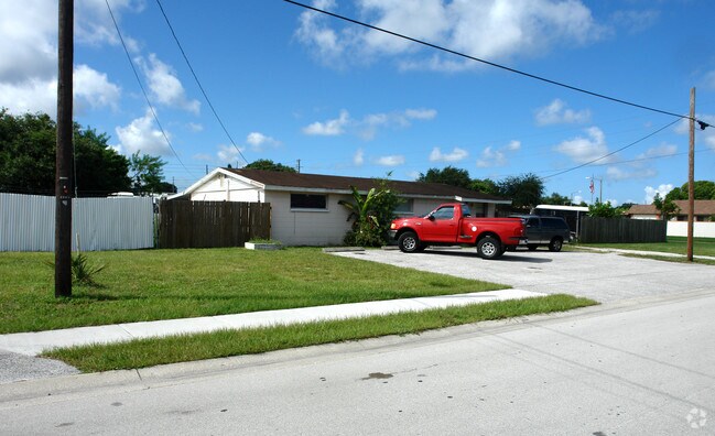
Property Detail
4950 71St Ave N
Tampa-St. Petersburg-Clearwater, FL
WADES CORNER LOTS 1, 2 & 3
28-30-16-94540-000-0010
Pinellas
Industrialgeneral
Florida
AE The base floodplain where base flood elevations are provided. AE Zones are now used on new format FIRMs instead of A1-A30 Zones.
1,2,3
2024
1.72 AC
2025
South Pinellas
024901
Tampa/St Petersburg
5,446 SF
NEARBY LISTINGS FOR SALE OR LEASE
DEMOGRAPHICS near 4950 71St Ave N
1 mile
3 mile
5 mile
2025 Total Population
13,291
113,223
275,232
2030 Population
13,206
113,293
275,549
Pop Growth 2025-2030
(0.64%)
+ 0.06%
+ 0.12%
Average Age
41
44
44
2025 Total Households
5,373
48,802
124,682
HH Growth 2025-2030
(0.80%)
0.00%
(0.03%)
Median Household Inc
$63,850
$61,952
$69,541
Avg Household Size
2.40
2.20
2.10
2025 Avg HH Vehicles
2.00
2.00
2.00
Median Home Value
$302,642
$281,111
$325,149
Median Year Built
1973
1972
1972
Nearby Places
Map Layers
Map Styles
 Street
 Aerial
Layers
 Traffic
 Biking
Places
Listings with unknown addresses are not visible on the map
- Restaurants
- Banks
- Shops
- Fitness
- Groceries
PUBLIC TRANSPORTATION
AIRPORT
St Pete-Clearwater International
Drive
Walk
Distance
St Pete-Clearwater International
11 min
5.9 mi
Tampa International
Drive
Walk
Distance
Tampa International
27 min
17.8 mi
Sarasota/Bradenton International
Drive
Walk
Distance
Sarasota/Bradenton International
57 min
38.8 mi
Freight Ports
Port of Tampa Bay
Drive
Walk
Distance
Port of Tampa Bay
34 min
22.1 mi
Nearby Properties
Address
Land Use
TOTAL SIZE
Lot Size
Zoning
Address
Land Use
TOTAL SIZE
Lot Size
Zoning
459,848 SF
19.74 AC
R6
Address
Land Use
TOTAL SIZE
Lot Size
Zoning
372,013 SF
10.10 AC
Address
Land Use
TOTAL SIZE
Lot Size
Zoning
447,664 SF
34.44 AC
Address
Land Use
TOTAL SIZE
Lot Size
Zoning
346,420 SF
17.95 AC
Address
Land Use
TOTAL SIZE
Lot Size
Zoning
372,436 SF
22.30 AC
Address
Land Use
TOTAL SIZE
Lot Size
Zoning
404,063 SF
12.98 AC
Address
Land Use
TOTAL SIZE
Lot Size
Zoning
404,899 SF
35.35 AC
Address
Land Use
TOTAL SIZE
Lot Size
Zoning
358,681 SF
11.70 AC
Address
Land Use
TOTAL SIZE
Lot Size
Zoning
240,736 SF
58.40 AC
Address
Land Use
TOTAL SIZE
Lot Size
Zoning
402,681 SF
18.40 AC
Address
Land Use
TOTAL SIZE
Lot Size
Zoning
324,579 SF
16.97 AC
Address
Land Use
TOTAL SIZE
Lot Size
Zoning
309,526 SF
36.85 AC
C2
Address
Land Use
TOTAL SIZE
Lot Size
Zoning
300,546 SF
6.49 AC
Address
Land Use
TOTAL SIZE
Lot Size
Zoning
423,776 SF
20.91 AC
Address
Land Use
TOTAL SIZE
Lot Size
Zoning
170,146 SF
17.78 AC
Address
Land Use
TOTAL SIZE
Lot Size
Zoning
206,685 SF
16.75 AC
RPD5
Address
Land Use
TOTAL SIZE
Lot Size
Zoning
267,649 SF
17.86 AC
Address
Land Use
TOTAL SIZE
Lot Size
Zoning
258,722 SF
11.04 AC
Address
Land Use
TOTAL SIZE
Lot Size
Zoning
281,993 SF
85.13 AC
Address
Land Use
TOTAL SIZE
Lot Size
Zoning
193,194 SF
13.53 AC
Address
Land Use
TOTAL SIZE
Lot Size
Zoning
360,137 SF
37.64 AC
AE
Address
Land Use
TOTAL SIZE
Lot Size
Zoning
172,600 SF
20.57 AC
Address
Land Use
TOTAL SIZE
Lot Size
Zoning
172,768 SF
15.05 AC
RPD20
Address
Land Use
TOTAL SIZE
Lot Size
Zoning
99,116 SF
20.60 AC
Address
Land Use
TOTAL SIZE
Lot Size
Zoning
125,218 SF
13.51 AC
Address
Land Use
TOTAL SIZE
Lot Size
Zoning
88,793 SF
13.78 AC
IL
Address
Land Use
TOTAL SIZE
Lot Size
Zoning
113,365 SF
13.32 AC
Address
Land Use
TOTAL SIZE
Lot Size
Zoning
226,561 SF
24.34 AC
Address
Land Use
TOTAL SIZE
Lot Size
Zoning
116,358 SF
12.74 AC
Address
Land Use
TOTAL SIZE
Lot Size
Zoning
248,572 SF
15.22 AC
PSP
The World's #1 Commercial Real Estate Marketplace
Connect with us
© 2026 CoStar Group
The information above has been obtained from sources believed reliable. While we do not doubt its accuracy we have not verified it and make no guarantee, warranty or representation about it. It is your responsibility to independently confirm its accuracy and completeness. Any projections, opinions, assumptions, or estimates used are for example only and do not represent the current or future performance of the property. The value of this transaction to you depends on tax and other factors which should be evaluated by your tax, financial, and legal advisors. You and your advisors should conduct a careful, independent investigation of the property to determine to your satisfaction the suitability of the property for your needs.