Property Record
4950 Beaner Blvd, Gas City, IN 46933

NEARBY LISTINGS FOR SALE OR LEASE
-
-
View all Gas City listings for sale on LoopNet.com
Property Detail
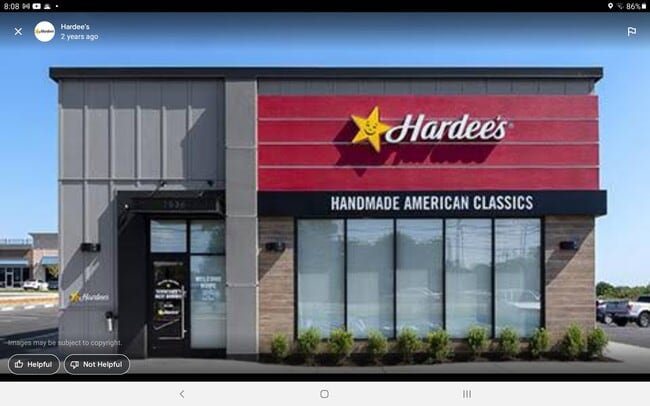
4950 Beaner Blvd
27-08-31-300-020.009-037
PT SE SW SEC 31 .82A MP 0831-300-020.009
Storebuilding
Grant
X
Indiana
18053C0260E
0.82 AC
2024
Indiana North Area
2024
Other Market Areas
010800
Marion, IN
1,809 SF
DEMOGRAPHICS near 4950 Beaner Blvd
1 Mile
3 Mile
5 Mile
2024 Total Population
127
5,250
15,162
2029 Population
123
5,071
14,781
Pop Growth 2024-2029
(3.15%)
(3.41%)
(2.51%)
Average Age
43
40
39
2024 Total Households
51
2,025
5,506
HH Growth 2024-2029
(3.92%)
(3.70%)
(2.78%)
Median Household Inc
$62,500
$65,785
$60,462
Avg Household Size
2.40
2.40
2.40
2024 Avg HH Vehicles
2.00
2.00
2.00
Median Home Value
$192,856
$142,327
$132,395
Median Year Built
1977
1968
1965
Nearby Places
Map Layers
Map Styles
 Street
 Aerial
- Restaurants
- Banks
- Shops
- Fitness
- Groceries
SALE & LEASE HISTORY
LISTING DATE
SALE/LEASE

Sep 14, 2021
For Sale
Sep 09, 2021
For Sale
Nearby Properties
Address
Land Use
TOTAL SIZE
Lot Size
Zoning
Address
Land Use
TOTAL SIZE
Lot Size
Zoning
1,222,384 SF
144.03 AC
Address
Land Use
TOTAL SIZE
Lot Size
Zoning
402,500 SF
36.97 AC
Address
Land Use
TOTAL SIZE
Lot Size
Zoning
27,940 SF
4.52 AC
Address
Land Use
TOTAL SIZE
Lot Size
Zoning
40,656 SF
3.32 AC
Address
Land Use
TOTAL SIZE
Lot Size
Zoning
43,585 SF
5.74 AC
Address
Land Use
TOTAL SIZE
Lot Size
Zoning
185,550 SF
30 AC
Address
Land Use
TOTAL SIZE
Lot Size
Zoning
75,000 SF
11.85 AC
Address
Land Use
TOTAL SIZE
Lot Size
Zoning
16,300 SF
6.14 AC
Address
Land Use
TOTAL SIZE
Lot Size
Zoning
36,884 SF
3.28 AC
Address
Land Use
TOTAL SIZE
Lot Size
Zoning
32.93 AC
Address
Land Use
TOTAL SIZE
Lot Size
Zoning
17,824 SF
9.14 AC
Address
Land Use
TOTAL SIZE
Lot Size
Zoning
7,848 SF
3.62 AC
Address
Land Use
TOTAL SIZE
Lot Size
Zoning
36,728 SF
16.50 AC
Address
Land Use
TOTAL SIZE
Lot Size
Zoning
52,500 SF
12.93 AC
Address
Land Use
TOTAL SIZE
Lot Size
Zoning
24,860 SF
5 AC
Address
Land Use
TOTAL SIZE
Lot Size
Zoning
30,000 SF
7 AC
Address
Land Use
TOTAL SIZE
Lot Size
Zoning
984 SF
11 AC
Address
Land Use
TOTAL SIZE
Lot Size
Zoning
5,084 SF
3.12 AC
Address
Land Use
TOTAL SIZE
Lot Size
Zoning
19,600 SF
2.01 AC
Address
Land Use
TOTAL SIZE
Lot Size
Zoning
9,782 SF
2.72 AC
Address
Land Use
TOTAL SIZE
Lot Size
Zoning
19.85 AC
Address
Land Use
TOTAL SIZE
Lot Size
Zoning
4,508 SF
1.23 AC
Address
Land Use
TOTAL SIZE
Lot Size
Zoning
2,928 SF
3 AC
Address
Land Use
TOTAL SIZE
Lot Size
Zoning
3,000 SF
3.77 AC
Address
Land Use
TOTAL SIZE
Lot Size
Zoning
63,285 SF
5.93 AC
Address
Land Use
TOTAL SIZE
Lot Size
Zoning
29,213 SF
2.43 AC
Address
Land Use
TOTAL SIZE
Lot Size
Zoning
10,640 SF
1.35 AC
Address
Land Use
TOTAL SIZE
Lot Size
Zoning
3,126 SF
2.41 AC
Address
Land Use
TOTAL SIZE
Lot Size
Zoning
1.90 AC
Address
Land Use
TOTAL SIZE
Lot Size
Zoning
4,964 SF
5.24 AC
The World's #1 Commercial Real Estate Marketplace
Connect with us
© 2026 CoStar Group
The information above has been obtained from sources believed reliable. While we do not doubt its accuracy we have not verified it and make no guarantee, warranty or representation about it. It is your responsibility to independently confirm its accuracy and completeness. Any projections, opinions, assumptions, or estimates used are for example only and do not represent the current or future performance of the property. The value of this transaction to you depends on tax and other factors which should be evaluated by your tax, financial, and legal advisors. You and your advisors should conduct a careful, independent investigation of the property to determine to your satisfaction the suitability of the property for your needs.