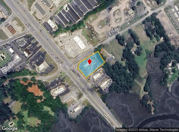
Property Record
4950 New Jesup Hwy, Brunswick, GA 31520

NEARBY LISTINGS FOR SALE OR LEASE
Property Detail
4950 New Jesup Hwy
Brunswick, GA
0077-30
03-04223
PTN LOTS 1&2 GLYNDAL
Commercialnec
Glynn
X
Georgia
13127C0209H
1-2
2025
1.27 AC
2025
Dock Junction
000601
Other Market Areas
DEMOGRAPHICS near 4950 New Jesup Hwy
1 Mile
3 Mile
5 Mile
2024 Total Population
3,340
22,474
46,653
2029 Population
3,321
22,348
46,804
Pop Growth 2024-2029
(0.57%)
(0.56%)
+ 0.32%
Average Age
41
41
41
2024 Total Households
1,349
9,010
17,907
HH Growth 2024-2029
(0.89%)
(0.92%)
(0.02%)
Median Household Inc
$48,464
$49,105
$48,077
Avg Household Size
2.40
2.40
2.40
2024 Avg HH Vehicles
2.00
2.00
2.00
Median Home Value
$139,153
$151,877
$165,780
Median Year Built
1973
1986
1987
Nearby Places
Map Layers
Map Styles
 Street
 Aerial
- Restaurants
- Banks
- Shops
- Fitness
- Groceries
PUBLIC TRANSPORTATION
AIRPORT
Brunswick Golden Isles
DRIVE
WALK
Distance
Brunswick Golden Isles
11 min
5.6 mi
Freight Ports
Georgia Ports - Brunswick
DRIVE
WALK
Distance
Georgia Ports - Brunswick
19 min
11.1 mi
Nearby Properties
Address
Land Use
TOTAL SIZE
Lot Size
Zoning
Address
Land Use
TOTAL SIZE
Lot Size
Zoning
57.20 AC
R9
Address
Land Use
TOTAL SIZE
Lot Size
Zoning
17.15 AC
PD
Address
Land Use
TOTAL SIZE
Lot Size
Zoning
41.94 AC
PD
Address
Land Use
TOTAL SIZE
Lot Size
Zoning
23.99 AC
PD
Address
Land Use
TOTAL SIZE
Lot Size
Zoning
31.68 AC
BI
Address
Land Use
TOTAL SIZE
Lot Size
Zoning
15.08 AC
MR
Address
Land Use
TOTAL SIZE
Lot Size
Zoning
10.85 AC
PD
Address
Land Use
TOTAL SIZE
Lot Size
Zoning
21.33 AC
PD
Address
Land Use
TOTAL SIZE
Lot Size
Zoning
Address
Land Use
TOTAL SIZE
Lot Size
Zoning
13 AC
PDS
Address
Land Use
TOTAL SIZE
Lot Size
Zoning
10.59 AC
PD
Address
Land Use
TOTAL SIZE
Lot Size
Zoning
13.33 AC
MR
Address
Land Use
TOTAL SIZE
Lot Size
Zoning
6.91 AC
PD
Address
Land Use
TOTAL SIZE
Lot Size
Zoning
11.09 AC
PD
Address
Land Use
TOTAL SIZE
Lot Size
Zoning
10.45 AC
MR
Address
Land Use
TOTAL SIZE
Lot Size
Zoning
6.75 AC
PDR
Address
Land Use
TOTAL SIZE
Lot Size
Zoning
2.94 AC
PD
Address
Land Use
TOTAL SIZE
Lot Size
Zoning
14.84 AC
PD
Address
Land Use
TOTAL SIZE
Lot Size
Zoning
14.66 AC
PD
Address
Land Use
TOTAL SIZE
Lot Size
Zoning
18.45 AC
MR
Address
Land Use
TOTAL SIZE
Lot Size
Zoning
11.67 AC
HC
Address
Land Use
TOTAL SIZE
Lot Size
Zoning
11.52 AC
PDR
Address
Land Use
TOTAL SIZE
Lot Size
Zoning
0.91 AC
GC
Address
Land Use
TOTAL SIZE
Lot Size
Zoning
55,647 SF
8.17 AC
HC
Address
Land Use
TOTAL SIZE
Lot Size
Zoning
8.50 AC
PD
Address
Land Use
TOTAL SIZE
Lot Size
Zoning
2.89 AC
PD
Address
Land Use
TOTAL SIZE
Lot Size
Zoning
4.09 AC
PD
Address
Land Use
TOTAL SIZE
Lot Size
Zoning
2.50 AC
FC
Address
Land Use
TOTAL SIZE
Lot Size
Zoning
9.54 AC
HC
Address
Land Use
TOTAL SIZE
Lot Size
Zoning
6.01 AC
FC
The World's #1 Commercial Real Estate Marketplace
Connect with us
© 2025 CoStar Group
The information above has been obtained from sources believed reliable. While we do not doubt its accuracy we have not verified it and make no guarantee, warranty or representation about it. It is your responsibility to independently confirm its accuracy and completeness. Any projections, opinions, assumptions, or estimates used are for example only and do not represent the current or future performance of the property. The value of this transaction to you depends on tax and other factors which should be evaluated by your tax, financial, and legal advisors. You and your advisors should conduct a careful, independent investigation of the property to determine to your satisfaction the suitability of the property for your needs.