Property Record
4951 Lower Roswell Rd, Marietta, GA 30068

NEARBY LISTINGS FOR SALE OR LEASE
-
-
View all Marietta listings for sale on LoopNet.com
Property Detail
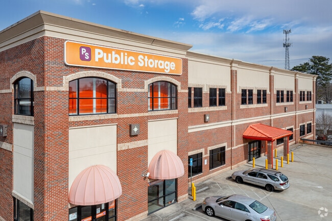
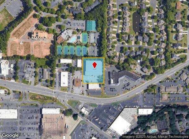
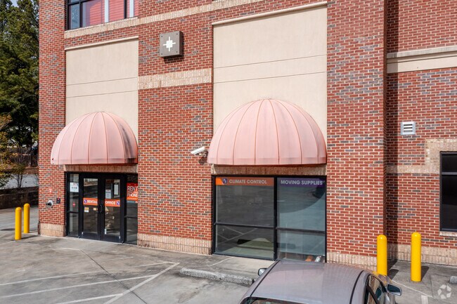
4951 Lower Roswell Rd
Atlanta-Sandy Springs-Roswell, GA
Lrr Properties Llc
01-0085-0-025-0
ALL THAT TRACT OR PARCEL OF LAND LYING AND BEING IN THE 1ST DISTRICT, 2ND SECTION, COBB COUNTY, GEORGIA, LYING WITHIN LAND LOT 0085, IDENTIFIED AS TAX PARCEL 025, ON THE FIELD
Publicstorage
Cobb
X
Georgia
13121C0133G
85
2025
1.28 AC
2025
East Cobb
030337
Atlanta
98,580 SF
DEMOGRAPHICS near 4951 Lower Roswell Rd
1 Mile
3 Mile
5 Mile
2024 Total Population
8,401
65,108
211,875
2029 Population
8,467
65,766
214,447
Pop Growth 2024-2029
+ 0.79%
+ 1.01%
+ 1.21%
Average Age
43
41
40
2024 Total Households
3,072
25,280
86,546
HH Growth 2024-2029
+ 0.72%
+ 0.97%
+ 1.30%
Median Household Inc
$128,828
$126,440
$112,879
Avg Household Size
2.70
2.50
2.40
2024 Avg HH Vehicles
2.00
2.00
2.00
Median Home Value
$642,041
$578,298
$509,945
Median Year Built
1984
1982
1984
Nearby Places
Map Layers
Map Styles
 Street
 Aerial
- Restaurants
- Banks
- Shops
- Fitness
- Groceries
PUBLIC TRANSPORTATION
AIRPORT
Hartsfield - Jackson Atlanta International
DRIVE
WALK
Distance
Hartsfield - Jackson Atlanta International
44 min
28.5 mi
Nearby Properties
Address
Land Use
TOTAL SIZE
Lot Size
Zoning
Address
Land Use
TOTAL SIZE
Lot Size
Zoning
485,132 SF
37.90 AC
OI
Address
Land Use
TOTAL SIZE
Lot Size
Zoning
12,342,500 SF
125.51 AC
AC
Address
Land Use
TOTAL SIZE
Lot Size
Zoning
258,955 SF
29.70 AC
CRC/LRO
Address
Land Use
TOTAL SIZE
Lot Size
Zoning
416,113 SF
28.12 AC
RM-12
Address
Land Use
TOTAL SIZE
Lot Size
Zoning
3,714,740 SF
45.91 AC
A1
Address
Land Use
TOTAL SIZE
Lot Size
Zoning
647,376 SF
22.43 AC
AC
Address
Land Use
TOTAL SIZE
Lot Size
Zoning
9,550,520 SF
25.59 AC
AC
Address
Land Use
TOTAL SIZE
Lot Size
Zoning
279,518 SF
7.70 AC
C1
Address
Land Use
TOTAL SIZE
Lot Size
Zoning
287,388 SF
44.90 AC
ACOND
Address
Land Use
TOTAL SIZE
Lot Size
Zoning
4,124,136 SF
19.85 AC
AC
Address
Land Use
TOTAL SIZE
Lot Size
Zoning
269,200 SF
18.70 AC
A0
Address
Land Use
TOTAL SIZE
Lot Size
Zoning
1,957,333 SF
19.86 AC
AC
Address
Land Use
TOTAL SIZE
Lot Size
Zoning
2,928,960 SF
22.67 AC
AC
Address
Land Use
TOTAL SIZE
Lot Size
Zoning
690,426 SF
34.99 AC
AC
Address
Land Use
TOTAL SIZE
Lot Size
Zoning
1,024,880 SF
23.70 AC
AC
Address
Land Use
TOTAL SIZE
Lot Size
Zoning
1,198,136 SF
30.94 AC
E2
Address
Land Use
TOTAL SIZE
Lot Size
Zoning
2,557,920 SF
14.04 AC
AC
Address
Land Use
TOTAL SIZE
Lot Size
Zoning
3,406 SF
23.20 AC
R20
Address
Land Use
TOTAL SIZE
Lot Size
Zoning
2,359,060 SF
16.50 AC
AC
Address
Land Use
TOTAL SIZE
Lot Size
Zoning
152,152 SF
19.36 AC
AC
Address
Land Use
TOTAL SIZE
Lot Size
Zoning
730,932 SF
20.92 AC
AC
Address
Land Use
TOTAL SIZE
Lot Size
Zoning
79,435 SF
8.36 AC
C1
Address
Land Use
TOTAL SIZE
Lot Size
Zoning
166,048 SF
20.29 AC
GC
Address
Land Use
TOTAL SIZE
Lot Size
Zoning
194,453 SF
17.71 AC
CRC/WS
Address
Land Use
TOTAL SIZE
Lot Size
Zoning
24.85 AC
R3
Address
Land Use
TOTAL SIZE
Lot Size
Zoning
2,317,668 SF
12.23 AC
AC
Address
Land Use
TOTAL SIZE
Lot Size
Zoning
2,279,460 SF
20 AC
AC
Address
Land Use
TOTAL SIZE
Lot Size
Zoning
149,187 SF
13.69 AC
C1
Address
Land Use
TOTAL SIZE
Lot Size
Zoning
37.92 AC
R2
Address
Land Use
TOTAL SIZE
Lot Size
Zoning
2,441,385 SF
20.01 AC
AC
The World's #1 Commercial Real Estate Marketplace
Connect with us
© 2026 CoStar Group
The information above has been obtained from sources believed reliable. While we do not doubt its accuracy we have not verified it and make no guarantee, warranty or representation about it. It is your responsibility to independently confirm its accuracy and completeness. Any projections, opinions, assumptions, or estimates used are for example only and do not represent the current or future performance of the property. The value of this transaction to you depends on tax and other factors which should be evaluated by your tax, financial, and legal advisors. You and your advisors should conduct a careful, independent investigation of the property to determine to your satisfaction the suitability of the property for your needs.