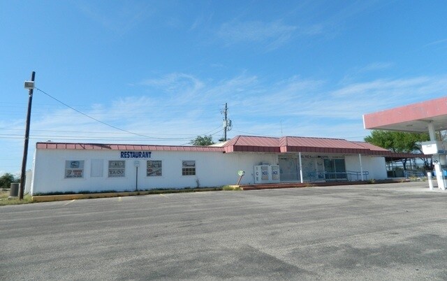
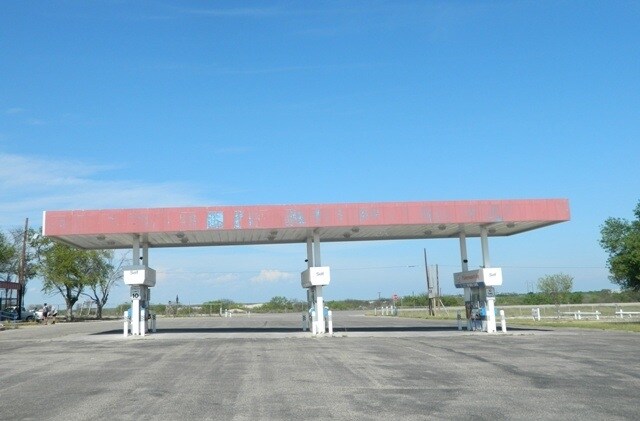
Property Record
4957 W Us Highway 90, Del Rio, TX 78840
NEARBY LISTINGS FOR SALE OR LEASE
-
-
View all Del Rio listings for sale on LoopNet.com
Property Detail
4957 W Us Highway 90
12727
A1815 Abst 1815 Sur 876 E Strode
Commercialnec
ABST 0149 SUR 876 C C S D & R G N G RR CO, ACRES 3.87
X
Val Verde
48465C1645D
Texas
2025
3.87 AC
2025
Texas West Area
950802
Other Market Areas
46,859 SF
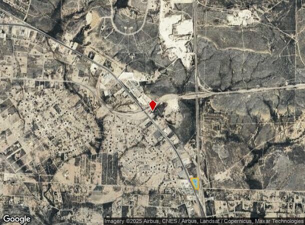
Del Rio, TX
DEMOGRAPHICS near 4957 W Us Highway 90
1 Mile
3 Mile
5 Mile
2024 Total Population
431
8,240
18,606
2029 Population
449
8,431
18,711
Pop Growth 2024-2029
+ 4.18%
+ 2.32%
+ 0.56%
Average Age
40
38
38
2024 Total Households
158
2,871
6,572
HH Growth 2024-2029
+ 3.80%
+ 2.37%
+ 0.53%
Median Household Inc
$85,344
$91,601
$65,233
Avg Household Size
2.70
2.80
2.80
2024 Avg HH Vehicles
2.00
2.00
2.00
Median Home Value
$246,774
$197,113
$167,060
Median Year Built
2008
2000
1993
Nearby Places
Map Layers
Map Styles
 Street
 Aerial
- Restaurants
- Banks
- Shops
- Fitness
- Groceries
PUBLIC TRANSPORTATION
COMMUTER RAIL
Del Rio Amtrak Station (Sunset Limited - Amtrak, Texas Eagle - Amtrak)
DRIVE
WALK
Distance
Del Rio Amtrak Station (Sunset Limited - Amtrak, Texas Eagle - Amtrak)
10 min
6.5 mi
Freight Ports
Port of Corpus Christi
DRIVE
WALK
Distance
Port of Corpus Christi
324 min
287.0 mi
SALE & LEASE HISTORY
LISTING DATE
SALE/LEASE

Sep 24, 2016
For Sale
Nearby Properties
Address
Land Use
TOTAL SIZE
Lot Size
Zoning
Address
Land Use
TOTAL SIZE
Lot Size
Zoning
193,052 SF
12.79 AC
Address
Land Use
TOTAL SIZE
Lot Size
Zoning
171,950 SF
10.26 AC
Address
Land Use
TOTAL SIZE
Lot Size
Zoning
239,818 SF
6.91 AC
Address
Land Use
TOTAL SIZE
Lot Size
Zoning
38,915 SF
2 AC
Address
Land Use
TOTAL SIZE
Lot Size
Zoning
79,382 SF
1.61 AC
Address
Land Use
TOTAL SIZE
Lot Size
Zoning
143,214 SF
4.81 AC
Address
Land Use
TOTAL SIZE
Lot Size
Zoning
37,140 SF
3.76 AC
Address
Land Use
TOTAL SIZE
Lot Size
Zoning
157,646 SF
5.38 AC
Address
Land Use
TOTAL SIZE
Lot Size
Zoning
104,330 SF
4.54 AC
Address
Land Use
TOTAL SIZE
Lot Size
Zoning
156,121 SF
4.53 AC
Address
Land Use
TOTAL SIZE
Lot Size
Zoning
38,674 SF
3.11 AC
Address
Land Use
TOTAL SIZE
Lot Size
Zoning
24,970 SF
4 AC
Address
Land Use
TOTAL SIZE
Lot Size
Zoning
63,000 SF
3 AC
Address
Land Use
TOTAL SIZE
Lot Size
Zoning
67,664 SF
3.69 AC
Address
Land Use
TOTAL SIZE
Lot Size
Zoning
129,772 SF
5.54 AC
Address
Land Use
TOTAL SIZE
Lot Size
Zoning
119,069 SF
2.48 AC
Address
Land Use
TOTAL SIZE
Lot Size
Zoning
130,090 SF
4.07 AC
Address
Land Use
TOTAL SIZE
Lot Size
Zoning
99,826 SF
2.25 AC
Address
Land Use
TOTAL SIZE
Lot Size
Zoning
113,062 SF
1.39 AC
Address
Land Use
TOTAL SIZE
Lot Size
Zoning
30,512 SF
5 AC
Address
Land Use
TOTAL SIZE
Lot Size
Zoning
103,406 SF
4.51 AC
Address
Land Use
TOTAL SIZE
Lot Size
Zoning
21,704 SF
4.94 AC
Address
Land Use
TOTAL SIZE
Lot Size
Zoning
15,225 SF
2.13 AC
Address
Land Use
TOTAL SIZE
Lot Size
Zoning
60,680 SF
2.98 AC
Address
Land Use
TOTAL SIZE
Lot Size
Zoning
30,788 SF
3.58 AC
Address
Land Use
TOTAL SIZE
Lot Size
Zoning
30,000 SF
4.46 AC
Address
Land Use
TOTAL SIZE
Lot Size
Zoning
45,395 SF
2.50 AC
Address
Land Use
TOTAL SIZE
Lot Size
Zoning
14,962 SF
24.13 AC
Address
Land Use
TOTAL SIZE
Lot Size
Zoning
26,858 SF
1.24 AC
Address
Land Use
TOTAL SIZE
Lot Size
Zoning
12,173 SF
0.44 AC
The World's #1 Commercial Real Estate Marketplace
Connect with us
© 2026 CoStar Group
The information above has been obtained from sources believed reliable. While we do not doubt its accuracy we have not verified it and make no guarantee, warranty or representation about it. It is your responsibility to independently confirm its accuracy and completeness. Any projections, opinions, assumptions, or estimates used are for example only and do not represent the current or future performance of the property. The value of this transaction to you depends on tax and other factors which should be evaluated by your tax, financial, and legal advisors. You and your advisors should conduct a careful, independent investigation of the property to determine to your satisfaction the suitability of the property for your needs.