Property Record
496 Long Pond Rd, Rochester, NY 14612

NEARBY LISTINGS FOR SALE OR LEASE
Property Detail
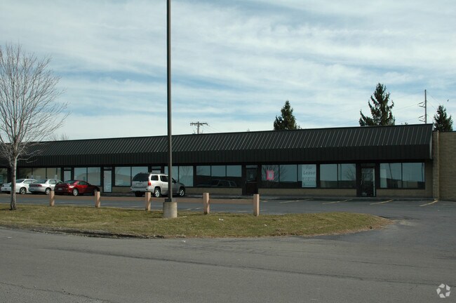
496 Long Pond Rd
Rochester, NY
Cedarfield Commons Subdivision
262800-045-010-0001-006-220
L34 T2 D1 SHORT RANGE CDRFLD COM RESUB 295-60 LR104
Stripcommercialcenter
Monroe
X
New York
36055C0064H
6.220
2025
1.65 AC
2024
Northwest
013603
Rochester
9,900 SF
DEMOGRAPHICS near 496 Long Pond Rd
1 Mile
3 Mile
5 Mile
2024 Total Population
7,116
44,162
110,108
2029 Population
7,012
43,708
108,555
Pop Growth 2024-2029
(1.46%)
(1.03%)
(1.41%)
Average Age
45
44
43
2024 Total Households
2,725
18,177
47,512
HH Growth 2024-2029
(1.58%)
(1.10%)
(1.48%)
Median Household Inc
$100,333
$78,854
$67,396
Avg Household Size
2.50
2.40
2.30
2024 Avg HH Vehicles
2.00
2.00
2.00
Median Home Value
$180,773
$180,746
$159,095
Median Year Built
1984
1978
1970
Nearby Places
Map Layers
Map Styles
 Street
 Aerial
- Restaurants
- Banks
- Shops
- Fitness
- Groceries
PUBLIC TRANSPORTATION
AIRPORT
Frederick Douglass/Greater Rochester International
DRIVE
WALK
Distance
Frederick Douglass/Greater Rochester International
19 min
13.2 mi
Freight Ports
Albany, NY Port
DRIVE
WALK
Distance
Albany, NY Port
284 min
239.1 mi
SALE & LEASE HISTORY
LISTING DATE
SALE/LEASE

Sep 28, 2016
For Lease
Nearby Properties
Address
Land Use
TOTAL SIZE
Lot Size
Zoning
Address
Land Use
TOTAL SIZE
Lot Size
Zoning
1,763.70 AC
Address
Land Use
TOTAL SIZE
Lot Size
Zoning
352,001 SF
76.90 AC
Address
Land Use
TOTAL SIZE
Lot Size
Zoning
330,700 SF
66.90 AC
Address
Land Use
TOTAL SIZE
Lot Size
Zoning
180,406 SF
28.80 AC
Address
Land Use
TOTAL SIZE
Lot Size
Zoning
65,000 SF
5.10 AC
Address
Land Use
TOTAL SIZE
Lot Size
Zoning
37,487 SF
47.63 AC
Address
Land Use
TOTAL SIZE
Lot Size
Zoning
4,728 SF
34.54 AC
03 - MULTI
Address
Land Use
TOTAL SIZE
Lot Size
Zoning
1.90 AC
05 - COMME
Address
Land Use
TOTAL SIZE
Lot Size
Zoning
9,360 SF
23.50 AC
05 - COMME
Address
Land Use
TOTAL SIZE
Lot Size
Zoning
0.84 AC
Address
Land Use
TOTAL SIZE
Lot Size
Zoning
108,401 SF
67.82 AC
05 - COMME
Address
Land Use
TOTAL SIZE
Lot Size
Zoning
7,120 SF
23.10 AC
Address
Land Use
TOTAL SIZE
Lot Size
Zoning
78,957 SF
90.80 AC
02 - SINGL
Address
Land Use
TOTAL SIZE
Lot Size
Zoning
14,080 SF
15.20 AC
05 - COMME
Address
Land Use
TOTAL SIZE
Lot Size
Zoning
2,572 SF
26.40 AC
Address
Land Use
TOTAL SIZE
Lot Size
Zoning
93,865 SF
62.80 AC
Address
Land Use
TOTAL SIZE
Lot Size
Zoning
76,739 SF
12.79 AC
Address
Land Use
TOTAL SIZE
Lot Size
Zoning
56,856 SF
15 AC
Address
Land Use
TOTAL SIZE
Lot Size
Zoning
3,472 SF
19.60 AC
05 - COMME
Address
Land Use
TOTAL SIZE
Lot Size
Zoning
5,758 SF
10.50 AC
Address
Land Use
TOTAL SIZE
Lot Size
Zoning
44,785 SF
8.20 AC
05 - COMME
Address
Land Use
TOTAL SIZE
Lot Size
Zoning
7,064 SF
9.90 AC
Address
Land Use
TOTAL SIZE
Lot Size
Zoning
7,064 SF
11.10 AC
Address
Land Use
TOTAL SIZE
Lot Size
Zoning
14.60 AC
Address
Land Use
TOTAL SIZE
Lot Size
Zoning
33,431 SF
9.60 AC
Address
Land Use
TOTAL SIZE
Lot Size
Zoning
13,233 SF
16.60 AC
Address
Land Use
TOTAL SIZE
Lot Size
Zoning
5,048 SF
11.30 AC
02 - SINGL
Address
Land Use
TOTAL SIZE
Lot Size
Zoning
97,168 SF
6.90 AC
Address
Land Use
TOTAL SIZE
Lot Size
Zoning
7,353 SF
12.50 AC
The World's #1 Commercial Real Estate Marketplace
Connect with us
© 2026 CoStar Group
The information above has been obtained from sources believed reliable. While we do not doubt its accuracy we have not verified it and make no guarantee, warranty or representation about it. It is your responsibility to independently confirm its accuracy and completeness. Any projections, opinions, assumptions, or estimates used are for example only and do not represent the current or future performance of the property. The value of this transaction to you depends on tax and other factors which should be evaluated by your tax, financial, and legal advisors. You and your advisors should conduct a careful, independent investigation of the property to determine to your satisfaction the suitability of the property for your needs.