Property Record
4960 Us Highway 50 E, Dayton, NV 89403
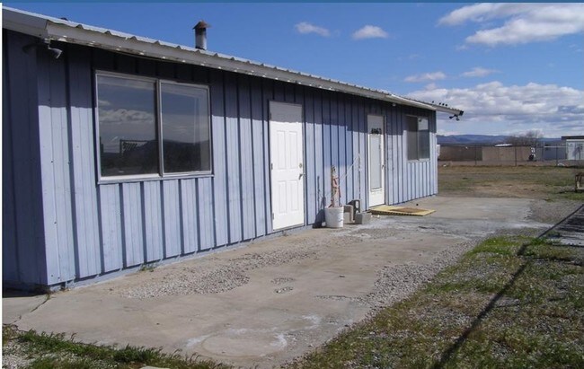

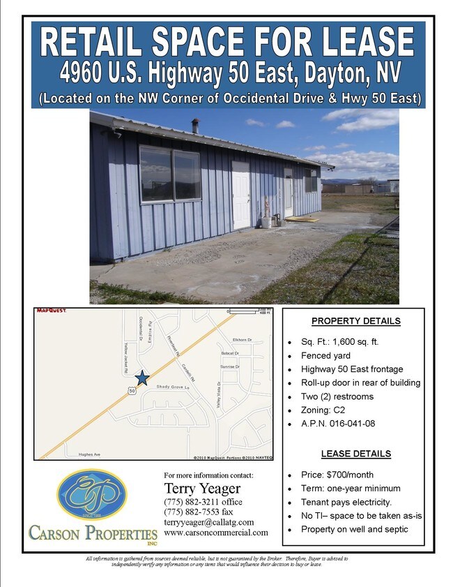
Property Detail
4960 Us Highway 50 E
016-041-08
33-17-22 FRNW4SW4SW4NW4 CHANGED FROM PARCEL #016-041-06
Commercialnec
Lyon
C2
Nevada
C and X Area of minimal flood hazard, usually depicted on FIRMs as above the 500-year flood level.
1.43 AC
2026
Lyon County
2025
Reno/Sparks
960305
Reno, NV
1,600 SF
NEARBY LISTINGS FOR SALE OR LEASE
-
-
View all Dayton listings for sale on LoopNet.com
DEMOGRAPHICS near 4960 Us Highway 50 E
1 mile
3 mile
5 mile
2025 Total Population
5,239
9,623
17,715
2030 Population
5,552
10,190
18,717
Pop Growth 2025-2030
+ 5.97%
+ 5.89%
+ 5.66%
Average Age
44
44
44
2025 Total Households
1,957
3,657
6,897
HH Growth 2025-2030
+ 5.98%
+ 5.85%
+ 5.60%
Median Household Inc
$96,292
$93,194
$91,593
Avg Household Size
2.70
2.60
2.50
2025 Avg HH Vehicles
3.00
3.00
2.00
Median Home Value
$422,751
$427,994
$426,746
Median Year Built
2003
2003
2001
Nearby Places
Map Layers
Map Styles
 Street
 Aerial
Layers
 Traffic
 Biking
Places
Listings with unknown addresses are not visible on the map
- Restaurants
- Banks
- Shops
- Fitness
- Groceries
PUBLIC TRANSPORTATION
AIRPORT
Reno/Tahoe International
Drive
Walk
Distance
Reno/Tahoe International
70 min
32.7 mi
Freight Ports
Port of Stockton
Drive
Walk
Distance
Port of Stockton
242 min
168.4 mi
SALE & LEASE HISTORY
LISTING DATE
SALE/LEASE

Sep 24, 2016
For Sale
Nearby Properties
Address
Land Use
TOTAL SIZE
Lot Size
Zoning
Address
Land Use
TOTAL SIZE
Lot Size
Zoning
50,495 SF
10.76 AC
E1
Address
Land Use
TOTAL SIZE
Lot Size
Zoning
24.60 AC
MULT
Address
Land Use
TOTAL SIZE
Lot Size
Zoning
9,600 SF
4.50 AC
C2
Address
Land Use
TOTAL SIZE
Lot Size
Zoning
5,760 SF
3 AC
M1
Address
Land Use
TOTAL SIZE
Lot Size
Zoning
35,000 SF
3 AC
M1
Address
Land Use
TOTAL SIZE
Lot Size
Zoning
17.04 AC
C2
Address
Land Use
TOTAL SIZE
Lot Size
Zoning
29,290 SF
2 AC
M1
Address
Land Use
TOTAL SIZE
Lot Size
Zoning
37,200 SF
5.55 AC
M1
Address
Land Use
TOTAL SIZE
Lot Size
Zoning
4,644 SF
1.18 AC
C2
Address
Land Use
TOTAL SIZE
Lot Size
Zoning
4,537 SF
35.19 AC
RR2T
Address
Land Use
TOTAL SIZE
Lot Size
Zoning
12.39 AC
C2
Address
Land Use
TOTAL SIZE
Lot Size
Zoning
1,620 SF
2.81 AC
C2
Address
Land Use
TOTAL SIZE
Lot Size
Zoning
78.88 AC
E1
Address
Land Use
TOTAL SIZE
Lot Size
Zoning
2,400 SF
3.01 AC
C2
Address
Land Use
TOTAL SIZE
Lot Size
Zoning
5,250 SF
2.15 AC
M1
Address
Land Use
TOTAL SIZE
Lot Size
Zoning
7,771 SF
1.21 AC
C2
Address
Land Use
TOTAL SIZE
Lot Size
Zoning
10,125 SF
2.03 AC
C2
Address
Land Use
TOTAL SIZE
Lot Size
Zoning
230.76 AC
MULT
Address
Land Use
TOTAL SIZE
Lot Size
Zoning
5,952 SF
3.50 AC
M1
Address
Land Use
TOTAL SIZE
Lot Size
Zoning
7,488 SF
5.07 AC
C2
Address
Land Use
TOTAL SIZE
Lot Size
Zoning
67.47 AC
E1
Address
Land Use
TOTAL SIZE
Lot Size
Zoning
2,301 SF
4.98 AC
C2
Address
Land Use
TOTAL SIZE
Lot Size
Zoning
10,800 SF
2.73 AC
C2
Address
Land Use
TOTAL SIZE
Lot Size
Zoning
7.40 AC
F16
Address
Land Use
TOTAL SIZE
Lot Size
Zoning
5,880 SF
2.70 AC
C2
Address
Land Use
TOTAL SIZE
Lot Size
Zoning
9.45 AC
MULT
Address
Land Use
TOTAL SIZE
Lot Size
Zoning
4,000 SF
3.59 AC
C1
Address
Land Use
TOTAL SIZE
Lot Size
Zoning
0.51 AC
RR2T
The World's #1 Commercial Real Estate Marketplace
Connect with us
© 2026 CoStar Group
The information above has been obtained from sources believed reliable. While we do not doubt its accuracy we have not verified it and make no guarantee, warranty or representation about it. It is your responsibility to independently confirm its accuracy and completeness. Any projections, opinions, assumptions, or estimates used are for example only and do not represent the current or future performance of the property. The value of this transaction to you depends on tax and other factors which should be evaluated by your tax, financial, and legal advisors. You and your advisors should conduct a careful, independent investigation of the property to determine to your satisfaction the suitability of the property for your needs.