Property Record
487 Nh Route 12 N, Fitzwilliam, NH 03447

NEARBY LISTINGS FOR SALE OR LEASE
-
-
View all Fitzwilliam listings for sale on LoopNet.com
Property Detail
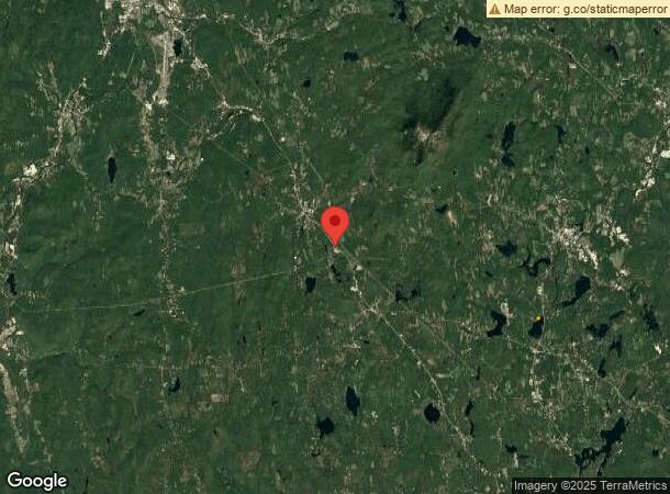
487 Nh Route 12 N
Keene, NH
Cheshire
FITZ-000041-000016
New Hampshire
Sfr
2 AC
X
Manchester/New Hampshire South Area
33005C0445E
Other Market Areas
1,446 SF
DEMOGRAPHICS near 487 Nh Route 12 N
1 Mile
3 Mile
5 Mile
2024 Total Population
293
2,709
4,711
2029 Population
302
2,782
4,884
Pop Growth 2024-2029
+ 3.07%
+ 2.69%
+ 3.67%
Average Age
43
43
44
2024 Total Households
116
1,101
1,931
HH Growth 2024-2029
+ 2.59%
+ 2.27%
+ 3.16%
Median Household Inc
$63,750
$58,999
$66,543
Avg Household Size
2.40
2.40
2.40
2024 Avg HH Vehicles
2.00
2.00
2.00
Median Home Value
$226,470
$222,474
$238,773
Median Year Built
1972
1971
1972
Nearby Places
Map Layers
Map Styles
 Street
 Aerial
- Restaurants
- Banks
- Shops
- Fitness
- Groceries
Nearby Properties
Address
Land Use
TOTAL SIZE
Lot Size
Zoning
Address
Land Use
TOTAL SIZE
Lot Size
Zoning
17.67 AC
RURAL
Address
Land Use
TOTAL SIZE
Lot Size
Zoning
95,041 SF
18.90 AC
LI L
Address
Land Use
TOTAL SIZE
Lot Size
Zoning
30,573 SF
16 AC
R1
Address
Land Use
TOTAL SIZE
Lot Size
Zoning
28,172 SF
14.48 AC
VILLAG
Address
Land Use
TOTAL SIZE
Lot Size
Zoning
107.50 AC
RURAL
Address
Land Use
TOTAL SIZE
Lot Size
Zoning
5.64 AC
VILLAG
Address
Land Use
TOTAL SIZE
Lot Size
Zoning
3,123 SF
0.96 AC
GB G
Address
Land Use
TOTAL SIZE
Lot Size
Zoning
8,380 SF
5.70 AC
R1
Address
Land Use
TOTAL SIZE
Lot Size
Zoning
15,568 SF
6.76 AC
HIGHWA
Address
Land Use
TOTAL SIZE
Lot Size
Zoning
9,471 SF
32 AC
RUR
Address
Land Use
TOTAL SIZE
Lot Size
Zoning
9,100 SF
3.25 AC
HIGHWA
Address
Land Use
TOTAL SIZE
Lot Size
Zoning
30.20 AC
HIGHWA
Address
Land Use
TOTAL SIZE
Lot Size
Zoning
6.50 AC
HIGHWA
Address
Land Use
TOTAL SIZE
Lot Size
Zoning
0.69 AC
VILLAG
Address
Land Use
TOTAL SIZE
Lot Size
Zoning
1,886 SF
200 AC
RUR
Address
Land Use
TOTAL SIZE
Lot Size
Zoning
3,675 SF
121.20 AC
RUR
Address
Land Use
TOTAL SIZE
Lot Size
Zoning
8,363 SF
1.54 AC
GB G
Address
Land Use
TOTAL SIZE
Lot Size
Zoning
6,335 SF
0.81 AC
R1
Address
Land Use
TOTAL SIZE
Lot Size
Zoning
5,774 SF
0.40 AC
R1
Address
Land Use
TOTAL SIZE
Lot Size
Zoning
1.20 AC
RESIDE
Address
Land Use
TOTAL SIZE
Lot Size
Zoning
3.50 AC
R1
Address
Land Use
TOTAL SIZE
Lot Size
Zoning
3.42 AC
HIGHWA
Address
Land Use
TOTAL SIZE
Lot Size
Zoning
8,984 SF
9.02 AC
HIGHWA
Address
Land Use
TOTAL SIZE
Lot Size
Zoning
1,764 SF
0.92 AC
GB G
Address
Land Use
TOTAL SIZE
Lot Size
Zoning
8,435 SF
0.80 AC
RUR
Address
Land Use
TOTAL SIZE
Lot Size
Zoning
5,084 SF
0.60 AC
R1
Address
Land Use
TOTAL SIZE
Lot Size
Zoning
2,020 SF
3.20 AC
RESIDE
Address
Land Use
TOTAL SIZE
Lot Size
Zoning
17,520 SF
6.23 AC
GI GEN
Address
Land Use
TOTAL SIZE
Lot Size
Zoning
10,865 SF
5 AC
LI L
Address
Land Use
TOTAL SIZE
Lot Size
Zoning
7,208 SF
0.85 AC
VILLAG
The World's #1 Commercial Real Estate Marketplace
Connect with us
© 2025 CoStar Group
The information above has been obtained from sources believed reliable. While we do not doubt its accuracy we have not verified it and make no guarantee, warranty or representation about it. It is your responsibility to independently confirm its accuracy and completeness. Any projections, opinions, assumptions, or estimates used are for example only and do not represent the current or future performance of the property. The value of this transaction to you depends on tax and other factors which should be evaluated by your tax, financial, and legal advisors. You and your advisors should conduct a careful, independent investigation of the property to determine to your satisfaction the suitability of the property for your needs.