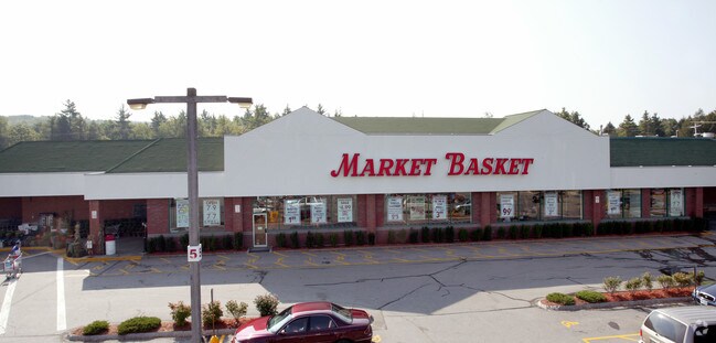
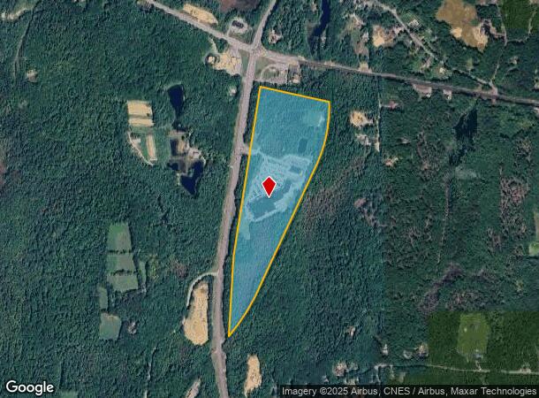
Property Record
497 Us Route 202, Rindge, NH 03461
NEARBY LISTINGS FOR SALE OR LEASE
Property Detail
497 Us Route 202
RIND-000006-000014
Cheshire
Commercialnec
New Hampshire
X
14
33005C0468E
48.16 AC
2024
Manchester/New Hampshire South Area
2024
Other Market Areas
970600
Keene, NH
91,174 SF
DEMOGRAPHICS near 497 Us Route 202
1 Mile
3 Mile
5 Mile
2024 Total Population
609
5,343
16,610
2029 Population
637
5,605
17,221
Pop Growth 2024-2029
+ 4.60%
+ 4.90%
+ 3.68%
Average Age
37
38
41
2024 Total Households
193
1,737
6,320
HH Growth 2024-2029
+ 5.18%
+ 5.24%
+ 3.53%
Median Household Inc
$83,152
$86,219
$78,595
Avg Household Size
2.60
2.60
2.40
2024 Avg HH Vehicles
2.00
2.00
2.00
Median Home Value
$275,949
$277,318
$252,931
Median Year Built
1983
1982
1975
Nearby Places
Map Layers
Map Styles
 Street
 Aerial
- Restaurants
- Banks
- Shops
- Fitness
- Groceries
SALE & LEASE HISTORY
LISTING DATE
SALE/LEASE

Sep 25, 2016
For Lease
Nearby Properties
Address
Land Use
TOTAL SIZE
Lot Size
Zoning
Address
Land Use
TOTAL SIZE
Lot Size
Zoning
402 AC
COM
Address
Land Use
TOTAL SIZE
Lot Size
Zoning
COLLEG
Address
Land Use
TOTAL SIZE
Lot Size
Zoning
3.50 AC
COM
Address
Land Use
TOTAL SIZE
Lot Size
Zoning
69,485 SF
17.31 AC
COM
Address
Land Use
TOTAL SIZE
Lot Size
Zoning
56,426 SF
16.63 AC
COM
Address
Land Use
TOTAL SIZE
Lot Size
Zoning
56,886 SF
11 AC
VILLAG
Address
Land Use
TOTAL SIZE
Lot Size
Zoning
1,860 SF
COLLEG
Address
Land Use
TOTAL SIZE
Lot Size
Zoning
10.91 AC
BUSINE
Address
Land Use
TOTAL SIZE
Lot Size
Zoning
Address
Land Use
TOTAL SIZE
Lot Size
Zoning
34,567 SF
12.80 AC
COM
Address
Land Use
TOTAL SIZE
Lot Size
Zoning
4.51 AC
COM
Address
Land Use
TOTAL SIZE
Lot Size
Zoning
104 AC
COM
Address
Land Use
TOTAL SIZE
Lot Size
Zoning
24.43 AC
COM
Address
Land Use
TOTAL SIZE
Lot Size
Zoning
9.80 AC
COM
Address
Land Use
TOTAL SIZE
Lot Size
Zoning
720 SF
81 AC
COM
Address
Land Use
TOTAL SIZE
Lot Size
Zoning
24.30 AC
COM
Address
Land Use
TOTAL SIZE
Lot Size
Zoning
8,270 SF
7.24 AC
GATEWA
Address
Land Use
TOTAL SIZE
Lot Size
Zoning
5,982 SF
3.89 AC
COM
Address
Land Use
TOTAL SIZE
Lot Size
Zoning
10,431 SF
3.17 AC
COM
Address
Land Use
TOTAL SIZE
Lot Size
Zoning
6,946 SF
2.35 AC
COM
Address
Land Use
TOTAL SIZE
Lot Size
Zoning
7,985 SF
22.99 AC
RESIDE
Address
Land Use
TOTAL SIZE
Lot Size
Zoning
1,060 SF
9.33 AC
COM
Address
Land Use
TOTAL SIZE
Lot Size
Zoning
30 AC
RESIDE
Address
Land Use
TOTAL SIZE
Lot Size
Zoning
10,473 SF
3.50 AC
VILLAG
Address
Land Use
TOTAL SIZE
Lot Size
Zoning
18,000 SF
19.60 AC
BUSINE
Address
Land Use
TOTAL SIZE
Lot Size
Zoning
7,010 SF
0.61 AC
COM
Address
Land Use
TOTAL SIZE
Lot Size
Zoning
11,332 SF
6.98 AC
COM
Address
Land Use
TOTAL SIZE
Lot Size
Zoning
23 AC
COM
Address
Land Use
TOTAL SIZE
Lot Size
Zoning
22,242 SF
2.88 AC
VILLAG
The World's #1 Commercial Real Estate Marketplace
Connect with us
© 2025 CoStar Group
The information above has been obtained from sources believed reliable. While we do not doubt its accuracy we have not verified it and make no guarantee, warranty or representation about it. It is your responsibility to independently confirm its accuracy and completeness. Any projections, opinions, assumptions, or estimates used are for example only and do not represent the current or future performance of the property. The value of this transaction to you depends on tax and other factors which should be evaluated by your tax, financial, and legal advisors. You and your advisors should conduct a careful, independent investigation of the property to determine to your satisfaction the suitability of the property for your needs.