Property Record
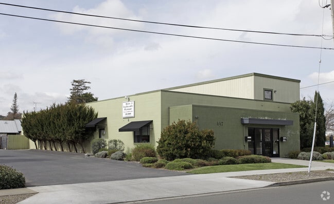
497 Walnut St, Napa, CA 94559


Current Lease Availabilities
Property Detail
497 Walnut St
004-201-028
MAP NO 2344 18R/S29 H 004201029000 004201029000 P
Commercialbuilding
Napa
IL
California
B and X Area of moderate flood hazard, usually the area between the limits of the 100-year and 500-year floods.
0.30 AC
2025
Napa County
2025
North Bay/Santa Rosa
200201
Napa, CA
7,090 SF
NEARBY LISTINGS FOR SALE OR LEASE
DEMOGRAPHICS near 497 Walnut St
1 mile
3 mile
5 mile
2025 Total Population
21,543
73,108
85,669
2030 Population
21,097
71,567
83,746
Pop Growth 2025-2030
(2.07%)
(2.11%)
(2.24%)
Average Age
39
42
43
2025 Total Households
7,647
26,908
31,814
HH Growth 2025-2030
(2.07%)
(2.20%)
(2.38%)
Median Household Inc
$95,415
$104,979
$109,074
Avg Household Size
2.60
2.60
2.60
2025 Avg HH Vehicles
2.00
2.00
2.00
Median Home Value
$835,455
$830,526
$862,464
Median Year Built
1958
1972
1973
Nearby Places
Map Layers
Map Styles
 Street
 Aerial
Layers
 Traffic
 Biking
Places
Listings with unknown addresses are not visible on the map
- Restaurants
- Banks
- Shops
- Fitness
- Groceries
PUBLIC TRANSPORTATION
AIRPORT
Charles M Schulz - Sonoma County
Drive
Walk
Distance
Charles M Schulz - Sonoma County
67 min
46.6 mi
Freight Ports
Port of Richmond
Drive
Walk
Distance
Port of Richmond
52 min
37.5 mi
Nearby Properties
Address
Land Use
TOTAL SIZE
Lot Size
Zoning
Address
Land Use
TOTAL SIZE
Lot Size
Zoning
12.32 AC
PQ
Address
Land Use
TOTAL SIZE
Lot Size
Zoning
195,343 SF
9.31 AC
CT
Address
Land Use
TOTAL SIZE
Lot Size
Zoning
160,241 SF
12.54 AC
Address
Land Use
TOTAL SIZE
Lot Size
Zoning
19.27 AC
Address
Land Use
TOTAL SIZE
Lot Size
Zoning
149,714 SF
0.40 AC
Address
Land Use
TOTAL SIZE
Lot Size
Zoning
83,251 SF
8.05 AC
CT
Address
Land Use
TOTAL SIZE
Lot Size
Zoning
283,311 SF
8.27 AC
Address
Land Use
TOTAL SIZE
Lot Size
Zoning
97,515 SF
0.30 AC
03
Address
Land Use
TOTAL SIZE
Lot Size
Zoning
10.05 AC
Address
Land Use
TOTAL SIZE
Lot Size
Zoning
177,350 SF
7.85 AC
RM
Address
Land Use
TOTAL SIZE
Lot Size
Zoning
201,042 SF
11.38 AC
Address
Land Use
TOTAL SIZE
Lot Size
Zoning
2.95 AC
Address
Land Use
TOTAL SIZE
Lot Size
Zoning
202,098 SF
6.67 AC
RM
Address
Land Use
TOTAL SIZE
Lot Size
Zoning
80,498 SF
2.38 AC
Address
Land Use
TOTAL SIZE
Lot Size
Zoning
53,871 SF
2.49 AC
CT
Address
Land Use
TOTAL SIZE
Lot Size
Zoning
4.70 AC
RM
Address
Land Use
TOTAL SIZE
Lot Size
Zoning
4.99 AC
RM
Address
Land Use
TOTAL SIZE
Lot Size
Zoning
94,464 SF
6.48 AC
RM
Address
Land Use
TOTAL SIZE
Lot Size
Zoning
105,371 SF
0.83 AC
CD
Address
Land Use
TOTAL SIZE
Lot Size
Zoning
63,612 SF
9.08 AC
RM
Address
Land Use
TOTAL SIZE
Lot Size
Zoning
157,093 SF
12.58 AC
CC
Address
Land Use
TOTAL SIZE
Lot Size
Zoning
134,629 SF
4.13 AC
Address
Land Use
TOTAL SIZE
Lot Size
Zoning
30,449 SF
1.23 AC
Address
Land Use
TOTAL SIZE
Lot Size
Zoning
68,360 SF
1.58 AC
CDP
Address
Land Use
TOTAL SIZE
Lot Size
Zoning
68,409 SF
5.66 AC
RM
Address
Land Use
TOTAL SIZE
Lot Size
Zoning
10.64 AC
Address
Land Use
TOTAL SIZE
Lot Size
Zoning
2.90 AC
RM
Address
Land Use
TOTAL SIZE
Lot Size
Zoning
49,709 SF
1.47 AC
CT
Address
Land Use
TOTAL SIZE
Lot Size
Zoning
2.56 AC
Address
Land Use
TOTAL SIZE
Lot Size
Zoning
11.08 AC
CC
The World's #1 Commercial Real Estate Marketplace
Connect with us
© 2026 CoStar Group
The information above has been obtained from sources believed reliable. While we do not doubt its accuracy we have not verified it and make no guarantee, warranty or representation about it. It is your responsibility to independently confirm its accuracy and completeness. Any projections, opinions, assumptions, or estimates used are for example only and do not represent the current or future performance of the property. The value of this transaction to you depends on tax and other factors which should be evaluated by your tax, financial, and legal advisors. You and your advisors should conduct a careful, independent investigation of the property to determine to your satisfaction the suitability of the property for your needs.