Property Record
4970 S Alma School Rd, Chandler, AZ 85248


NEARBY LISTINGS FOR SALE OR LEASE
Property Detail
4970 S Alma School Rd
Phoenix-Mesa-Scottsdale, AZ
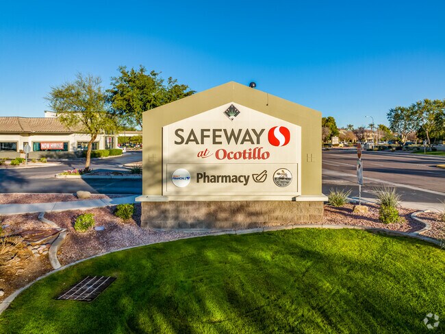
Safeway At Ocotillo
303-48-477
SAFEWAY AT OCOTILLO MCR 473-26
Regionalshoppingcenterormallwithanchorstore
Maricopa
X
Arizona
04013C3105M
1
2025
6.57 AC
2025
Chandler
812900
Phoenix
55,130 SF
DEMOGRAPHICS near 4970 S Alma School Rd
1 Mile
3 Mile
5 Mile
2024 Total Population
10,014
71,778
151,950
2029 Population
10,885
78,415
165,232
Pop Growth 2024-2029
+ 8.70%
+ 9.25%
+ 8.74%
Average Age
49
46
42
2024 Total Households
4,184
28,954
58,349
HH Growth 2024-2029
+ 8.75%
+ 9.29%
+ 8.88%
Median Household Inc
$111,857
$100,483
$100,602
Avg Household Size
2.40
2.40
2.50
2024 Avg HH Vehicles
2.00
2.00
2.00
Median Home Value
$525,563
$454,332
$458,907
Median Year Built
2003
2000
2001
Nearby Places
Map Layers
Map Styles
 Street
 Aerial
- Restaurants
- Banks
- Shops
- Fitness
- Groceries
PUBLIC TRANSPORTATION
AIRPORT
Phoenix-Mesa Gateway
DRIVE
WALK
Distance
Phoenix-Mesa Gateway
27 min
16.0 mi
Phoenix Sky Harbor International
DRIVE
WALK
Distance
Phoenix Sky Harbor International
34 min
22.9 mi
SALE & LEASE HISTORY
LISTING DATE
SALE/LEASE

Sep 25, 2016
For Lease
Sep 23, 2020
For Lease
Nearby Properties
Address
Land Use
TOTAL SIZE
Lot Size
Zoning
Address
Land Use
TOTAL SIZE
Lot Size
Zoning
1,420,114 SF
66.08 AC
PAD
Address
Land Use
TOTAL SIZE
Lot Size
Zoning
10.02 AC
Address
Land Use
TOTAL SIZE
Lot Size
Zoning
3,688,548 SF
285.19 AC
PAD
Address
Land Use
TOTAL SIZE
Lot Size
Zoning
30,414 SF
97.19 AC
PAD
Address
Land Use
TOTAL SIZE
Lot Size
Zoning
434,857 SF
36.73 AC
PF
Address
Land Use
TOTAL SIZE
Lot Size
Zoning
1.83 AC
Address
Land Use
TOTAL SIZE
Lot Size
Zoning
456,122 SF
25.97 AC
PAD
Address
Land Use
TOTAL SIZE
Lot Size
Zoning
24,038 SF
40.27 AC
AG1
Address
Land Use
TOTAL SIZE
Lot Size
Zoning
1.64 AC
Address
Land Use
TOTAL SIZE
Lot Size
Zoning
363,785 SF
46.73 AC
Address
Land Use
TOTAL SIZE
Lot Size
Zoning
563,460 SF
33.65 AC
Address
Land Use
TOTAL SIZE
Lot Size
Zoning
58,989 SF
37.62 AC
PAD
Address
Land Use
TOTAL SIZE
Lot Size
Zoning
444,707 SF
21.62 AC
I-2
Address
Land Use
TOTAL SIZE
Lot Size
Zoning
329,305 SF
18.06 AC
PAD
Address
Land Use
TOTAL SIZE
Lot Size
Zoning
199,250 SF
1.24 AC
PCO
Address
Land Use
TOTAL SIZE
Lot Size
Zoning
180,117 SF
28.41 AC
PF
Address
Land Use
TOTAL SIZE
Lot Size
Zoning
200,084 SF
1.31 AC
PCO
Address
Land Use
TOTAL SIZE
Lot Size
Zoning
199,805 SF
1.32 AC
PCO
Address
Land Use
TOTAL SIZE
Lot Size
Zoning
200,660 SF
1.24 AC
PCO
Address
Land Use
TOTAL SIZE
Lot Size
Zoning
199,808 SF
48.05 AC
PAD
Address
Land Use
TOTAL SIZE
Lot Size
Zoning
524,160 SF
57.07 AC
PCO
Address
Land Use
TOTAL SIZE
Lot Size
Zoning
365,929 SF
40.92 AC
PAD
Address
Land Use
TOTAL SIZE
Lot Size
Zoning
7,886 SF
40.19 AC
AG
Address
Land Use
TOTAL SIZE
Lot Size
Zoning
8,307 SF
234.90 AC
AG
Address
Land Use
TOTAL SIZE
Lot Size
Zoning
202,139 SF
12.08 AC
PAD
Address
Land Use
TOTAL SIZE
Lot Size
Zoning
202,951 SF
10.62 AC
PAD
Address
Land Use
TOTAL SIZE
Lot Size
Zoning
322,816 SF
18.90 AC
PAD
Address
Land Use
TOTAL SIZE
Lot Size
Zoning
137,000 SF
28.06 AC
PF
Address
Land Use
TOTAL SIZE
Lot Size
Zoning
260,808 SF
14.11 AC
PAD
The World's #1 Commercial Real Estate Marketplace
Connect with us
© 2026 CoStar Group
The information above has been obtained from sources believed reliable. While we do not doubt its accuracy we have not verified it and make no guarantee, warranty or representation about it. It is your responsibility to independently confirm its accuracy and completeness. Any projections, opinions, assumptions, or estimates used are for example only and do not represent the current or future performance of the property. The value of this transaction to you depends on tax and other factors which should be evaluated by your tax, financial, and legal advisors. You and your advisors should conduct a careful, independent investigation of the property to determine to your satisfaction the suitability of the property for your needs.