Property Record
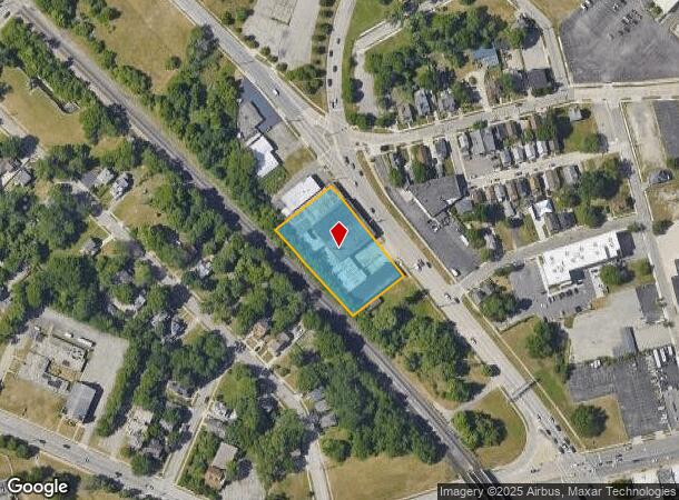
49730 Woodward Ave, Pontiac, MI 48342

NEARBY LISTINGS FOR SALE OR LEASE
Property Detail
49730 Woodward Ave
Detroit-Warren-Dearborn, MI
Assessors Plat No
14-29-402-005
T3N, R10E, SEC 29 ASSESSOR'S PLAT NO. 119 LOTS 10 TO 14 INCL
Warehouse
Oakland
X
Michigan
26125C0368F
10-14
2024
1.22 AC
2024
Auburn Hills, Pontiac & Rochester
141600
Detroit
45,139 SF
DEMOGRAPHICS near 49730 Woodward Ave
1 Mile
3 Mile
5 Mile
2024 Total Population
12,183
76,135
158,943
2029 Population
12,312
76,132
158,491
Pop Growth 2024-2029
+ 1.06%
0.00%
(0.28%)
Average Age
38
39
41
2024 Total Households
4,540
30,802
66,252
HH Growth 2024-2029
+ 1.06%
(0.02%)
(0.33%)
Median Household Inc
$36,133
$43,286
$61,273
Avg Household Size
2.40
2.30
2.30
2024 Avg HH Vehicles
1.00
2.00
2.00
Median Home Value
$90,009
$120,905
$214,773
Median Year Built
1949
1960
1968
Nearby Places
Map Layers
Map Styles
 Street
 Aerial
- Restaurants
- Banks
- Shops
- Fitness
- Groceries
PUBLIC TRANSPORTATION
AIRPORT
Detroit City
DRIVE
WALK
Distance
Detroit City
35 min
28.8 mi
Detroit Metro Wayne County
DRIVE
WALK
Distance
Detroit Metro Wayne County
54 min
40.7 mi
Freight Ports
Port of Baltimore
DRIVE
WALK
Distance
Port of Baltimore
1 min
420.1 mi
SALE & LEASE HISTORY
LISTING DATE
SALE/LEASE

Sep 24, 2019
For Sale
Sep 24, 2016
For Sale
Oct 01, 2024
For Lease
Oct 01, 2024
For Sale
Nov 08, 2022
For Sale
Jun 07, 2017
For Sale
Jul 28, 2017
For Sale
Jan 20, 2017
For Lease
Aug 01, 2018
For Sale
Nearby Properties
Address
Land Use
TOTAL SIZE
Lot Size
Zoning
Address
Land Use
TOTAL SIZE
Lot Size
Zoning
2,734,739 SF
80.39 AC
Address
Land Use
TOTAL SIZE
Lot Size
Zoning
526,398 SF
32.99 AC
Address
Land Use
TOTAL SIZE
Lot Size
Zoning
1,771,589 SF
96.73 AC
Address
Land Use
TOTAL SIZE
Lot Size
Zoning
608,251 SF
50.49 AC
II
Address
Land Use
TOTAL SIZE
Lot Size
Zoning
374,400 SF
4.10 AC
Address
Land Use
TOTAL SIZE
Lot Size
Zoning
426,034 SF
24.99 AC
AI
Address
Land Use
TOTAL SIZE
Lot Size
Zoning
601,151 SF
Address
Land Use
TOTAL SIZE
Lot Size
Zoning
221,340 SF
26.88 AC
Address
Land Use
TOTAL SIZE
Lot Size
Zoning
156,668 SF
13.19 AC
BI
Address
Land Use
TOTAL SIZE
Lot Size
Zoning
23.28 AC
AI
Address
Land Use
TOTAL SIZE
Lot Size
Zoning
199,125 SF
47.43 AC
Address
Land Use
TOTAL SIZE
Lot Size
Zoning
97,172 SF
13.82 AC
BI
Address
Land Use
TOTAL SIZE
Lot Size
Zoning
205,703 SF
21.63 AC
B2
Address
Land Use
TOTAL SIZE
Lot Size
Zoning
101,320 SF
28.20 AC
Address
Land Use
TOTAL SIZE
Lot Size
Zoning
79,263 SF
22.27 AC
Address
Land Use
TOTAL SIZE
Lot Size
Zoning
903,018 SF
73.92 AC
II
Address
Land Use
TOTAL SIZE
Lot Size
Zoning
145,712 SF
10.51 AC
BV
Address
Land Use
TOTAL SIZE
Lot Size
Zoning
87,560 SF
7.94 AC
BI
Address
Land Use
TOTAL SIZE
Lot Size
Zoning
288,124 SF
15.76 AC
Address
Land Use
TOTAL SIZE
Lot Size
Zoning
186,197 SF
12.11 AC
TR
Address
Land Use
TOTAL SIZE
Lot Size
Zoning
1,870,974 SF
61.73 AC
Address
Land Use
TOTAL SIZE
Lot Size
Zoning
152,346 SF
14.07 AC
TR
Address
Land Use
TOTAL SIZE
Lot Size
Zoning
92,524 SF
14.62 AC
TR
Address
Land Use
TOTAL SIZE
Lot Size
Zoning
100,169 SF
9.74 AC
TR
Address
Land Use
TOTAL SIZE
Lot Size
Zoning
109,556 SF
7.21 AC
Address
Land Use
TOTAL SIZE
Lot Size
Zoning
93,706 SF
1.13 AC
Address
Land Use
TOTAL SIZE
Lot Size
Zoning
94,184 SF
12 AC
TR
Address
Land Use
TOTAL SIZE
Lot Size
Zoning
55,912 SF
1.11 AC
Address
Land Use
TOTAL SIZE
Lot Size
Zoning
128,010 SF
9.56 AC
TR
Address
Land Use
TOTAL SIZE
Lot Size
Zoning
1 SF
65.92 AC
MHP
The World's #1 Commercial Real Estate Marketplace
Connect with us
© 2025 CoStar Group
The information above has been obtained from sources believed reliable. While we do not doubt its accuracy we have not verified it and make no guarantee, warranty or representation about it. It is your responsibility to independently confirm its accuracy and completeness. Any projections, opinions, assumptions, or estimates used are for example only and do not represent the current or future performance of the property. The value of this transaction to you depends on tax and other factors which should be evaluated by your tax, financial, and legal advisors. You and your advisors should conduct a careful, independent investigation of the property to determine to your satisfaction the suitability of the property for your needs.