Property Record
4975 Braselton Hwy, Auburn, GA 30011
NEARBY LISTINGS FOR SALE OR LEASE
Property Detail
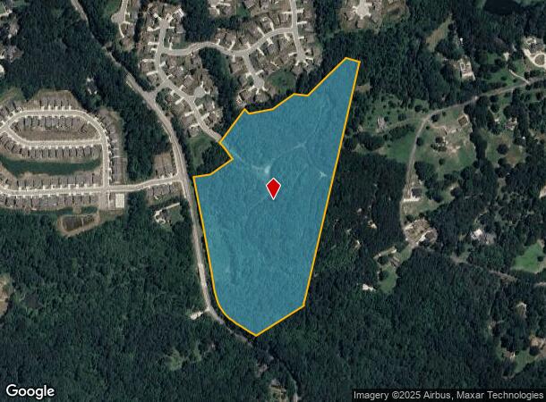
4975 Braselton Hwy
Atlanta-Sandy Springs-Roswell, GA
Hwy 124
3-004-010
ST HWY 124
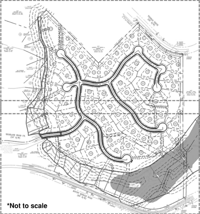
Residentialacreage
Gwinnett
AE
Georgia
13013C0050D
1-140
2025
31.13 AC
2025
Lawrenceville/Lilburn
180106
Atlanta
DEMOGRAPHICS near 4975 Braselton Hwy
1 mile
3 mile
5 mile
2024 Total Population
4,248
29,879
94,884
2029 Population
4,599
32,798
103,573
Pop Growth 2024-2029
+ 8.26%
+ 9.77%
+ 9.16%
Average Age
37
38
39
2024 Total Households
1,253
9,448
30,352
HH Growth 2024-2029
+ 8.54%
+ 10.19%
+ 9.46%
Median Household Inc
$136,041
$111,316
$103,947
Avg Household Size
3.40
3.10
3.10
2024 Avg HH Vehicles
2.00
2.00
2.00
Median Home Value
$402,138
$370,262
$335,147
Median Year Built
2006
2004
2004
Nearby Places
Map Layers
Map Styles
 Street
 Aerial
Transit
 Traffic
 Biking
Places
Listings with unknown addresses are not visible on the map
- Restaurants
- Banks
- Shops
- Fitness
- Groceries
SALE & LEASE HISTORY
LISTING DATE
SALE/LEASE

Nov 01, 2024
For Sale
Nearby Properties
Address
Land Use
TOTAL SIZE
Lot Size
Zoning
Address
Land Use
TOTAL SIZE
Lot Size
Zoning
891.66 AC
R100
Address
Land Use
TOTAL SIZE
Lot Size
Zoning
379,680 SF
76.71 AC
R100
Address
Land Use
TOTAL SIZE
Lot Size
Zoning
404,091 SF
58.20 AC
RA200
Address
Land Use
TOTAL SIZE
Lot Size
Zoning
160,277 SF
53.35 AC
PUD
Address
Land Use
TOTAL SIZE
Lot Size
Zoning
134,673 SF
29.74 AC
RA200
Address
Land Use
TOTAL SIZE
Lot Size
Zoning
Address
Land Use
TOTAL SIZE
Lot Size
Zoning
84,890 SF
20.02 AC
RA200
Address
Land Use
TOTAL SIZE
Lot Size
Zoning
5,220 SF
53.11 AC
PUD
Address
Land Use
TOTAL SIZE
Lot Size
Zoning
73,810 SF
34.67 AC
GC
Address
Land Use
TOTAL SIZE
Lot Size
Zoning
24,490 SF
8.30 AC
C2
Address
Land Use
TOTAL SIZE
Lot Size
Zoning
17,900 SF
21.18 AC
RA200
Address
Land Use
TOTAL SIZE
Lot Size
Zoning
191.82 AC
PUD
Address
Land Use
TOTAL SIZE
Lot Size
Zoning
40,921 SF
18.03 AC
C2
Address
Land Use
TOTAL SIZE
Lot Size
Zoning
19,357 SF
10 AC
RA200
Address
Land Use
TOTAL SIZE
Lot Size
Zoning
11,744 SF
15.78 AC
RA200
Address
Land Use
TOTAL SIZE
Lot Size
Zoning
13,800 SF
5 AC
PUD
Address
Land Use
TOTAL SIZE
Lot Size
Zoning
57 AC
TND
Address
Land Use
TOTAL SIZE
Lot Size
Zoning
129.04 AC
Address
Land Use
TOTAL SIZE
Lot Size
Zoning
43,094 SF
107.98 AC
PUD
Address
Land Use
TOTAL SIZE
Lot Size
Zoning
10,356 SF
11.57 AC
RA200
Address
Land Use
TOTAL SIZE
Lot Size
Zoning
5,940 SF
7.05 AC
RA200
Address
Land Use
TOTAL SIZE
Lot Size
Zoning
18,470 SF
1.18 AC
PUD
Address
Land Use
TOTAL SIZE
Lot Size
Zoning
16,950 SF
1.37 AC
PUD
Address
Land Use
TOTAL SIZE
Lot Size
Zoning
19,176 SF
1.13 AC
C2
Address
Land Use
TOTAL SIZE
Lot Size
Zoning
19,826 SF
0.93 AC
PUD
Address
Land Use
TOTAL SIZE
Lot Size
Zoning
13,701 SF
3.69 AC
PUD
Address
Land Use
TOTAL SIZE
Lot Size
Zoning
7,360 SF
2.57 AC
C2
Address
Land Use
TOTAL SIZE
Lot Size
Zoning
17,478 SF
3.06 AC
PUD
Address
Land Use
TOTAL SIZE
Lot Size
Zoning
16,745 SF
1.01 AC
PUD
Address
Land Use
TOTAL SIZE
Lot Size
Zoning
60,307 SF
33.41 AC
AG
The World's #1 Commercial Real Estate Marketplace
Connect with us
© 2026 CoStar Group
The information above has been obtained from sources believed reliable. While we do not doubt its accuracy we have not verified it and make no guarantee, warranty or representation about it. It is your responsibility to independently confirm its accuracy and completeness. Any projections, opinions, assumptions, or estimates used are for example only and do not represent the current or future performance of the property. The value of this transaction to you depends on tax and other factors which should be evaluated by your tax, financial, and legal advisors. You and your advisors should conduct a careful, independent investigation of the property to determine to your satisfaction the suitability of the property for your needs.