Property Record
4975 State Route 71, Oswego, IL 60543

NEARBY LISTINGS FOR SALE OR LEASE
-
-
View all Oswego listings for sale on LoopNet.com
Property Detail
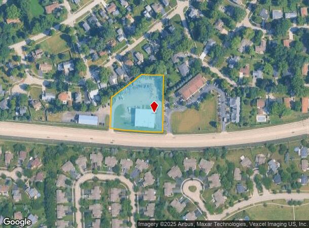
4975 State Route 71
Chicago-Naperville-Elgin, IL-IN-WI
Dannys Commercial Division
03-19-230-020
LT 2 DANNYS COMMERCIAL DIVISION (EXC ROW TAKEN 11-04419) VILLAGE OF OSWEGO
Commercialnec
Kendall
X
Illinois
17093C0065H
2
2024
1.99 AC
2024
I-88 West
890106
Chicago
11,000 SF
DEMOGRAPHICS near 4975 State Route 71
1 Mile
3 Mile
5 Mile
2024 Total Population
6,960
41,626
99,618
2029 Population
7,663
45,996
108,167
Pop Growth 2024-2029
+ 10.10%
+ 10.50%
+ 8.58%
Average Age
38
38
37
2024 Total Households
2,376
13,814
33,119
HH Growth 2024-2029
+ 10.44%
+ 10.58%
+ 8.67%
Median Household Inc
$99,502
$94,079
$90,535
Avg Household Size
2.90
3.00
3.00
2024 Avg HH Vehicles
2.00
2.00
2.00
Median Home Value
$266,767
$279,113
$256,660
Median Year Built
1994
1997
1999
Nearby Places
Map Layers
Map Styles
 Street
 Aerial
- Restaurants
- Banks
- Shops
- Fitness
- Groceries
PUBLIC TRANSPORTATION
COMMUTER RAIL
Aurora Station (Burlington Northern-Santa Fe Railway Line - Northeast Illinois Regional Commuter Railroad (Metra))
DRIVE
WALK
Distance
Aurora Station (Burlington Northern-Santa Fe Railway Line - Northeast Illinois Regional Commuter Railroad (Metra))
16 min
8.0 mi
Freight Ports
Port Milwaukee
DRIVE
WALK
Distance
Port Milwaukee
147 min
114.1 mi
Nearby Properties
Address
Land Use
TOTAL SIZE
Lot Size
Zoning
Address
Land Use
TOTAL SIZE
Lot Size
Zoning
350.78 AC
Address
Land Use
TOTAL SIZE
Lot Size
Zoning
56.02 AC
Address
Land Use
TOTAL SIZE
Lot Size
Zoning
20.76 AC
Address
Land Use
TOTAL SIZE
Lot Size
Zoning
9.86 AC
Address
Land Use
TOTAL SIZE
Lot Size
Zoning
156,614 SF
17.63 AC
Address
Land Use
TOTAL SIZE
Lot Size
Zoning
207,596 SF
20.63 AC
Address
Land Use
TOTAL SIZE
Lot Size
Zoning
118,236 SF
20.93 AC
Address
Land Use
TOTAL SIZE
Lot Size
Zoning
56.13 AC
Address
Land Use
TOTAL SIZE
Lot Size
Zoning
87,746 SF
8.01 AC
Address
Land Use
TOTAL SIZE
Lot Size
Zoning
49,292 SF
1.70 AC
Address
Land Use
TOTAL SIZE
Lot Size
Zoning
49,292 SF
1.70 AC
Address
Land Use
TOTAL SIZE
Lot Size
Zoning
49,292 SF
1.70 AC
Address
Land Use
TOTAL SIZE
Lot Size
Zoning
125,513 SF
9.94 AC
Address
Land Use
TOTAL SIZE
Lot Size
Zoning
120,750 SF
11.07 AC
Address
Land Use
TOTAL SIZE
Lot Size
Zoning
62,164 SF
6.76 AC
Address
Land Use
TOTAL SIZE
Lot Size
Zoning
39,020 SF
1.70 AC
Address
Land Use
TOTAL SIZE
Lot Size
Zoning
31.35 AC
Address
Land Use
TOTAL SIZE
Lot Size
Zoning
65,040 SF
6.04 AC
Address
Land Use
TOTAL SIZE
Lot Size
Zoning
65,982 SF
5.21 AC
Address
Land Use
TOTAL SIZE
Lot Size
Zoning
33,730 SF
6.95 AC
Address
Land Use
TOTAL SIZE
Lot Size
Zoning
120,058 SF
10.71 AC
Address
Land Use
TOTAL SIZE
Lot Size
Zoning
18,774 SF
4.95 AC
Address
Land Use
TOTAL SIZE
Lot Size
Zoning
36,711 SF
0.44 AC
Address
Land Use
TOTAL SIZE
Lot Size
Zoning
16,152 SF
2.40 AC
Address
Land Use
TOTAL SIZE
Lot Size
Zoning
65,646 SF
2.76 AC
Address
Land Use
TOTAL SIZE
Lot Size
Zoning
8,056 SF
2.64 AC
Address
Land Use
TOTAL SIZE
Lot Size
Zoning
31,827 SF
4.48 AC
Address
Land Use
TOTAL SIZE
Lot Size
Zoning
30,310 SF
6 AC
Address
Land Use
TOTAL SIZE
Lot Size
Zoning
18,720 SF
2.06 AC
Address
Land Use
TOTAL SIZE
Lot Size
Zoning
9,945 SF
1.25 AC
The World's #1 Commercial Real Estate Marketplace
Connect with us
© 2025 CoStar Group
The information above has been obtained from sources believed reliable. While we do not doubt its accuracy we have not verified it and make no guarantee, warranty or representation about it. It is your responsibility to independently confirm its accuracy and completeness. Any projections, opinions, assumptions, or estimates used are for example only and do not represent the current or future performance of the property. The value of this transaction to you depends on tax and other factors which should be evaluated by your tax, financial, and legal advisors. You and your advisors should conduct a careful, independent investigation of the property to determine to your satisfaction the suitability of the property for your needs.