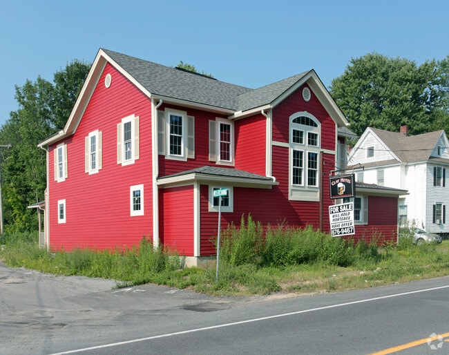
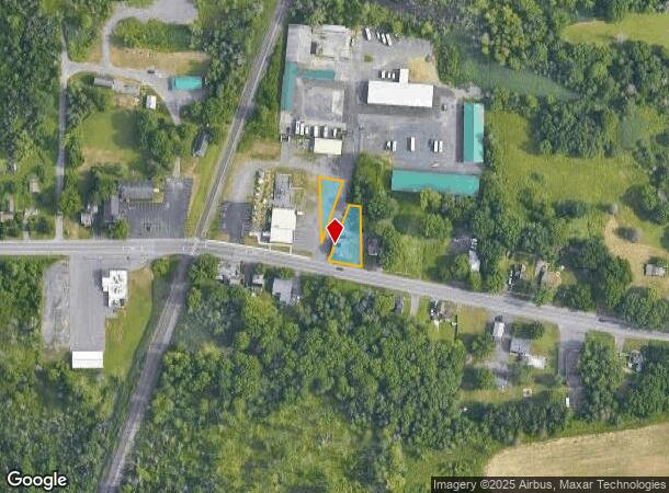
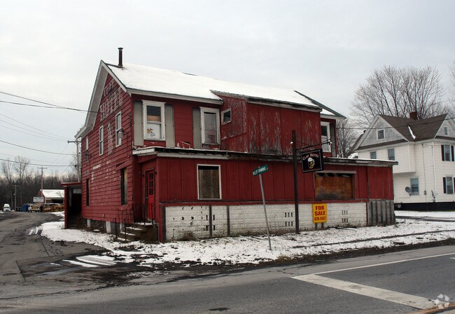
Property Record
4985 State Route 31, Clay, NY 13041
NEARBY LISTINGS FOR SALE OR LEASE
Property Detail
4985 State Route 31
312489-046-000-0001-015-000-0000
FL 39 0161060
Redevelopmentagencyorzone
Onondaga
X
New York
36067C0091F
15.000
2025
0.51 AC
2024
NE Outer Onondaga County
011300
Syracuse
3,710 SF
Syracuse, NY
DEMOGRAPHICS near 4985 State Route 31
1 Mile
3 Mile
5 Mile
2024 Total Population
876
17,221
85,577
2029 Population
855
16,631
83,228
Pop Growth 2024-2029
(2.40%)
(3.43%)
(2.74%)
Average Age
43
41
42
2024 Total Households
329
6,593
35,562
HH Growth 2024-2029
(2.43%)
(3.63%)
(2.92%)
Median Household Inc
$117,150
$103,496
$80,754
Avg Household Size
2.60
2.60
2.30
2024 Avg HH Vehicles
2.00
2.00
2.00
Median Home Value
$256,944
$190,070
$175,746
Median Year Built
1991
1983
1976
Nearby Places
- Restaurants
- Banks
- Shops
- Fitness
- Groceries
PUBLIC TRANSPORTATION
AIRPORT
Syracuse Hancock International
DRIVE
WALK
Distance
Syracuse Hancock International
15 min
9.5 mi
Nearby Properties
Address
Land Use
TOTAL SIZE
Lot Size
Zoning
Address
Land Use
TOTAL SIZE
Lot Size
Zoning
8,417 SF
13.95 AC
Address
Land Use
TOTAL SIZE
Lot Size
Zoning
125,400 SF
18.11 AC
GC
Address
Land Use
TOTAL SIZE
Lot Size
Zoning
66,538 SF
18.24 AC
Address
Land Use
TOTAL SIZE
Lot Size
Zoning
271,263 SF
77.30 AC
Address
Land Use
TOTAL SIZE
Lot Size
Zoning
17,436 SF
98.89 AC
06000
Address
Land Use
TOTAL SIZE
Lot Size
Zoning
16,630 SF
10.16 AC
Address
Land Use
TOTAL SIZE
Lot Size
Zoning
43,968 SF
1.95 AC
Address
Land Use
TOTAL SIZE
Lot Size
Zoning
3,724 SF
56.89 AC
N00
Address
Land Use
TOTAL SIZE
Lot Size
Zoning
12,220 SF
5.86 AC
Address
Land Use
TOTAL SIZE
Lot Size
Zoning
7,416 SF
7.30 AC
Address
Land Use
TOTAL SIZE
Lot Size
Zoning
116,020 SF
15.72 AC
PUD
Address
Land Use
TOTAL SIZE
Lot Size
Zoning
42,720 SF
3.09 AC
Address
Land Use
TOTAL SIZE
Lot Size
Zoning
8,114 SF
2.79 AC
Address
Land Use
TOTAL SIZE
Lot Size
Zoning
42,210 SF
62.23 AC
N00
Address
Land Use
TOTAL SIZE
Lot Size
Zoning
26,445 SF
3.95 AC
Address
Land Use
TOTAL SIZE
Lot Size
Zoning
952 SF
3.81 AC
Address
Land Use
TOTAL SIZE
Lot Size
Zoning
16,630 SF
2.66 AC
Address
Land Use
TOTAL SIZE
Lot Size
Zoning
16,630 SF
3.95 AC
Address
Land Use
TOTAL SIZE
Lot Size
Zoning
39,055 SF
28.38 AC
Address
Land Use
TOTAL SIZE
Lot Size
Zoning
17,760 SF
4.54 AC
CG
Address
Land Use
TOTAL SIZE
Lot Size
Zoning
3,600 SF
2.13 AC
Address
Land Use
TOTAL SIZE
Lot Size
Zoning
30,971 SF
4.02 AC
CG
Address
Land Use
TOTAL SIZE
Lot Size
Zoning
4,096 SF
3.06 AC
Address
Land Use
TOTAL SIZE
Lot Size
Zoning
8,068 SF
3.33 AC
Address
Land Use
TOTAL SIZE
Lot Size
Zoning
2,314 SF
96.17 AC
06000
Address
Land Use
TOTAL SIZE
Lot Size
Zoning
21,224 SF
3 AC
CG
Address
Land Use
TOTAL SIZE
Lot Size
Zoning
51,294 SF
6.25 AC
Address
Land Use
TOTAL SIZE
Lot Size
Zoning
3,600 SF
1.17 AC
Address
Land Use
TOTAL SIZE
Lot Size
Zoning
10,540 SF
4.59 AC
CG
Address
Land Use
TOTAL SIZE
Lot Size
Zoning
6,200 SF
117.28 AC
06 - INDUS
The World's #1 Commercial Real Estate Marketplace
Connect with us
© 2025 CoStar Group
The information above has been obtained from sources believed reliable. While we do not doubt its accuracy we have not verified it and make no guarantee, warranty or representation about it. It is your responsibility to independently confirm its accuracy and completeness. Any projections, opinions, assumptions, or estimates used are for example only and do not represent the current or future performance of the property. The value of this transaction to you depends on tax and other factors which should be evaluated by your tax, financial, and legal advisors. You and your advisors should conduct a careful, independent investigation of the property to determine to your satisfaction the suitability of the property for your needs.