Property Record
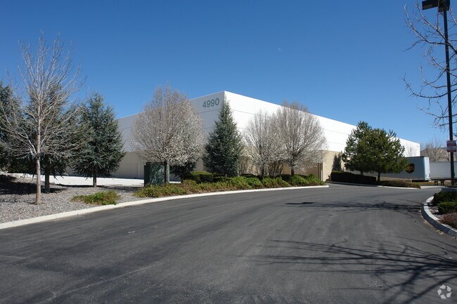
4990 Aircenter Cir, Reno, NV 89502


NEARBY LISTINGS FOR SALE OR LEASE
Property Detail
4990 Aircenter Cir
021-461-31
Dermody Aircenter Fr
Industrialgeneral
DERMODY AIRCENTER FR BLK L
X
Washoe
32031C3232G
Nevada
2025
4.32 AC
2026
Airport
980000
Reno/Sparks
70,400 SF
Reno, NV
DEMOGRAPHICS near 4990 Aircenter Cir
1 Mile
3 Mile
5 Mile
2024 Total Population
9,649
70,021
193,365
2029 Population
10,097
73,795
203,640
Pop Growth 2024-2029
+ 4.64%
+ 5.39%
+ 5.31%
Average Age
40
39
40
2024 Total Households
3,902
29,449
82,847
HH Growth 2024-2029
+ 4.89%
+ 5.57%
+ 5.48%
Median Household Inc
$64,825
$63,099
$63,703
Avg Household Size
2.40
2.30
2.20
2024 Avg HH Vehicles
2.00
2.00
2.00
Median Home Value
$342,358
$422,068
$478,532
Median Year Built
1976
1981
1981
Nearby Places
Map Layers
Map Styles
 Street
 Aerial
- Restaurants
- Banks
- Shops
- Fitness
- Groceries
PUBLIC TRANSPORTATION
COMMUTER RAIL
Reno (California Zephyr - Amtrak)
DRIVE
WALK
Distance
Reno (California Zephyr - Amtrak)
11 min
5.7 mi
AIRPORT
Reno/Tahoe International
DRIVE
WALK
Distance
Reno/Tahoe International
24 min
6.1 mi
Freight Ports
Port of Stockton
DRIVE
WALK
Distance
Port of Stockton
216 min
185.4 mi
Nearby Properties
Address
Land Use
TOTAL SIZE
Lot Size
Zoning
Address
Land Use
TOTAL SIZE
Lot Size
Zoning
1,638,272 SF
17.11 AC
MU
Address
Land Use
TOTAL SIZE
Lot Size
Zoning
762,384 SF
1,131.28 AC
MA
Address
Land Use
TOTAL SIZE
Lot Size
Zoning
799,762 SF
13.30 AC
MU
Address
Land Use
TOTAL SIZE
Lot Size
Zoning
390,743 SF
22.20 AC
IC
Address
Land Use
TOTAL SIZE
Lot Size
Zoning
1,051,043 SF
78.81 AC
PD
Address
Land Use
TOTAL SIZE
Lot Size
Zoning
425,118 SF
30.37 AC
IC
Address
Land Use
TOTAL SIZE
Lot Size
Zoning
759,161 SF
37.37 AC
MU
Address
Land Use
TOTAL SIZE
Lot Size
Zoning
991,800 SF
51.03 AC
PD
Address
Land Use
TOTAL SIZE
Lot Size
Zoning
893,055 SF
52.71 AC
MA
Address
Land Use
TOTAL SIZE
Lot Size
Zoning
451,635 SF
15 AC
PD
Address
Land Use
TOTAL SIZE
Lot Size
Zoning
497,928 SF
3.52 AC
MU
Address
Land Use
TOTAL SIZE
Lot Size
Zoning
645,699 SF
4.53 AC
MU
Address
Land Use
TOTAL SIZE
Lot Size
Zoning
421,744 SF
12.07 AC
MS
Address
Land Use
TOTAL SIZE
Lot Size
Zoning
500,079 SF
45.66 AC
SPD
Address
Land Use
TOTAL SIZE
Lot Size
Zoning
335,490 SF
19.54 AC
PD
Address
Land Use
TOTAL SIZE
Lot Size
Zoning
342,019 SF
23.32 AC
MF14
Address
Land Use
TOTAL SIZE
Lot Size
Zoning
365,634 SF
19.70 AC
MF21
Address
Land Use
TOTAL SIZE
Lot Size
Zoning
366,641 SF
37.91 AC
MA
Address
Land Use
TOTAL SIZE
Lot Size
Zoning
231,329 SF
8.37 AC
GC
Address
Land Use
TOTAL SIZE
Lot Size
Zoning
591,000 SF
5.46 AC
MU
Address
Land Use
TOTAL SIZE
Lot Size
Zoning
187,900 SF
14.83 AC
PD
Address
Land Use
TOTAL SIZE
Lot Size
Zoning
322,180 SF
2.87 AC
MU
Address
Land Use
TOTAL SIZE
Lot Size
Zoning
149,324 SF
4.34 AC
PD
Address
Land Use
TOTAL SIZE
Lot Size
Zoning
270,950 SF
14.86 AC
IC
Address
Land Use
TOTAL SIZE
Lot Size
Zoning
170,507 SF
17.24 AC
GC
Address
Land Use
TOTAL SIZE
Lot Size
Zoning
378.16 AC
GR
Address
Land Use
TOTAL SIZE
Lot Size
Zoning
176,666 SF
7.10 AC
PD
Address
Land Use
TOTAL SIZE
Lot Size
Zoning
80,970 SF
5.28 AC
MS
Address
Land Use
TOTAL SIZE
Lot Size
Zoning
181,296 SF
2.65 AC
MU
Address
Land Use
TOTAL SIZE
Lot Size
Zoning
117,360 SF
1.75 AC
MU
The World's #1 Commercial Real Estate Marketplace
Connect with us
© 2026 CoStar Group
The information above has been obtained from sources believed reliable. While we do not doubt its accuracy we have not verified it and make no guarantee, warranty or representation about it. It is your responsibility to independently confirm its accuracy and completeness. Any projections, opinions, assumptions, or estimates used are for example only and do not represent the current or future performance of the property. The value of this transaction to you depends on tax and other factors which should be evaluated by your tax, financial, and legal advisors. You and your advisors should conduct a careful, independent investigation of the property to determine to your satisfaction the suitability of the property for your needs.