Property Record
4991 Harrodsburg Rd, Nicholasville, KY 40356


NEARBY LISTINGS FOR SALE OR LEASE
Property Detail
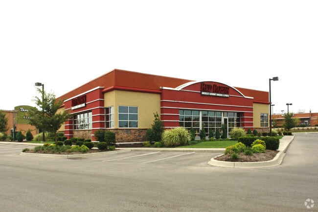
4991 Harrodsburg Rd
Lexington-Fayette, KY
Crosswoods
042-00-00-006.00
CONSOLIDATED LOT CB
Taxexempt
Jessamine
X
Kentucky
21113C0055D
cb
0
11.30 AC
2025
Jessamine County
060600
Lexington/Fayette
27,430 SF
DEMOGRAPHICS near 4991 Harrodsburg Rd
1 Mile
3 Mile
5 Mile
2024 Total Population
3,514
59,496
142,510
2029 Population
3,572
59,350
142,495
Pop Growth 2024-2029
+ 1.65%
(0.25%)
(0.01%)
Average Age
41
39
40
2024 Total Households
1,322
25,264
60,486
HH Growth 2024-2029
+ 1.74%
(0.28%)
(0.12%)
Median Household Inc
$83,805
$70,433
$69,291
Avg Household Size
2.60
2.30
2.30
2024 Avg HH Vehicles
2.00
2.00
2.00
Median Home Value
$260,599
$250,289
$262,525
Median Year Built
1993
1989
1983
Nearby Places
Map Layers
Map Styles
 Street
 Aerial
- Restaurants
- Banks
- Shops
- Fitness
- Groceries
PUBLIC TRANSPORTATION
AIRPORT
Blue Grass
DRIVE
WALK
Distance
Blue Grass
15 min
8.1 mi
Freight Ports
Port of Toledo
DRIVE
WALK
Distance
Port of Toledo
344 min
294.0 mi
Nearby Properties
Address
Land Use
TOTAL SIZE
Lot Size
Zoning
Address
Land Use
TOTAL SIZE
Lot Size
Zoning
263,090 SF
37.66 AC
A-U
Address
Land Use
TOTAL SIZE
Lot Size
Zoning
41,040 SF
14.77 AC
R-4
Address
Land Use
TOTAL SIZE
Lot Size
Zoning
97,729 SF
4.22 AC
P-1
Address
Land Use
TOTAL SIZE
Lot Size
Zoning
10.41 AC
R-3
Address
Land Use
TOTAL SIZE
Lot Size
Zoning
123,221 SF
17.32 AC
R-1B
Address
Land Use
TOTAL SIZE
Lot Size
Zoning
33,996 SF
2 AC
Address
Land Use
TOTAL SIZE
Lot Size
Zoning
4,214 SF
741.62 AC
A-R
Address
Land Use
TOTAL SIZE
Lot Size
Zoning
160,800 SF
74.22 AC
R-1C
Address
Land Use
TOTAL SIZE
Lot Size
Zoning
219,320 SF
8.35 AC
R-4
Address
Land Use
TOTAL SIZE
Lot Size
Zoning
118,794 SF
16.05 AC
B-6P
Address
Land Use
TOTAL SIZE
Lot Size
Zoning
71,790 SF
11.91 AC
R-1B
Address
Land Use
TOTAL SIZE
Lot Size
Zoning
67,347 SF
14.07 AC
R-1C
Address
Land Use
TOTAL SIZE
Lot Size
Zoning
110,901 SF
14.04 AC
B-6P
Address
Land Use
TOTAL SIZE
Lot Size
Zoning
131,031 SF
5.65 AC
P-1
Address
Land Use
TOTAL SIZE
Lot Size
Zoning
46,567 SF
3.16 AC
P-1
Address
Land Use
TOTAL SIZE
Lot Size
Zoning
26,400 SF
1.73 AC
P-1
Address
Land Use
TOTAL SIZE
Lot Size
Zoning
63,000 SF
7.46 AC
B-1
Address
Land Use
TOTAL SIZE
Lot Size
Zoning
48,510 SF
2.97 AC
B-3
Address
Land Use
TOTAL SIZE
Lot Size
Zoning
1.20 AC
B-3
Address
Land Use
TOTAL SIZE
Lot Size
Zoning
17,258 SF
6.18 AC
B-6P
Address
Land Use
TOTAL SIZE
Lot Size
Zoning
11,200 SF
6.23 AC
R-3
Address
Land Use
TOTAL SIZE
Lot Size
Zoning
6,164 SF
8.31 AC
R-3
Address
Land Use
TOTAL SIZE
Lot Size
Zoning
24,678 SF
2.47 AC
R-3
Address
Land Use
TOTAL SIZE
Lot Size
Zoning
44,576 SF
2.11 AC
P-1
Address
Land Use
TOTAL SIZE
Lot Size
Zoning
29,970 SF
1.47 AC
R-4
Address
Land Use
TOTAL SIZE
Lot Size
Zoning
6.79 AC
B-3
Address
Land Use
TOTAL SIZE
Lot Size
Zoning
73,496 SF
1.80 AC
B-3
Address
Land Use
TOTAL SIZE
Lot Size
Zoning
2,409 SF
0.99 AC
B-3
Address
Land Use
TOTAL SIZE
Lot Size
Zoning
1,917 SF
298.76 AC
A-R
Address
Land Use
TOTAL SIZE
Lot Size
Zoning
29,872 SF
1.27 AC
B-3
The World's #1 Commercial Real Estate Marketplace
Connect with us
© 2026 CoStar Group
The information above has been obtained from sources believed reliable. While we do not doubt its accuracy we have not verified it and make no guarantee, warranty or representation about it. It is your responsibility to independently confirm its accuracy and completeness. Any projections, opinions, assumptions, or estimates used are for example only and do not represent the current or future performance of the property. The value of this transaction to you depends on tax and other factors which should be evaluated by your tax, financial, and legal advisors. You and your advisors should conduct a careful, independent investigation of the property to determine to your satisfaction the suitability of the property for your needs.