Property Record
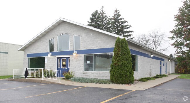
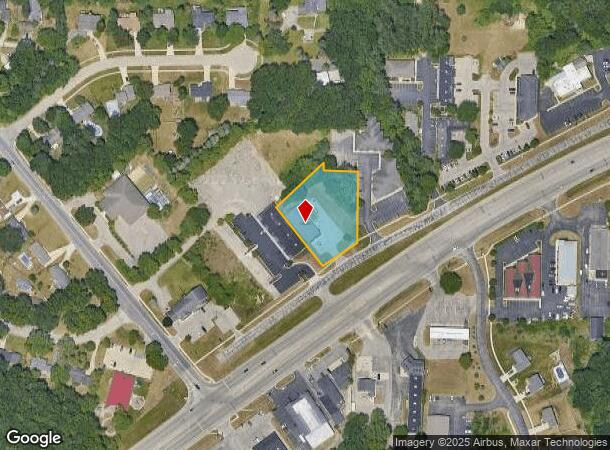
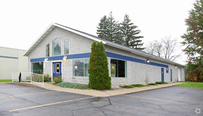
4993 Plainfield Ave Ne, Grand Rapids, MI 49525
NEARBY LISTINGS FOR SALE OR LEASE
-
-
View all Grand Rapids listings for sale on LoopNet.com
Property Detail
4993 Plainfield Ave Ne
41-10-27-203-047
411027203047 PART OF NE 1/4 COM AT CEN OF SEC TH N 0D 47M E ALONG N&S 1/4 LINE 207.74 FT TO CL OF PLAINFIELD AVE TH N 53D 24M
Commercialnec
Kent
X
Michigan
26081C0311D
1 AC
2024
Northeast Grand Rapids
2025
West Michigan
011301
Grand Rapids-Wyoming, MI
DEMOGRAPHICS near 4993 Plainfield Ave Ne
1 Mile
3 Mile
5 Mile
2024 Total Population
5,523
33,012
89,733
2029 Population
5,571
33,464
90,684
Pop Growth 2024-2029
+ 0.87%
+ 1.37%
+ 1.06%
Average Age
42
41
40
2024 Total Households
2,324
12,841
35,995
HH Growth 2024-2029
+ 0.90%
+ 1.33%
+ 1.01%
Median Household Inc
$70,729
$86,025
$78,178
Avg Household Size
2.40
2.50
2.40
2024 Avg HH Vehicles
2.00
2.00
2.00
Median Home Value
$272,168
$279,288
$263,745
Median Year Built
1984
1982
1981
Nearby Places
Map Layers
Map Styles
 Street
 Aerial
- Restaurants
- Banks
- Shops
- Fitness
- Groceries
PUBLIC TRANSPORTATION
AIRPORT
Gerald R Ford International
DRIVE
WALK
Distance
Gerald R Ford International
28 min
18.5 mi
Freight Ports
Port Milwaukee
DRIVE
WALK
Distance
Port Milwaukee
317 min
271.3 mi
Nearby Properties
Address
Land Use
TOTAL SIZE
Lot Size
Zoning
Address
Land Use
TOTAL SIZE
Lot Size
Zoning
494,398 SF
R-PUD
Address
Land Use
TOTAL SIZE
Lot Size
Zoning
25.41 AC
Address
Land Use
TOTAL SIZE
Lot Size
Zoning
Address
Land Use
TOTAL SIZE
Lot Size
Zoning
Address
Land Use
TOTAL SIZE
Lot Size
Zoning
16.34 AC
Address
Land Use
TOTAL SIZE
Lot Size
Zoning
Address
Land Use
TOTAL SIZE
Lot Size
Zoning
Address
Land Use
TOTAL SIZE
Lot Size
Zoning
138,864 SF
34.91 AC
R-1
Address
Land Use
TOTAL SIZE
Lot Size
Zoning
8.43 AC
Address
Land Use
TOTAL SIZE
Lot Size
Zoning
Address
Land Use
TOTAL SIZE
Lot Size
Zoning
Address
Land Use
TOTAL SIZE
Lot Size
Zoning
8 AC
MON-MDR
Address
Land Use
TOTAL SIZE
Lot Size
Zoning
Address
Land Use
TOTAL SIZE
Lot Size
Zoning
Address
Land Use
TOTAL SIZE
Lot Size
Zoning
Address
Land Use
TOTAL SIZE
Lot Size
Zoning
Address
Land Use
TOTAL SIZE
Lot Size
Zoning
42,443 SF
5.29 AC
O-PUD
Address
Land Use
TOTAL SIZE
Lot Size
Zoning
Address
Land Use
TOTAL SIZE
Lot Size
Zoning
16.45 AC
Address
Land Use
TOTAL SIZE
Lot Size
Zoning
Address
Land Use
TOTAL SIZE
Lot Size
Zoning
24.43 AC
R-1
Address
Land Use
TOTAL SIZE
Lot Size
Zoning
53.29 AC
Address
Land Use
TOTAL SIZE
Lot Size
Zoning
20.20 AC
Address
Land Use
TOTAL SIZE
Lot Size
Zoning
Address
Land Use
TOTAL SIZE
Lot Size
Zoning
199,601 SF
14.05 AC
C
Address
Land Use
TOTAL SIZE
Lot Size
Zoning
Address
Land Use
TOTAL SIZE
Lot Size
Zoning
Address
Land Use
TOTAL SIZE
Lot Size
Zoning
Address
Land Use
TOTAL SIZE
Lot Size
Zoning
Address
Land Use
TOTAL SIZE
Lot Size
Zoning
232.19 AC
The World's #1 Commercial Real Estate Marketplace
Connect with us
© 2025 CoStar Group
The information above has been obtained from sources believed reliable. While we do not doubt its accuracy we have not verified it and make no guarantee, warranty or representation about it. It is your responsibility to independently confirm its accuracy and completeness. Any projections, opinions, assumptions, or estimates used are for example only and do not represent the current or future performance of the property. The value of this transaction to you depends on tax and other factors which should be evaluated by your tax, financial, and legal advisors. You and your advisors should conduct a careful, independent investigation of the property to determine to your satisfaction the suitability of the property for your needs.