Property Record
21 Penfield Pl, Farmington, CT 06032


NEARBY LISTINGS FOR SALE OR LEASE
Property Detail
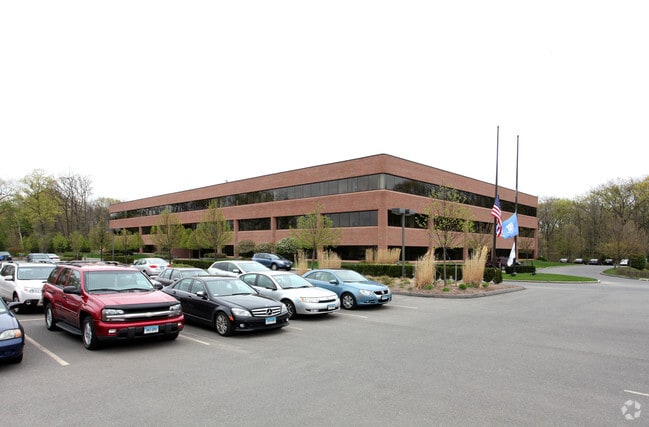
21 Penfield Pl
Hartford-West Hartford-East Hartford, CT
Hartford
FARM-000075-000000-000005
Connecticut
Sfr
0.98 AC
X
Farmington
09003C0476F
Hartford
1,828 SF
DEMOGRAPHICS near 21 Penfield Pl
1 Mile
3 Mile
5 Mile
2024 Total Population
6,133
65,309
170,190
2029 Population
6,089
64,960
168,805
Pop Growth 2024-2029
(0.72%)
(0.53%)
(0.81%)
Average Age
41
39
41
2024 Total Households
2,417
25,963
68,731
HH Growth 2024-2029
(0.79%)
(0.52%)
(0.83%)
Median Household Inc
$85,937
$59,650
$73,306
Avg Household Size
2.50
2.30
2.40
2024 Avg HH Vehicles
2.00
2.00
2.00
Median Home Value
$195,467
$225,739
$258,846
Median Year Built
1958
1959
1958
Nearby Places
Map Layers
Map Styles
 Street
 Aerial
- Restaurants
- Banks
- Shops
- Fitness
- Groceries
PUBLIC TRANSPORTATION
AIRPORT
Bradley International
DRIVE
WALK
Distance
Bradley International
49 min
25.6 mi
Freight Ports
Port of New Haven
DRIVE
WALK
Distance
Port of New Haven
48 min
34.2 mi
SALE & LEASE HISTORY
LISTING DATE
SALE/LEASE

Sep 25, 2016
For Lease
Jan 17, 2018
For Lease
Nearby Properties
Address
Land Use
TOTAL SIZE
Lot Size
Zoning
Address
Land Use
TOTAL SIZE
Lot Size
Zoning
268,369 SF
13.32 AC
B1
Address
Land Use
TOTAL SIZE
Lot Size
Zoning
61.11 AC
R20
Address
Land Use
TOTAL SIZE
Lot Size
Zoning
39.45 AC
R80
Address
Land Use
TOTAL SIZE
Lot Size
Zoning
137,242 SF
25.80 AC
R40
Address
Land Use
TOTAL SIZE
Lot Size
Zoning
28 AC
CR
Address
Land Use
TOTAL SIZE
Lot Size
Zoning
0.01 AC
PR
Address
Land Use
TOTAL SIZE
Lot Size
Zoning
11.16 AC
R30
Address
Land Use
TOTAL SIZE
Lot Size
Zoning
12 AC
R20
Address
Land Use
TOTAL SIZE
Lot Size
Zoning
120,310 SF
13.43 AC
BR
Address
Land Use
TOTAL SIZE
Lot Size
Zoning
182,930 SF
15.70 AC
SA
Address
Land Use
TOTAL SIZE
Lot Size
Zoning
48.09 AC
CR
Address
Land Use
TOTAL SIZE
Lot Size
Zoning
24.61 AC
CR
Address
Land Use
TOTAL SIZE
Lot Size
Zoning
288,827 SF
24.01 AC
RI
Address
Land Use
TOTAL SIZE
Lot Size
Zoning
103,886 SF
10.47 AC
BR
Address
Land Use
TOTAL SIZE
Lot Size
Zoning
173,619 SF
20 AC
SA
Address
Land Use
TOTAL SIZE
Lot Size
Zoning
365.02 AC
CR
Address
Land Use
TOTAL SIZE
Lot Size
Zoning
10.10 AC
RDM
Address
Land Use
TOTAL SIZE
Lot Size
Zoning
13.20 AC
CR
Address
Land Use
TOTAL SIZE
Lot Size
Zoning
59.40 AC
RA
Address
Land Use
TOTAL SIZE
Lot Size
Zoning
25.61 AC
RDM
Address
Land Use
TOTAL SIZE
Lot Size
Zoning
46,768 SF
40.04 AC
R40
Address
Land Use
TOTAL SIZE
Lot Size
Zoning
46,005 SF
4.60 AC
R20
Address
Land Use
TOTAL SIZE
Lot Size
Zoning
168,296 SF
17.94 AC
C1
Address
Land Use
TOTAL SIZE
Lot Size
Zoning
41,011 SF
8.50 AC
BG
Address
Land Use
TOTAL SIZE
Lot Size
Zoning
38,901 SF
10 AC
R20
Address
Land Use
TOTAL SIZE
Lot Size
Zoning
99,576 SF
6.22 AC
CR
Address
Land Use
TOTAL SIZE
Lot Size
Zoning
147,132 SF
12.50 AC
BG
Address
Land Use
TOTAL SIZE
Lot Size
Zoning
122,737 SF
17.20 AC
BG
Address
Land Use
TOTAL SIZE
Lot Size
Zoning
139.76 AC
R20
Address
Land Use
TOTAL SIZE
Lot Size
Zoning
The World's #1 Commercial Real Estate Marketplace
Connect with us
© 2025 CoStar Group
The information above has been obtained from sources believed reliable. While we do not doubt its accuracy we have not verified it and make no guarantee, warranty or representation about it. It is your responsibility to independently confirm its accuracy and completeness. Any projections, opinions, assumptions, or estimates used are for example only and do not represent the current or future performance of the property. The value of this transaction to you depends on tax and other factors which should be evaluated by your tax, financial, and legal advisors. You and your advisors should conduct a careful, independent investigation of the property to determine to your satisfaction the suitability of the property for your needs.