Property Record
5 Brookside Ln, Woodstock, CT 06281
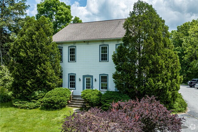
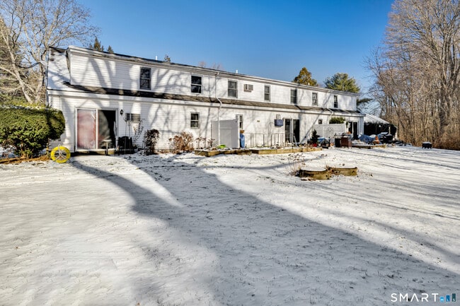
This Property Is For Sale
NEARBY LISTINGS FOR SALE OR LEASE
Property Detail
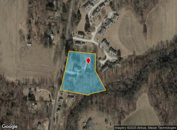
5 Brookside Ln
Worcester, MA-CT
Windham
WOOD-005779-000055-000034-300000
Connecticut
Commercialnec
34-3
2024
3.30 AC
2025
Windham County
901102
Hartford
DEMOGRAPHICS near 5 Brookside Ln
1 Mile
3 Mile
5 Mile
2024 Total Population
984
7,703
19,541
2029 Population
982
7,729
19,511
Pop Growth 2024-2029
(0.20%)
+ 0.34%
(0.15%)
Average Age
44
42
42
2024 Total Households
394
3,268
8,080
HH Growth 2024-2029
(0.25%)
+ 0.46%
(0.10%)
Median Household Inc
$85,381
$73,965
$78,098
Avg Household Size
2.50
2.30
2.30
2024 Avg HH Vehicles
2.00
2.00
2.00
Median Home Value
$273,562
$250,539
$253,237
Median Year Built
1981
1967
1967
Nearby Places
Map Layers
Map Styles
 Street
 Aerial
- Restaurants
- Banks
- Shops
- Fitness
- Groceries
PUBLIC TRANSPORTATION
AIRPORT
Worcester Regional
DRIVE
WALK
Distance
Worcester Regional
49 min
32.1 mi
Freight Ports
Port of Davisville, RI
DRIVE
WALK
Distance
Port of Davisville, RI
73 min
53.6 mi
Nearby Properties
Address
Land Use
TOTAL SIZE
Lot Size
Zoning
Address
Land Use
TOTAL SIZE
Lot Size
Zoning
199,059 SF
31.65 AC
R-10
Address
Land Use
TOTAL SIZE
Lot Size
Zoning
104,330 SF
15 AC
R-10
Address
Land Use
TOTAL SIZE
Lot Size
Zoning
119.01 AC
Address
Land Use
TOTAL SIZE
Lot Size
Zoning
55,340 SF
4 AC
0
Address
Land Use
TOTAL SIZE
Lot Size
Zoning
10.08 AC
R-10
Address
Land Use
TOTAL SIZE
Lot Size
Zoning
62,370 SF
46.40 AC
0
Address
Land Use
TOTAL SIZE
Lot Size
Zoning
38.20 AC
RRAD
Address
Land Use
TOTAL SIZE
Lot Size
Zoning
64,209 SF
4.91 AC
R-7
Address
Land Use
TOTAL SIZE
Lot Size
Zoning
135,012 SF
31.12 AC
0
Address
Land Use
TOTAL SIZE
Lot Size
Zoning
16,771 SF
4.04 AC
0
Address
Land Use
TOTAL SIZE
Lot Size
Zoning
52,724 SF
6.46 AC
SZD
Address
Land Use
TOTAL SIZE
Lot Size
Zoning
1.20 AC
0
Address
Land Use
TOTAL SIZE
Lot Size
Zoning
18,268 SF
3 AC
M/OD
Address
Land Use
TOTAL SIZE
Lot Size
Zoning
3.87 AC
R-7
Address
Land Use
TOTAL SIZE
Lot Size
Zoning
2.26 AC
R-7
Address
Land Use
TOTAL SIZE
Lot Size
Zoning
32,700 SF
2.61 AC
0
Address
Land Use
TOTAL SIZE
Lot Size
Zoning
43.90 AC
0
Address
Land Use
TOTAL SIZE
Lot Size
Zoning
52.20 AC
RR
Address
Land Use
TOTAL SIZE
Lot Size
Zoning
0.91 AC
I
Address
Land Use
TOTAL SIZE
Lot Size
Zoning
17.90 AC
0
Address
Land Use
TOTAL SIZE
Lot Size
Zoning
1.58 AC
R-7
Address
Land Use
TOTAL SIZE
Lot Size
Zoning
13,170 SF
4.01 AC
M/OD
Address
Land Use
TOTAL SIZE
Lot Size
Zoning
7,450 SF
0.70 AC
0
Address
Land Use
TOTAL SIZE
Lot Size
Zoning
74,641 SF
3.43 AC
SZD
Address
Land Use
TOTAL SIZE
Lot Size
Zoning
16,224 SF
6.30 AC
Address
Land Use
TOTAL SIZE
Lot Size
Zoning
Address
Land Use
TOTAL SIZE
Lot Size
Zoning
15,382 SF
0.70 AC
M/OD
Address
Land Use
TOTAL SIZE
Lot Size
Zoning
16,568 SF
15.30 AC
R-10
Address
Land Use
TOTAL SIZE
Lot Size
Zoning
3,698 SF
93.55 AC
0
Address
Land Use
TOTAL SIZE
Lot Size
Zoning
7,160 SF
2.03 AC
R-10
The World's #1 Commercial Real Estate Marketplace
Connect with us
© 2026 CoStar Group
The information above has been obtained from sources believed reliable. While we do not doubt its accuracy we have not verified it and make no guarantee, warranty or representation about it. It is your responsibility to independently confirm its accuracy and completeness. Any projections, opinions, assumptions, or estimates used are for example only and do not represent the current or future performance of the property. The value of this transaction to you depends on tax and other factors which should be evaluated by your tax, financial, and legal advisors. You and your advisors should conduct a careful, independent investigation of the property to determine to your satisfaction the suitability of the property for your needs.