Property Record
5 Central St, Winchendon, MA 01475


Save to a Folder
{{folder.Name}}
{{folder.ListingIds.length}} Properties
{{folder.ListingIds.length}} Property
Create a New Folder
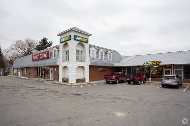
Property Detail
5 Central St
Worcester, MA
WORCESTER
WINC-000053B-000000-000137
Massachusetts
Commercialnec
137
C3
2.25 AC
2025
Outlying Worcester
2025
Boston
701102
NEARBY LISTINGS FOR SALE OR LEASE
DEMOGRAPHICS near 5 Central St
1 mile
3 mile
5 mile
2025 Total Population
4,592
9,690
15,832
2030 Population
4,723
10,023
16,504
Pop Growth 2025-2030
+ 2.85%
+ 3.44%
+ 4.24%
Average Age
41
42
42
2025 Total Households
1,802
3,745
6,059
HH Growth 2025-2030
+ 2.89%
+ 3.55%
+ 4.34%
Median Household Inc
$74,431
$85,006
$96,162
Avg Household Size
2.50
2.50
2.50
2025 Avg HH Vehicles
2.00
2.00
2.00
Median Home Value
$313,761
$334,670
$355,027
Median Year Built
1951
1981
1983
Nearby Places
Map Layers
Map Styles
 Street
 Aerial
Layers
 Traffic
 Biking
Places
Listings with unknown addresses are not visible on the map
- Restaurants
- Banks
- Shops
- Fitness
- Groceries
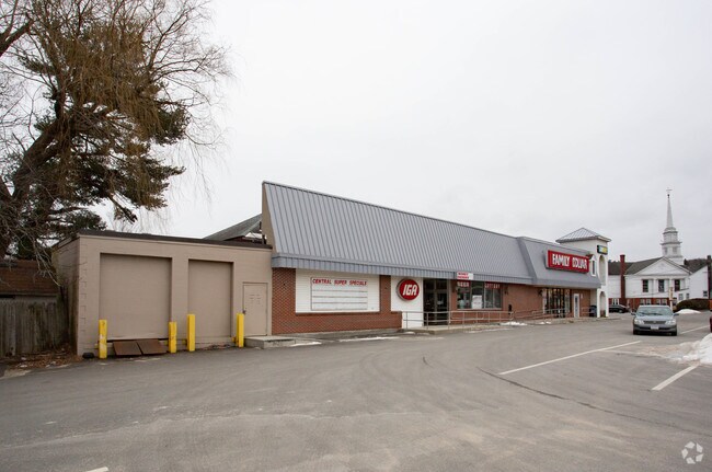
Nearby Properties
Address
Land Use
TOTAL SIZE
Lot Size
Zoning
Address
Land Use
TOTAL SIZE
Lot Size
Zoning
36.05 AC
R3
Address
Land Use
TOTAL SIZE
Lot Size
Zoning
92,819 SF
79.50 AC
R4
Address
Land Use
TOTAL SIZE
Lot Size
Zoning
116,964 SF
7.60 AC
R4
Address
Land Use
TOTAL SIZE
Lot Size
Zoning
8.25 AC
C3
Address
Land Use
TOTAL SIZE
Lot Size
Zoning
55,284 SF
8.25 AC
I
Address
Land Use
TOTAL SIZE
Lot Size
Zoning
26.70 AC
R4
Address
Land Use
TOTAL SIZE
Lot Size
Zoning
28,039 SF
7 AC
R4
Address
Land Use
TOTAL SIZE
Lot Size
Zoning
10.04 AC
R3
Address
Land Use
TOTAL SIZE
Lot Size
Zoning
27,685 SF
1.72 AC
R4
Address
Land Use
TOTAL SIZE
Lot Size
Zoning
11.69 AC
I
Address
Land Use
TOTAL SIZE
Lot Size
Zoning
6 AC
I
Address
Land Use
TOTAL SIZE
Lot Size
Zoning
11.08 AC
R4
Address
Land Use
TOTAL SIZE
Lot Size
Zoning
4,866 SF
106.88 AC
R3
Address
Land Use
TOTAL SIZE
Lot Size
Zoning
13,462 SF
1.67 AC
C3
Address
Land Use
TOTAL SIZE
Lot Size
Zoning
18,300 SF
4.50 AC
C1
Address
Land Use
TOTAL SIZE
Lot Size
Zoning
16,000 SF
3.77 AC
C3
Address
Land Use
TOTAL SIZE
Lot Size
Zoning
2.44 AC
R4
Address
Land Use
TOTAL SIZE
Lot Size
Zoning
14,860 SF
2.71 AC
R4
Address
Land Use
TOTAL SIZE
Lot Size
Zoning
4.46 AC
Address
Land Use
TOTAL SIZE
Lot Size
Zoning
164,674 SF
1.40 AC
C2
Address
Land Use
TOTAL SIZE
Lot Size
Zoning
2.14 AC
R3
Address
Land Use
TOTAL SIZE
Lot Size
Zoning
489.75 AC
R2
Address
Land Use
TOTAL SIZE
Lot Size
Zoning
10,708 SF
1.11 AC
C3
Address
Land Use
TOTAL SIZE
Lot Size
Zoning
0.53 AC
C3
Address
Land Use
TOTAL SIZE
Lot Size
Zoning
5,952 SF
0.78 AC
C3
Address
Land Use
TOTAL SIZE
Lot Size
Zoning
7,985 SF
22.99 AC
RESIDE
Address
Land Use
TOTAL SIZE
Lot Size
Zoning
13,920 SF
1.34 AC
C3
Address
Land Use
TOTAL SIZE
Lot Size
Zoning
8,945 SF
0.41 AC
R4
Address
Land Use
TOTAL SIZE
Lot Size
Zoning
79,104 SF
3.82 AC
I
The World's #1 Commercial Real Estate Marketplace
Connect with us
© 2026 CoStar Group
The information above has been obtained from sources believed reliable. While we do not doubt its accuracy we have not verified it and make no guarantee, warranty or representation about it. It is your responsibility to independently confirm its accuracy and completeness. Any projections, opinions, assumptions, or estimates used are for example only and do not represent the current or future performance of the property. The value of this transaction to you depends on tax and other factors which should be evaluated by your tax, financial, and legal advisors. You and your advisors should conduct a careful, independent investigation of the property to determine to your satisfaction the suitability of the property for your needs.