Property Record
5 Chop Rd, Cameron, SC 29030

Property Detail
5 Chop Rd
Orangeburg, SC
INT HWY 301 & 176 70 08790006
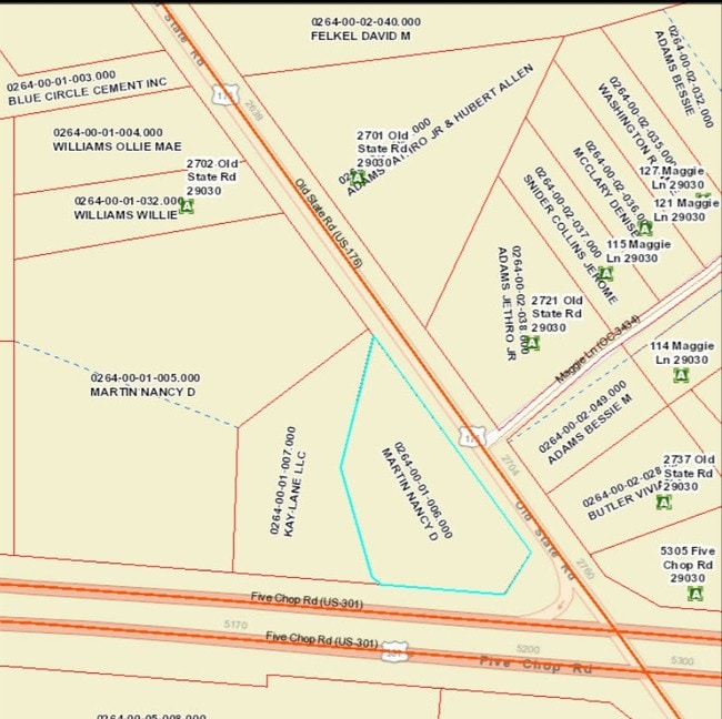
0264-00-01-006.000
ORANGEBURG
Residentialacreage
South Carolina
B and X Area of moderate flood hazard, usually the area between the limits of the 100-year and 500-year floods.
1.50 AC
2024
Orangeburg/Sumter
2024
Other Market Areas
950400
NEARBY LISTINGS FOR SALE OR LEASE
-
-
View all Cameron listings for sale on LoopNet.com
DEMOGRAPHICS near 5 Chop Rd
1 mile
3 mile
5 mile
2024 Total Population
85
858
2,065
2029 Population
83
851
2,056
Pop Growth 2024-2029
(2.35%)
(0.82%)
(0.44%)
Average Age
43
44
44
2024 Total Households
36
351
838
HH Growth 2024-2029
(2.78%)
(0.85%)
(0.60%)
Median Household Inc
$34,999
$47,812
$51,818
Avg Household Size
2.20
2.30
2.30
2024 Avg HH Vehicles
2.00
2.00
2.00
Median Home Value
$146,666
$147,561
$148,161
Median Year Built
1985
1985
1985
Nearby Places
Map Layers
Map Styles
 Street
 Aerial
Transit
 Traffic
 Biking
Places
Listings with unknown addresses are not visible on the map
- Restaurants
- Banks
- Shops
- Fitness
- Groceries
SALE & LEASE HISTORY
LISTING DATE
SALE/LEASE

Jan 11, 2019
For Sale
Apr 19, 2018
For Sale
Nearby Properties
Address
Land Use
TOTAL SIZE
Lot Size
Zoning
Address
Land Use
TOTAL SIZE
Lot Size
Zoning
10 AC
Address
Land Use
TOTAL SIZE
Lot Size
Zoning
9,301 SF
1.63 AC
Address
Land Use
TOTAL SIZE
Lot Size
Zoning
35.40 AC
Address
Land Use
TOTAL SIZE
Lot Size
Zoning
365.80 AC
Address
Land Use
TOTAL SIZE
Lot Size
Zoning
4,504 SF
2.01 AC
Address
Land Use
TOTAL SIZE
Lot Size
Zoning
Address
Land Use
TOTAL SIZE
Lot Size
Zoning
Address
Land Use
TOTAL SIZE
Lot Size
Zoning
Address
Land Use
TOTAL SIZE
Lot Size
Zoning
5,840 SF
9.20 AC
Address
Land Use
TOTAL SIZE
Lot Size
Zoning
8,772 SF
5.20 AC
Address
Land Use
TOTAL SIZE
Lot Size
Zoning
923.70 AC
Address
Land Use
TOTAL SIZE
Lot Size
Zoning
0.97 AC
Address
Land Use
TOTAL SIZE
Lot Size
Zoning
7.60 AC
Address
Land Use
TOTAL SIZE
Lot Size
Zoning
219.60 AC
Address
Land Use
TOTAL SIZE
Lot Size
Zoning
716.30 AC
Address
Land Use
TOTAL SIZE
Lot Size
Zoning
16.90 AC
Address
Land Use
TOTAL SIZE
Lot Size
Zoning
13.70 AC
Address
Land Use
TOTAL SIZE
Lot Size
Zoning
3,480 SF
9.80 AC
Address
Land Use
TOTAL SIZE
Lot Size
Zoning
4,730 SF
7.50 AC
Address
Land Use
TOTAL SIZE
Lot Size
Zoning
145.20 AC
Address
Land Use
TOTAL SIZE
Lot Size
Zoning
4.20 AC
Address
Land Use
TOTAL SIZE
Lot Size
Zoning
Address
Land Use
TOTAL SIZE
Lot Size
Zoning
Address
Land Use
TOTAL SIZE
Lot Size
Zoning
560 SF
17 AC
Address
Land Use
TOTAL SIZE
Lot Size
Zoning
311.10 AC
Address
Land Use
TOTAL SIZE
Lot Size
Zoning
239.20 AC
Address
Land Use
TOTAL SIZE
Lot Size
Zoning
13 AC
Address
Land Use
TOTAL SIZE
Lot Size
Zoning
13.80 AC
Address
Land Use
TOTAL SIZE
Lot Size
Zoning
9.54 AC
Address
Land Use
TOTAL SIZE
Lot Size
Zoning
The World's #1 Commercial Real Estate Marketplace
Connect with us
© 2026 CoStar Group
The information above has been obtained from sources believed reliable. While we do not doubt its accuracy we have not verified it and make no guarantee, warranty or representation about it. It is your responsibility to independently confirm its accuracy and completeness. Any projections, opinions, assumptions, or estimates used are for example only and do not represent the current or future performance of the property. The value of this transaction to you depends on tax and other factors which should be evaluated by your tax, financial, and legal advisors. You and your advisors should conduct a careful, independent investigation of the property to determine to your satisfaction the suitability of the property for your needs.