Property Record
5 Chop Rd, Cameron, SC 29030
Property Detail
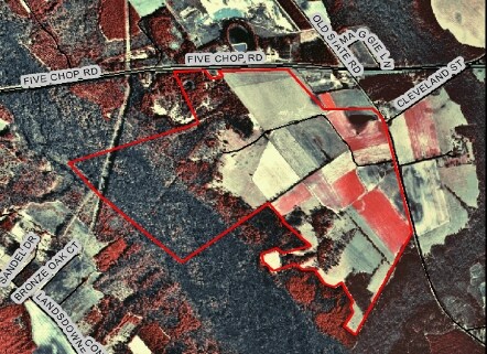
5 Chop Rd
Orangeburg, SC
OFF HWY 301 TRACT 7 70 08790007
0264-00-05-005.000
ORANGEBURG
Countyproperty
South Carolina
B and X Area of moderate flood hazard, usually the area between the limits of the 100-year and 500-year floods.
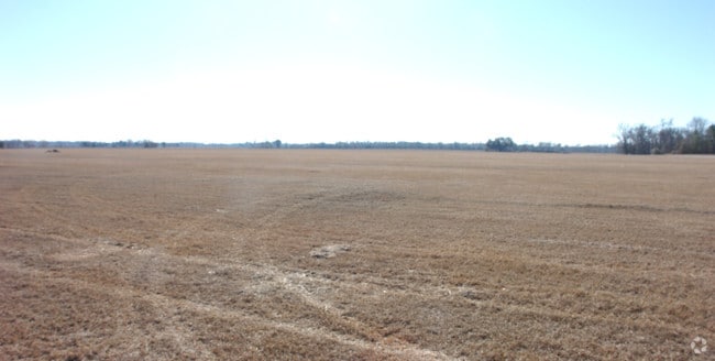
2.90 AC
0
Orangeburg/Sumter
2024
Other Market Areas
950400
NEARBY LISTINGS FOR SALE OR LEASE
-
-
View all Cameron listings for sale on LoopNet.com
DEMOGRAPHICS near 5 Chop Rd
1 mile
3 mile
5 mile
2025 Total Population
129
934
2,069
2030 Population
128
932
2,060
Pop Growth 2025-2030
(0.78%)
(0.21%)
(0.43%)
Average Age
44
44
44
2025 Total Households
52
380
842
HH Growth 2025-2030
0.00%
(0.26%)
(0.59%)
Median Household Inc
$55,000
$53,919
$52,891
Avg Household Size
2.30
2.30
2.30
2025 Avg HH Vehicles
2.00
2.00
2.00
Median Home Value
$167,856
$154,999
$149,657
Median Year Built
1987
1985
1985
Nearby Places
Map Layers
Map Styles
 Street
 Aerial
Transit
 Traffic
 Biking
Places
Listings with unknown addresses are not visible on the map
- Restaurants
- Banks
- Shops
- Fitness
- Groceries
Nearby Properties
Address
Land Use
TOTAL SIZE
Lot Size
Zoning
Address
Land Use
TOTAL SIZE
Lot Size
Zoning
10 AC
Address
Land Use
TOTAL SIZE
Lot Size
Zoning
9,301 SF
1.63 AC
Address
Land Use
TOTAL SIZE
Lot Size
Zoning
35.40 AC
Address
Land Use
TOTAL SIZE
Lot Size
Zoning
365.80 AC
Address
Land Use
TOTAL SIZE
Lot Size
Zoning
333.70 AC
Address
Land Use
TOTAL SIZE
Lot Size
Zoning
4,504 SF
2.01 AC
Address
Land Use
TOTAL SIZE
Lot Size
Zoning
Address
Land Use
TOTAL SIZE
Lot Size
Zoning
Address
Land Use
TOTAL SIZE
Lot Size
Zoning
Address
Land Use
TOTAL SIZE
Lot Size
Zoning
5,840 SF
9.20 AC
Address
Land Use
TOTAL SIZE
Lot Size
Zoning
923.70 AC
Address
Land Use
TOTAL SIZE
Lot Size
Zoning
0.97 AC
Address
Land Use
TOTAL SIZE
Lot Size
Zoning
1,276 SF
995.32 AC
Address
Land Use
TOTAL SIZE
Lot Size
Zoning
7.60 AC
Address
Land Use
TOTAL SIZE
Lot Size
Zoning
219.60 AC
Address
Land Use
TOTAL SIZE
Lot Size
Zoning
716.30 AC
Address
Land Use
TOTAL SIZE
Lot Size
Zoning
16.90 AC
Address
Land Use
TOTAL SIZE
Lot Size
Zoning
13.70 AC
Address
Land Use
TOTAL SIZE
Lot Size
Zoning
3,480 SF
9.80 AC
Address
Land Use
TOTAL SIZE
Lot Size
Zoning
4,730 SF
7.50 AC
Address
Land Use
TOTAL SIZE
Lot Size
Zoning
145.20 AC
Address
Land Use
TOTAL SIZE
Lot Size
Zoning
4.20 AC
Address
Land Use
TOTAL SIZE
Lot Size
Zoning
Address
Land Use
TOTAL SIZE
Lot Size
Zoning
560 SF
17 AC
Address
Land Use
TOTAL SIZE
Lot Size
Zoning
13.90 AC
Address
Land Use
TOTAL SIZE
Lot Size
Zoning
13.50 AC
Address
Land Use
TOTAL SIZE
Lot Size
Zoning
12 AC
Address
Land Use
TOTAL SIZE
Lot Size
Zoning
239.20 AC
Address
Land Use
TOTAL SIZE
Lot Size
Zoning
0.45 AC
Address
Land Use
TOTAL SIZE
Lot Size
Zoning
278 AC
The World's #1 Commercial Real Estate Marketplace
Connect with us
© 2026 CoStar Group
The information above has been obtained from sources believed reliable. While we do not doubt its accuracy we have not verified it and make no guarantee, warranty or representation about it. It is your responsibility to independently confirm its accuracy and completeness. Any projections, opinions, assumptions, or estimates used are for example only and do not represent the current or future performance of the property. The value of this transaction to you depends on tax and other factors which should be evaluated by your tax, financial, and legal advisors. You and your advisors should conduct a careful, independent investigation of the property to determine to your satisfaction the suitability of the property for your needs.