Property Record
5 County Road B E, Saint Paul, MN 55117
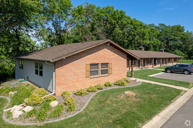


Property Detail
5 County Road B E
Minneapolis-St. Paul-Bloomington, MN-WI
J. F. EISENMENGERS,GARDEN LOT SUBJ TO HWY, LOT 19
07-29-22-34-0016
Ramsey
Officebuilding
Minnesota
B and X Area of moderate flood hazard, usually the area between the limits of the 100-year and 500-year floods.
19
2024
0.86 AC
2025
Suburban St Paul
042101
Minneapolis/St Paul
12,432 SF
NEARBY LISTINGS FOR SALE OR LEASE
DEMOGRAPHICS near 5 County Road B E
1 mile
3 mile
5 mile
2025 Total Population
8,744
105,683
304,281
2030 Population
8,698
104,674
303,219
Pop Growth 2025-2030
(0.53%)
(0.95%)
(0.35%)
Average Age
40
38
38
2025 Total Households
3,604
39,742
118,047
HH Growth 2025-2030
(0.78%)
(1.05%)
(0.35%)
Median Household Inc
$72,546
$75,940
$74,946
Avg Household Size
2.30
2.50
2.40
2025 Avg HH Vehicles
2.00
2.00
2.00
Median Home Value
$298,600
$295,795
$294,420
Median Year Built
1973
1965
1964
Nearby Places
Map Layers
Map Styles
 Street
 Aerial
Layers
 Traffic
 Biking
Places
Listings with unknown addresses are not visible on the map
- Restaurants
- Banks
- Shops
- Fitness
- Groceries
PUBLIC TRANSPORTATION
COMMUTER RAIL
Drive
Walk
Distance
10 min
5.9 mi
AIRPORT
Minneapolis-St Paul International/Wold-Chamberlain
Drive
Walk
Distance
Minneapolis-St Paul International/Wold-Chamberlain
24 min
13.4 mi
SALE & LEASE HISTORY
LISTING DATE
SALE/LEASE

Aug 01, 2019
For Lease
Nearby Properties
Address
Land Use
TOTAL SIZE
Lot Size
Zoning
Address
Land Use
TOTAL SIZE
Lot Size
Zoning
404,491 SF
27.01 AC
Address
Land Use
TOTAL SIZE
Lot Size
Zoning
48.52 AC
Address
Land Use
TOTAL SIZE
Lot Size
Zoning
3,050 SF
58.60 AC
Address
Land Use
TOTAL SIZE
Lot Size
Zoning
2.39 AC
Address
Land Use
TOTAL SIZE
Lot Size
Zoning
220 SF
19.66 AC
Address
Land Use
TOTAL SIZE
Lot Size
Zoning
4,800 SF
20.36 AC
Address
Land Use
TOTAL SIZE
Lot Size
Zoning
47,670 SF
179 AC
Address
Land Use
TOTAL SIZE
Lot Size
Zoning
13.10 AC
Address
Land Use
TOTAL SIZE
Lot Size
Zoning
Address
Land Use
TOTAL SIZE
Lot Size
Zoning
273,937 SF
16.75 AC
Address
Land Use
TOTAL SIZE
Lot Size
Zoning
202,958 SF
4.87 AC
Address
Land Use
TOTAL SIZE
Lot Size
Zoning
212,663 SF
3.50 AC
Address
Land Use
TOTAL SIZE
Lot Size
Zoning
313,546 SF
7.33 AC
Address
Land Use
TOTAL SIZE
Lot Size
Zoning
272,002 SF
8.16 AC
Address
Land Use
TOTAL SIZE
Lot Size
Zoning
129,854 SF
5.08 AC
Address
Land Use
TOTAL SIZE
Lot Size
Zoning
24.60 AC
Address
Land Use
TOTAL SIZE
Lot Size
Zoning
278,392 SF
8.04 AC
Address
Land Use
TOTAL SIZE
Lot Size
Zoning
35.93 AC
W7PUBLC
Address
Land Use
TOTAL SIZE
Lot Size
Zoning
2,779 SF
95.22 AC
Address
Land Use
TOTAL SIZE
Lot Size
Zoning
157,404 SF
40.84 AC
Address
Land Use
TOTAL SIZE
Lot Size
Zoning
17.16 AC
Address
Land Use
TOTAL SIZE
Lot Size
Zoning
90,080 SF
12.81 AC
Address
Land Use
TOTAL SIZE
Lot Size
Zoning
195,048 SF
5.33 AC
Address
Land Use
TOTAL SIZE
Lot Size
Zoning
211 SF
4.99 AC
Address
Land Use
TOTAL SIZE
Lot Size
Zoning
127,207 SF
3.49 AC
Address
Land Use
TOTAL SIZE
Lot Size
Zoning
145,458 SF
2.30 AC
Address
Land Use
TOTAL SIZE
Lot Size
Zoning
140,785 SF
26.78 AC
Address
Land Use
TOTAL SIZE
Lot Size
Zoning
209,830 SF
10.06 AC
Address
Land Use
TOTAL SIZE
Lot Size
Zoning
154,364 SF
3.26 AC
Address
Land Use
TOTAL SIZE
Lot Size
Zoning
3.09 AC
The World's #1 Commercial Real Estate Marketplace
Connect with us
© 2026 CoStar Group
The information above has been obtained from sources believed reliable. While we do not doubt its accuracy we have not verified it and make no guarantee, warranty or representation about it. It is your responsibility to independently confirm its accuracy and completeness. Any projections, opinions, assumptions, or estimates used are for example only and do not represent the current or future performance of the property. The value of this transaction to you depends on tax and other factors which should be evaluated by your tax, financial, and legal advisors. You and your advisors should conduct a careful, independent investigation of the property to determine to your satisfaction the suitability of the property for your needs.