Property Record
5 Cut St, Alton, IL 62002
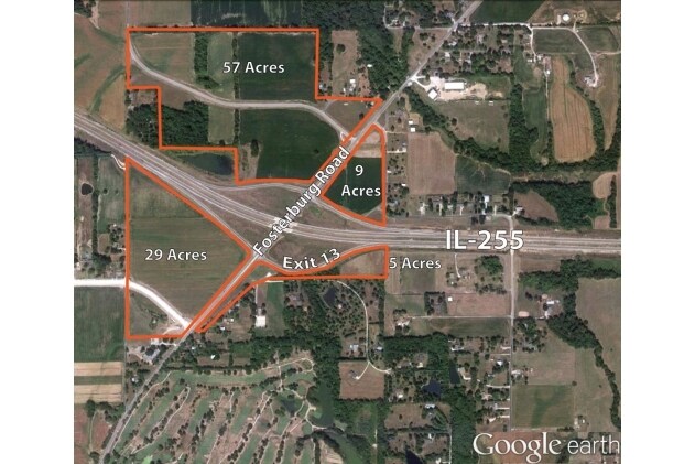

NEARBY LISTINGS FOR SALE OR LEASE
Property Detail
5 Cut St
St. Louis, MO-IL
PART SOUTHWEST NORTHWEST
20-1-02-34-01-101-036
Madison
Agriculturalland
Illinois
2024
4.96 AC
2024
Illinois
402400
St. Louis
DEMOGRAPHICS near 5 Cut St
1 Mile
3 Mile
5 Mile
2024 Total Population
475
10,587
57,110
2029 Population
466
10,446
56,601
Pop Growth 2024-2029
(1.89%)
(1.33%)
(0.89%)
Average Age
44
43
42
2024 Total Households
188
4,407
24,485
HH Growth 2024-2029
(1.60%)
(1.43%)
(0.93%)
Median Household Inc
$72,421
$64,022
$59,554
Avg Household Size
2.40
2.30
2.30
2024 Avg HH Vehicles
2.00
2.00
2.00
Median Home Value
$215,322
$153,300
$121,820
Median Year Built
1980
1970
1960
Nearby Places
Map Layers
Map Styles
 Street
 Aerial
- Restaurants
- Banks
- Shops
- Fitness
- Groceries
PUBLIC TRANSPORTATION
COMMUTER RAIL
Alton Amtrak Station (Lincoln Service - Amtrak, Lincoln Service Missouri River Runner - Amtrak, Texas Eagle - Amtrak)
DRIVE
WALK
Distance
Alton Amtrak Station (Lincoln Service - Amtrak, Lincoln Service Missouri River Runner - Amtrak, Texas Eagle - Amtrak)
11 min
4.1 mi
AIRPORT
St Louis Lambert International
DRIVE
WALK
Distance
St Louis Lambert International
31 min
19.5 mi
Scott AFB/Midamerica St Louis
DRIVE
WALK
Distance
Scott AFB/Midamerica St Louis
63 min
42.3 mi
Freight Ports
Port Milwaukee
DRIVE
WALK
Distance
Port Milwaukee
416 min
358.9 mi
SALE & LEASE HISTORY
LISTING DATE
SALE/LEASE

Sep 25, 2016
For Lease
Sep 24, 2016
For Sale
Nearby Properties
Address
Land Use
TOTAL SIZE
Lot Size
Zoning
Address
Land Use
TOTAL SIZE
Lot Size
Zoning
16.14 AC
Address
Land Use
TOTAL SIZE
Lot Size
Zoning
16.61 AC
Address
Land Use
TOTAL SIZE
Lot Size
Zoning
117,520 SF
2.29 AC
Address
Land Use
TOTAL SIZE
Lot Size
Zoning
132,494 SF
18.48 AC
Address
Land Use
TOTAL SIZE
Lot Size
Zoning
Address
Land Use
TOTAL SIZE
Lot Size
Zoning
625.98 AC
AA9
Address
Land Use
TOTAL SIZE
Lot Size
Zoning
Address
Land Use
TOTAL SIZE
Lot Size
Zoning
26.24 AC
Address
Land Use
TOTAL SIZE
Lot Size
Zoning
45,834 SF
7.10 AC
Address
Land Use
TOTAL SIZE
Lot Size
Zoning
114,461 SF
9.13 AC
Address
Land Use
TOTAL SIZE
Lot Size
Zoning
87,624 SF
4.28 AC
Address
Land Use
TOTAL SIZE
Lot Size
Zoning
6,146 SF
9 AC
Address
Land Use
TOTAL SIZE
Lot Size
Zoning
1.90 AC
Address
Land Use
TOTAL SIZE
Lot Size
Zoning
576 SF
16.80 AC
Address
Land Use
TOTAL SIZE
Lot Size
Zoning
64,260 SF
3.90 AC
Address
Land Use
TOTAL SIZE
Lot Size
Zoning
56,684 SF
2.19 AC
Address
Land Use
TOTAL SIZE
Lot Size
Zoning
1.90 AC
Address
Land Use
TOTAL SIZE
Lot Size
Zoning
334.25 AC
AA9
Address
Land Use
TOTAL SIZE
Lot Size
Zoning
320.80 AC
AA1
Address
Land Use
TOTAL SIZE
Lot Size
Zoning
28,193 SF
4.23 AC
Address
Land Use
TOTAL SIZE
Lot Size
Zoning
Address
Land Use
TOTAL SIZE
Lot Size
Zoning
155,147 SF
14.37 AC
Address
Land Use
TOTAL SIZE
Lot Size
Zoning
105,137 SF
2.60 AC
Address
Land Use
TOTAL SIZE
Lot Size
Zoning
76,022 SF
4.69 AC
Address
Land Use
TOTAL SIZE
Lot Size
Zoning
38,748 SF
2.32 AC
Address
Land Use
TOTAL SIZE
Lot Size
Zoning
235.26 AC
AA9
Address
Land Use
TOTAL SIZE
Lot Size
Zoning
39.31 AC
Address
Land Use
TOTAL SIZE
Lot Size
Zoning
68,870 SF
9.49 AC
Address
Land Use
TOTAL SIZE
Lot Size
Zoning
Address
Land Use
TOTAL SIZE
Lot Size
Zoning
10,968 SF
1.01 AC
The World's #1 Commercial Real Estate Marketplace
Connect with us
© 2025 CoStar Group
The information above has been obtained from sources believed reliable. While we do not doubt its accuracy we have not verified it and make no guarantee, warranty or representation about it. It is your responsibility to independently confirm its accuracy and completeness. Any projections, opinions, assumptions, or estimates used are for example only and do not represent the current or future performance of the property. The value of this transaction to you depends on tax and other factors which should be evaluated by your tax, financial, and legal advisors. You and your advisors should conduct a careful, independent investigation of the property to determine to your satisfaction the suitability of the property for your needs.