Property Record
5 Glen Rd, Sandy Hook, CT 06482


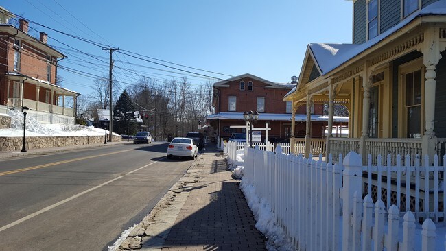
Property Detail
5 Glen Rd
NEWT-000039-000002-000008-000010-11
FAIRFIELD
Commercialbuilding
Connecticut
SHDD
8-10-11
AE The base floodplain where base flood elevations are provided. AE Zones are now used on new format FIRMs instead of A1-A30 Zones.
1.94 AC
2025
Newtown
2025
Westchester/So Connecticut
230100
Bridgeport-Stamford-Danbury, CT
2,368 SF
NEARBY LISTINGS FOR SALE OR LEASE
DEMOGRAPHICS near 5 Glen Rd
1 mile
3 mile
5 mile
2025 Total Population
2,699
15,943
37,072
2030 Population
2,811
16,478
38,217
Pop Growth 2025-2030
+ 4.15%
+ 3.36%
+ 3.09%
Average Age
43
44
45
2025 Total Households
1,031
5,820
13,698
HH Growth 2025-2030
+ 4.07%
+ 3.28%
+ 3.06%
Median Household Inc
$142,319
$132,110
$137,701
Avg Household Size
2.60
2.60
2.60
2025 Avg HH Vehicles
2.00
2.00
2.00
Median Home Value
$444,838
$479,108
$497,379
Median Year Built
1980
1975
1977
Nearby Places
Map Layers
Map Styles
 Street
 Aerial
Transit
 Traffic
 Biking
Places
Listings with unknown addresses are not visible on the map
- Restaurants
- Banks
- Shops
- Fitness
- Groceries
PUBLIC TRANSPORTATION
COMMUTER RAIL
Bethel Station (New Haven Line - Metro-North Commuter Railroad Company (Metro-North))
Drive
Walk
Distance
Bethel Station (New Haven Line - Metro-North Commuter Railroad Company (Metro-North))
19 min
9.9 mi
AIRPORT
Tweed/New Haven
Drive
Walk
Distance
Tweed/New Haven
46 min
28.7 mi
Westchester County
Drive
Walk
Distance
Westchester County
56 min
44.3 mi
Freight Ports
Port of New Haven
Drive
Walk
Distance
Port of New Haven
40 min
25.8 mi
SALE & LEASE HISTORY
LISTING DATE
SALE/LEASE

Feb 23, 2017
For Lease
Dec 11, 2019
For Lease
Apr 06, 2017
For Lease
Nearby Properties
Address
Land Use
TOTAL SIZE
Lot Size
Zoning
Address
Land Use
TOTAL SIZE
Lot Size
Zoning
114.88 AC
CA
Address
Land Use
TOTAL SIZE
Lot Size
Zoning
37.66 AC
R-2
Address
Land Use
TOTAL SIZE
Lot Size
Zoning
86,039 SF
15.68 AC
R-2
Address
Land Use
TOTAL SIZE
Lot Size
Zoning
21.20 AC
PS
Address
Land Use
TOTAL SIZE
Lot Size
Zoning
2,400 SF
553.67 AC
R-80
Address
Land Use
TOTAL SIZE
Lot Size
Zoning
133,516 SF
34.02 AC
R-1
Address
Land Use
TOTAL SIZE
Lot Size
Zoning
8.13 AC
B-1/2
Address
Land Use
TOTAL SIZE
Lot Size
Zoning
11,000 SF
185 AC
FHAR
Address
Land Use
TOTAL SIZE
Lot Size
Zoning
43.38 AC
EH-10
Address
Land Use
TOTAL SIZE
Lot Size
Zoning
1,498 SF
11.75 AC
R-2
Address
Land Use
TOTAL SIZE
Lot Size
Zoning
13,922 SF
62.75 AC
EH-10
Address
Land Use
TOTAL SIZE
Lot Size
Zoning
3.97 AC
P-1
Address
Land Use
TOTAL SIZE
Lot Size
Zoning
9.60 AC
R-1
Address
Land Use
TOTAL SIZE
Lot Size
Zoning
23.95 AC
M-1
Address
Land Use
TOTAL SIZE
Lot Size
Zoning
154.75 AC
CA
Address
Land Use
TOTAL SIZE
Lot Size
Zoning
212,698 SF
24.68 AC
M-1
Address
Land Use
TOTAL SIZE
Lot Size
Zoning
252,800 SF
22.70 AC
M-1
Address
Land Use
TOTAL SIZE
Lot Size
Zoning
12,074 SF
22.73 AC
SDD1
Address
Land Use
TOTAL SIZE
Lot Size
Zoning
45,079 SF
Address
Land Use
TOTAL SIZE
Lot Size
Zoning
30,220 SF
5.48 AC
M-4
Address
Land Use
TOTAL SIZE
Lot Size
Zoning
13.30 AC
M-5
Address
Land Use
TOTAL SIZE
Lot Size
Zoning
158,754 SF
17.74 AC
M-1
Address
Land Use
TOTAL SIZE
Lot Size
Zoning
13.98 AC
M-4
Address
Land Use
TOTAL SIZE
Lot Size
Zoning
46,620 SF
7.55 AC
B-1/2
Address
Land Use
TOTAL SIZE
Lot Size
Zoning
64,426 SF
13.22 AC
R-2
Address
Land Use
TOTAL SIZE
Lot Size
Zoning
124,412 SF
18.74 AC
M-1
Address
Land Use
TOTAL SIZE
Lot Size
Zoning
39,244 SF
1 AC
FHAR
Address
Land Use
TOTAL SIZE
Lot Size
Zoning
32,065 SF
2 AC
R-1
Address
Land Use
TOTAL SIZE
Lot Size
Zoning
63,060 SF
4.65 AC
I-2
Address
Land Use
TOTAL SIZE
Lot Size
Zoning
40,144 SF
8.69 AC
M-1
The World's #1 Commercial Real Estate Marketplace
Connect with us
© 2026 CoStar Group
The information above has been obtained from sources believed reliable. While we do not doubt its accuracy we have not verified it and make no guarantee, warranty or representation about it. It is your responsibility to independently confirm its accuracy and completeness. Any projections, opinions, assumptions, or estimates used are for example only and do not represent the current or future performance of the property. The value of this transaction to you depends on tax and other factors which should be evaluated by your tax, financial, and legal advisors. You and your advisors should conduct a careful, independent investigation of the property to determine to your satisfaction the suitability of the property for your needs.