Property Record
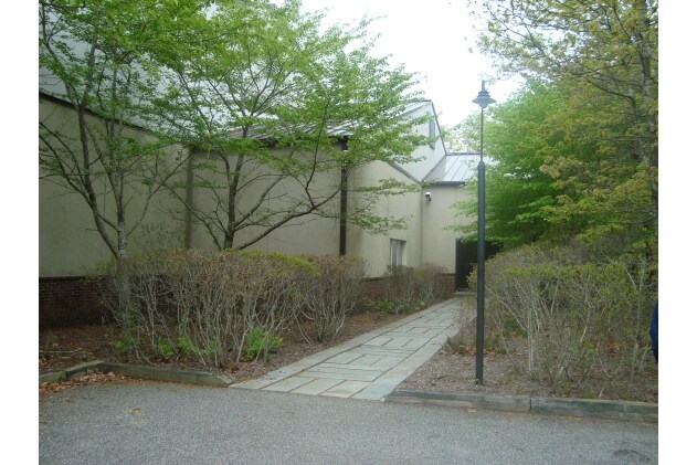
5 Goodfriend Dr, East Hampton, NY 11937

NEARBY LISTINGS FOR SALE OR LEASE
Property Detail
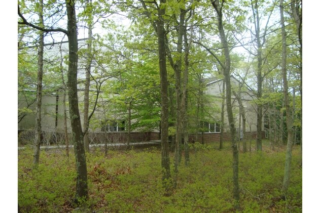
5 Goodfriend Dr
Nassau County-Suffolk County, NY
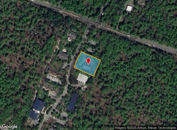
Map Of Goodfriend Park
0300-181-00-04-00-012-000
BLK LOT 12
Recreationalentertainmentgeneral
Suffolk
X
New York
36103C0551H
12
2024
0.92 AC
2024
Eastern Suffolk
200906
Long Island (New York)
DEMOGRAPHICS near 5 Goodfriend Dr
1 Mile
3 Mile
5 Mile
2024 Total Population
995
14,148
33,334
2029 Population
1,052
14,845
34,798
Pop Growth 2024-2029
+ 5.73%
+ 4.93%
+ 4.39%
Average Age
46
45
45
2024 Total Households
420
5,679
13,055
HH Growth 2024-2029
+ 5.71%
+ 5.04%
+ 4.44%
Median Household Inc
$147,760
$137,520
$127,037
Avg Household Size
2.40
2.50
2.50
2024 Avg HH Vehicles
2.00
2.00
2.00
Median Home Value
$1,039,623
$1,062,071
$1,022,335
Median Year Built
1988
1982
1981
Nearby Places
- Restaurants
- Banks
- Shops
- Fitness
- Groceries
PUBLIC TRANSPORTATION
COMMUTER RAIL
East Hampton Station (Montauk Branch - Long Island Rail Road)
DRIVE
WALK
Distance
East Hampton Station (Montauk Branch - Long Island Rail Road)
8 min
3.2 mi
Amagansett Station (Montauk Branch - Long Island Rail Road)
DRIVE
WALK
Distance
Amagansett Station (Montauk Branch - Long Island Rail Road)
14 min
6.6 mi
Freight Ports
Port of New Haven
DRIVE
WALK
Distance
Port of New Haven
198 min
88.7 mi
Nearby Properties
Address
Land Use
TOTAL SIZE
Lot Size
Zoning
Address
Land Use
TOTAL SIZE
Lot Size
Zoning
11,084 SF
7.36 AC
R120
Address
Land Use
TOTAL SIZE
Lot Size
Zoning
27,376 SF
3.01 AC
R120
Address
Land Use
TOTAL SIZE
Lot Size
Zoning
25,638 SF
4.13 AC
R120
Address
Land Use
TOTAL SIZE
Lot Size
Zoning
9,153 SF
2.28 AC
R120
Address
Land Use
TOTAL SIZE
Lot Size
Zoning
10,426 SF
4.11 AC
R120
Address
Land Use
TOTAL SIZE
Lot Size
Zoning
26.05 AC
OSC
Address
Land Use
TOTAL SIZE
Lot Size
Zoning
5,864 SF
2.95 AC
CR80
Address
Land Use
TOTAL SIZE
Lot Size
Zoning
8,338 SF
1.26 AC
R120
Address
Land Use
TOTAL SIZE
Lot Size
Zoning
9,828 SF
2.20 AC
R120
Address
Land Use
TOTAL SIZE
Lot Size
Zoning
5,951 SF
2.23 AC
R120
Address
Land Use
TOTAL SIZE
Lot Size
Zoning
2.23 AC
R120
Address
Land Use
TOTAL SIZE
Lot Size
Zoning
38.90 AC
CR120
Address
Land Use
TOTAL SIZE
Lot Size
Zoning
3.30 AC
R120
Address
Land Use
TOTAL SIZE
Lot Size
Zoning
2.15 AC
R120
Address
Land Use
TOTAL SIZE
Lot Size
Zoning
2.15 AC
R120
Address
Land Use
TOTAL SIZE
Lot Size
Zoning
1.83 AC
R120
Address
Land Use
TOTAL SIZE
Lot Size
Zoning
31.70 AC
CR120
Address
Land Use
TOTAL SIZE
Lot Size
Zoning
1.47 AC
R120
Address
Land Use
TOTAL SIZE
Lot Size
Zoning
22.30 AC
CR120
Address
Land Use
TOTAL SIZE
Lot Size
Zoning
34.40 AC
CR200
Address
Land Use
TOTAL SIZE
Lot Size
Zoning
36,044 SF
2.90 AC
CR80
Address
Land Use
TOTAL SIZE
Lot Size
Zoning
1.89 AC
R120
Address
Land Use
TOTAL SIZE
Lot Size
Zoning
1.85 AC
R120
Address
Land Use
TOTAL SIZE
Lot Size
Zoning
1.56 AC
R120
Address
Land Use
TOTAL SIZE
Lot Size
Zoning
23,742 SF
3.90 AC
CR80
Address
Land Use
TOTAL SIZE
Lot Size
Zoning
1.54 AC
R120
Address
Land Use
TOTAL SIZE
Lot Size
Zoning
1.49 AC
R120
Address
Land Use
TOTAL SIZE
Lot Size
Zoning
23.08 AC
CR120
Address
Land Use
TOTAL SIZE
Lot Size
Zoning
1.46 AC
R120
Address
Land Use
TOTAL SIZE
Lot Size
Zoning
1.38 AC
R120
The World's #1 Commercial Real Estate Marketplace
Connect with us
© 2025 CoStar Group
The information above has been obtained from sources believed reliable. While we do not doubt its accuracy we have not verified it and make no guarantee, warranty or representation about it. It is your responsibility to independently confirm its accuracy and completeness. Any projections, opinions, assumptions, or estimates used are for example only and do not represent the current or future performance of the property. The value of this transaction to you depends on tax and other factors which should be evaluated by your tax, financial, and legal advisors. You and your advisors should conduct a careful, independent investigation of the property to determine to your satisfaction the suitability of the property for your needs.