Property Record
5 Iron Bridge Dr, Collegeville, PA 19426


NEARBY LISTINGS FOR SALE OR LEASE
-
-
View all Collegeville listings for lease on LoopNet.com
Property Detail
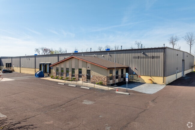
5 Iron Bridge Dr
Philadelphia-Camden-Wilmington, PA-NJ-DE-MD
Gorski Assoc
48-00-00292-209
IRR 80847 SF
Warehouse
Montgomery
X
Pennsylvania
42091C0229G
5
2024
1.86 AC
2025
West Montgomery Cty
206501
Philadelphia
60,942 SF
DEMOGRAPHICS near 5 Iron Bridge Dr
1 Mile
3 Mile
5 Mile
2024 Total Population
4,984
41,150
102,751
2029 Population
5,054
41,874
104,457
Pop Growth 2024-2029
+ 1.40%
+ 1.76%
+ 1.66%
Average Age
37
40
40
2024 Total Households
1,583
12,779
35,611
HH Growth 2024-2029
+ 1.20%
+ 1.90%
+ 1.77%
Median Household Inc
$119,718
$141,329
$122,354
Avg Household Size
2.70
2.80
2.70
2024 Avg HH Vehicles
2.00
2.00
2.00
Median Home Value
$409,036
$430,795
$412,894
Median Year Built
1989
1992
1991
Nearby Places
Map Layers
Map Styles
 Street
 Aerial
- Restaurants
- Banks
- Shops
- Fitness
- Groceries
PUBLIC TRANSPORTATION
COMMUTER RAIL
Main Street (Norristown) (R6 - Southeastern Pennsylvania Transportation Authority Regional Rail (SEPTA Regional Rail))
DRIVE
WALK
Distance
Main Street (Norristown) (R6 - Southeastern Pennsylvania Transportation Authority Regional Rail (SEPTA Regional Rail))
20 min
9.8 mi
AIRPORT
Philadelphia International
DRIVE
WALK
Distance
Philadelphia International
62 min
39.9 mi
Freight Ports
Port of Philadelphia
DRIVE
WALK
Distance
Port of Philadelphia
51 min
30.0 mi
SALE & LEASE HISTORY
LISTING DATE
SALE/LEASE

May 02, 2023
For Sale
Aug 30, 2023
For Lease
Nearby Properties
Address
Land Use
TOTAL SIZE
Lot Size
Zoning
Address
Land Use
TOTAL SIZE
Lot Size
Zoning
1.74 AC
IR
Address
Land Use
TOTAL SIZE
Lot Size
Zoning
975,535 SF
67.40 AC
R2
Address
Land Use
TOTAL SIZE
Lot Size
Zoning
1,113,725 SF
196.05 AC
IO
Address
Land Use
TOTAL SIZE
Lot Size
Zoning
989,814 SF
8.87 AC
IO
Address
Land Use
TOTAL SIZE
Lot Size
Zoning
463,481 SF
79.65 AC
R1
Address
Land Use
TOTAL SIZE
Lot Size
Zoning
425,899 SF
78.61 AC
R1
Address
Land Use
TOTAL SIZE
Lot Size
Zoning
634,096 SF
3.09 AC
IO
Address
Land Use
TOTAL SIZE
Lot Size
Zoning
217,154 SF
77.97 AC
R1
Address
Land Use
TOTAL SIZE
Lot Size
Zoning
160,533 SF
30.50 AC
PRD
Address
Land Use
TOTAL SIZE
Lot Size
Zoning
233,630 SF
15 AC
R4
Address
Land Use
TOTAL SIZE
Lot Size
Zoning
125,788 SF
24.83 AC
R1
Address
Land Use
TOTAL SIZE
Lot Size
Zoning
124,079 SF
16.92 AC
MS
Address
Land Use
TOTAL SIZE
Lot Size
Zoning
98,724 SF
35.50 AC
R1
Address
Land Use
TOTAL SIZE
Lot Size
Zoning
176,130 SF
18.88 AC
C3
Address
Land Use
TOTAL SIZE
Lot Size
Zoning
84,664 SF
14.71 AC
R2
Address
Land Use
TOTAL SIZE
Lot Size
Zoning
98,208 SF
2.26 AC
CRSC
Address
Land Use
TOTAL SIZE
Lot Size
Zoning
137,689 SF
21.46 AC
GC
Address
Land Use
TOTAL SIZE
Lot Size
Zoning
83,186 SF
11.81 AC
CRSC
Address
Land Use
TOTAL SIZE
Lot Size
Zoning
66,894 SF
14.18 AC
R2
Address
Land Use
TOTAL SIZE
Lot Size
Zoning
88,738 SF
9.63 AC
GA
Address
Land Use
TOTAL SIZE
Lot Size
Zoning
124,048 SF
15.62 AC
CC
Address
Land Use
TOTAL SIZE
Lot Size
Zoning
114,772 SF
13.60 AC
C1
Address
Land Use
TOTAL SIZE
Lot Size
Zoning
122,956 SF
10.67 AC
CRSC
Address
Land Use
TOTAL SIZE
Lot Size
Zoning
69,143 SF
5.21 AC
PBO
Address
Land Use
TOTAL SIZE
Lot Size
Zoning
368,327 SF
23.39 AC
IND
Address
Land Use
TOTAL SIZE
Lot Size
Zoning
101,836 SF
6.59 AC
LI
Address
Land Use
TOTAL SIZE
Lot Size
Zoning
37,662 SF
5.30 AC
R1
Address
Land Use
TOTAL SIZE
Lot Size
Zoning
36,567 SF
20.44 AC
R2
Address
Land Use
TOTAL SIZE
Lot Size
Zoning
14,019 SF
60.49 AC
R1
Address
Land Use
TOTAL SIZE
Lot Size
Zoning
105,533 SF
2.74 AC
MS
The World's #1 Commercial Real Estate Marketplace
Connect with us
© 2026 CoStar Group
The information above has been obtained from sources believed reliable. While we do not doubt its accuracy we have not verified it and make no guarantee, warranty or representation about it. It is your responsibility to independently confirm its accuracy and completeness. Any projections, opinions, assumptions, or estimates used are for example only and do not represent the current or future performance of the property. The value of this transaction to you depends on tax and other factors which should be evaluated by your tax, financial, and legal advisors. You and your advisors should conduct a careful, independent investigation of the property to determine to your satisfaction the suitability of the property for your needs.