Property Record
5 Main St, Auburn, MA 01501

This Property Is For Sale
Property Detail
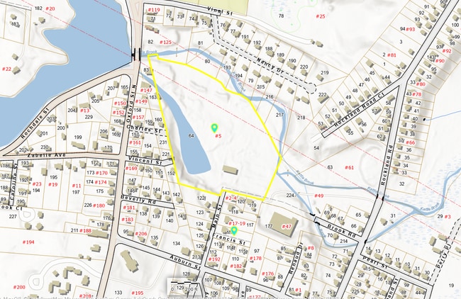
5 Main St
Worcester, MA
WORCESTER
AUBU-000017-000000-000064
Massachusetts
Vacantlandnec
64
AE The base floodplain where base flood elevations are provided. AE Zones are now used on new format FIRMs instead of A1-A30 Zones.
14.50 AC
2025
Worcester Metro
2025
Boston
736300
NEARBY LISTINGS FOR SALE OR LEASE
DEMOGRAPHICS near 5 Main St
1 mile
3 mile
5 mile
2025 Total Population
7,210
61,959
179,971
2030 Population
7,412
62,777
182,406
Pop Growth 2025-2030
+ 2.80%
+ 1.32%
+ 1.35%
Average Age
42
40
39
2025 Total Households
2,813
24,333
70,822
HH Growth 2025-2030
+ 2.95%
+ 1.48%
+ 1.49%
Median Household Inc
$96,006
$73,307
$72,918
Avg Household Size
2.50
2.40
2.40
2025 Avg HH Vehicles
2.00
2.00
1.00
Median Home Value
$374,536
$365,425
$388,212
Median Year Built
1952
1950
1950
Nearby Places
Map Layers
Map Styles
 Street
 Aerial
Layers
 Traffic
 Biking
Places
Listings with unknown addresses are not visible on the map
- Restaurants
- Banks
- Shops
- Fitness
- Groceries
PUBLIC TRANSPORTATION
COMMUTER RAIL
Drive
Walk
Distance
9 min
5.0 mi
Worcester (Framingham/Worcester Line - Massachusetts Bay Transportation Authority Commuter Rail (Purple Line))
Drive
Walk
Distance
Worcester (Framingham/Worcester Line - Massachusetts Bay Transportation Authority Commuter Rail (Purple Line))
10 min
5.1 mi
AIRPORT
Worcester Regional
Drive
Walk
Distance
Worcester Regional
14 min
5.6 mi
Rhode Island Tf Green International
Drive
Walk
Distance
Rhode Island Tf Green International
68 min
48.1 mi
Freight Ports
Port of Boston
Drive
Walk
Distance
Port of Boston
65 min
49.0 mi
Nearby Properties
Address
Land Use
TOTAL SIZE
Lot Size
Zoning
Address
Land Use
TOTAL SIZE
Lot Size
Zoning
244,486 SF
42.64 AC
RL-7
Address
Land Use
TOTAL SIZE
Lot Size
Zoning
142.98 AC
Address
Land Use
TOTAL SIZE
Lot Size
Zoning
25,000 SF
99.10 AC
MG-.5
Address
Land Use
TOTAL SIZE
Lot Size
Zoning
1,760 SF
105.54 AC
ML10
Address
Land Use
TOTAL SIZE
Lot Size
Zoning
164,378 SF
21.40 AC
Address
Land Use
TOTAL SIZE
Lot Size
Zoning
591,515 SF
33.04 AC
MG-1
Address
Land Use
TOTAL SIZE
Lot Size
Zoning
3.55 AC
RG-5
Address
Land Use
TOTAL SIZE
Lot Size
Zoning
69.46 AC
RS-7
Address
Land Use
TOTAL SIZE
Lot Size
Zoning
159,355 SF
207.62 AC
RL-7
Address
Land Use
TOTAL SIZE
Lot Size
Zoning
3.43 AC
ML10
Address
Land Use
TOTAL SIZE
Lot Size
Zoning
118,112 SF
6.54 AC
Address
Land Use
TOTAL SIZE
Lot Size
Zoning
41.84 AC
Address
Land Use
TOTAL SIZE
Lot Size
Zoning
643,250 SF
35.17 AC
RL-7
Address
Land Use
TOTAL SIZE
Lot Size
Zoning
36.67 AC
Address
Land Use
TOTAL SIZE
Lot Size
Zoning
222,474 SF
22.75 AC
MG-1
Address
Land Use
TOTAL SIZE
Lot Size
Zoning
279,977 SF
17.80 AC
Address
Land Use
TOTAL SIZE
Lot Size
Zoning
200 SF
50.14 AC
MG-2
Address
Land Use
TOTAL SIZE
Lot Size
Zoning
14.66 AC
BG-2
Address
Land Use
TOTAL SIZE
Lot Size
Zoning
153,745 SF
10.99 AC
MG-2
Address
Land Use
TOTAL SIZE
Lot Size
Zoning
92,604 SF
1 AC
Address
Land Use
TOTAL SIZE
Lot Size
Zoning
16.06 AC
RS-7
Address
Land Use
TOTAL SIZE
Lot Size
Zoning
210,001 SF
13.14 AC
Address
Land Use
TOTAL SIZE
Lot Size
Zoning
70,400 SF
17.10 AC
Address
Land Use
TOTAL SIZE
Lot Size
Zoning
8.77 AC
BL-1
Address
Land Use
TOTAL SIZE
Lot Size
Zoning
153,510 SF
1.67 AC
RG-5
Address
Land Use
TOTAL SIZE
Lot Size
Zoning
133,482 SF
15.80 AC
BG-2
Address
Land Use
TOTAL SIZE
Lot Size
Zoning
176,000 SF
19.52 AC
RL-7
Address
Land Use
TOTAL SIZE
Lot Size
Zoning
95,184 SF
2.44 AC
BL-1
Address
Land Use
TOTAL SIZE
Lot Size
Zoning
13,417 SF
28.90 AC
MG-.5
The World's #1 Commercial Real Estate Marketplace
Connect with us
© 2026 CoStar Group
The information above has been obtained from sources believed reliable. While we do not doubt its accuracy we have not verified it and make no guarantee, warranty or representation about it. It is your responsibility to independently confirm its accuracy and completeness. Any projections, opinions, assumptions, or estimates used are for example only and do not represent the current or future performance of the property. The value of this transaction to you depends on tax and other factors which should be evaluated by your tax, financial, and legal advisors. You and your advisors should conduct a careful, independent investigation of the property to determine to your satisfaction the suitability of the property for your needs.