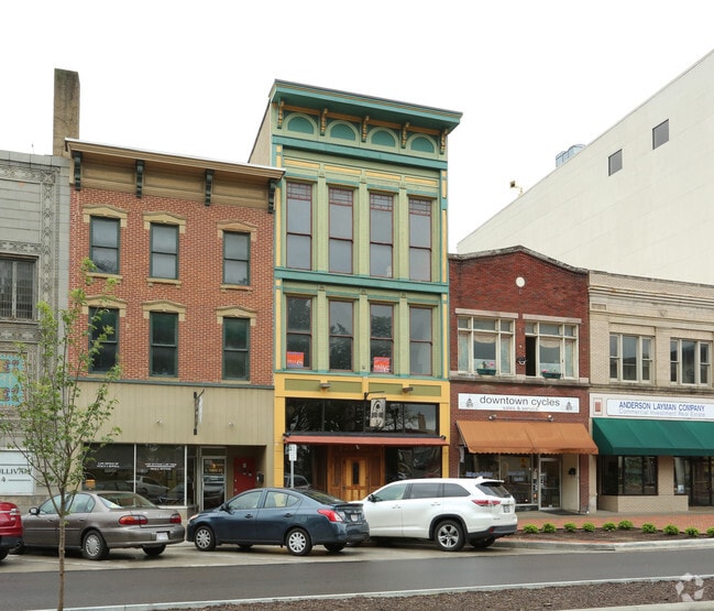
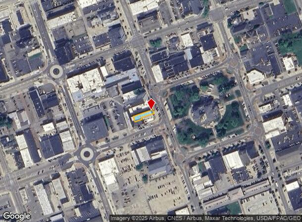
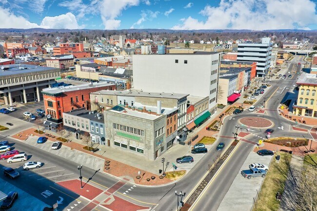
Property Record
5 N 3Rd St, Newark, OH 43055

NEARBY LISTINGS FOR SALE OR LEASE
Property Detail
5 N 3Rd St
Columbus, OH
Downtown
054-201492-00.000
LOT 72 PT PLAT OF NEWARK (0.076 AC)
Restaurantbuilding
Licking
X
Ohio
39089C0342H
72
2024
0.08 AC
2024
Licking County
759000
Columbus
8,316 SF
DEMOGRAPHICS near 5 N 3Rd St
1 Mile
3 Mile
5 Mile
2024 Total Population
11,905
48,912
73,067
2029 Population
12,572
51,163
76,533
Pop Growth 2024-2029
+ 5.60%
+ 4.60%
+ 4.74%
Average Age
37
40
41
2024 Total Households
4,764
20,351
29,946
HH Growth 2024-2029
+ 5.60%
+ 4.61%
+ 4.76%
Median Household Inc
$34,949
$52,781
$58,788
Avg Household Size
2.30
2.30
2.30
2024 Avg HH Vehicles
2.00
2.00
2.00
Median Home Value
$83,072
$140,193
$158,953
Median Year Built
1948
1959
1967
Nearby Places
Map Layers
Map Styles
 Street
 Aerial
- Restaurants
- Banks
- Shops
- Fitness
- Groceries
PUBLIC TRANSPORTATION
AIRPORT
John Glenn Columbus International
DRIVE
WALK
Distance
John Glenn Columbus International
44 min
30.8 mi
Rickenbacker International
DRIVE
WALK
Distance
Rickenbacker International
53 min
40.8 mi
SALE & LEASE HISTORY
LISTING DATE
SALE/LEASE

May 17, 2017
For Lease
Mar 08, 2022
For Sale
Mar 08, 2022
For Lease
Dec 29, 2017
For Sale
Nearby Properties
Address
Land Use
TOTAL SIZE
Lot Size
Zoning
Address
Land Use
TOTAL SIZE
Lot Size
Zoning
8,024,080 SF
20 AC
Address
Land Use
TOTAL SIZE
Lot Size
Zoning
212,744 SF
19.16 AC
Address
Land Use
TOTAL SIZE
Lot Size
Zoning
54,600 SF
101.38 AC
Address
Land Use
TOTAL SIZE
Lot Size
Zoning
87,785 SF
37.26 AC
Address
Land Use
TOTAL SIZE
Lot Size
Zoning
68,326 SF
28.51 AC
Address
Land Use
TOTAL SIZE
Lot Size
Zoning
69,244 SF
38 AC
Address
Land Use
TOTAL SIZE
Lot Size
Zoning
1,537,139 SF
11.11 AC
Address
Land Use
TOTAL SIZE
Lot Size
Zoning
67,824 SF
16.26 AC
Address
Land Use
TOTAL SIZE
Lot Size
Zoning
143,636 SF
7.25 AC
Address
Land Use
TOTAL SIZE
Lot Size
Zoning
3,108 SF
19.22 AC
Address
Land Use
TOTAL SIZE
Lot Size
Zoning
206,532 SF
21.65 AC
Address
Land Use
TOTAL SIZE
Lot Size
Zoning
118,791 SF
16.01 AC
Address
Land Use
TOTAL SIZE
Lot Size
Zoning
73,269 SF
15.64 AC
Address
Land Use
TOTAL SIZE
Lot Size
Zoning
3,552 SF
5.23 AC
Address
Land Use
TOTAL SIZE
Lot Size
Zoning
31,271 SF
20.10 AC
Address
Land Use
TOTAL SIZE
Lot Size
Zoning
94,672 SF
13.37 AC
Address
Land Use
TOTAL SIZE
Lot Size
Zoning
4,080 SF
12.84 AC
Address
Land Use
TOTAL SIZE
Lot Size
Zoning
57,280 SF
4.04 AC
Address
Land Use
TOTAL SIZE
Lot Size
Zoning
33,492 SF
1.07 AC
Address
Land Use
TOTAL SIZE
Lot Size
Zoning
22,974 SF
1.64 AC
Address
Land Use
TOTAL SIZE
Lot Size
Zoning
79,454 SF
19.13 AC
Address
Land Use
TOTAL SIZE
Lot Size
Zoning
78,000 SF
25 AC
Address
Land Use
TOTAL SIZE
Lot Size
Zoning
63,635 SF
7.91 AC
Address
Land Use
TOTAL SIZE
Lot Size
Zoning
135,148 SF
14.94 AC
Address
Land Use
TOTAL SIZE
Lot Size
Zoning
65,860 SF
3.35 AC
Address
Land Use
TOTAL SIZE
Lot Size
Zoning
316,800 SF
10.74 AC
Address
Land Use
TOTAL SIZE
Lot Size
Zoning
12,434 SF
103.18 AC
Address
Land Use
TOTAL SIZE
Lot Size
Zoning
7,400 SF
10.50 AC
Address
Land Use
TOTAL SIZE
Lot Size
Zoning
5,158 SF
15.45 AC
Address
Land Use
TOTAL SIZE
Lot Size
Zoning
60,060 SF
18 AC
The World's #1 Commercial Real Estate Marketplace
Connect with us
© 2026 CoStar Group
The information above has been obtained from sources believed reliable. While we do not doubt its accuracy we have not verified it and make no guarantee, warranty or representation about it. It is your responsibility to independently confirm its accuracy and completeness. Any projections, opinions, assumptions, or estimates used are for example only and do not represent the current or future performance of the property. The value of this transaction to you depends on tax and other factors which should be evaluated by your tax, financial, and legal advisors. You and your advisors should conduct a careful, independent investigation of the property to determine to your satisfaction the suitability of the property for your needs.